TopoQuest Logo
Do you find TopoQuest useful?
Help keep TopoQuest running and adding new maps/features by donating!
Bitcoin:  19c7KJd3qBynnjoSw5npx9KScwjBe4ifkT
Litecoin:  LXs6TkuXGGXo1vDsWCkWVdjQX94eUKd6ui
Home View Maps Find Maps Find Places Resources & Links


Questa, New Mexico Topographic Map

USGS Map Title: Questa, NM
USGS Map MRC: 36105F5
DRG (GeoTIFF) Download: o36105f5.tif


Neighboring USGS Topographic Map Quads:


  Sunshine, NM  
36105G6
 

  Cerro, NM  
36105G5
 

  Latir Peak, NM  
36105G4
 

  Guadalupe Mountain, NM  
36105F6
 

  Questa, NM  
36105F5
 

  Red River, NM  
36105F4
 

  Arroyo Hondo, NM  
36105E6
 

  Arroyo Seco, NM  
36105E5
 

  Wheeler Peak, NM  
36105E4


Map MRC Location:

N37°
W106°
N37°
W105°
H8 H7 H6 H5 H4 H3 H2 H1
G8 G7 G6 G5 G4 G3 G2 G1
F8 F7 F6 F5 F4 F3 F2 F1
E8 E7 E6 E5 E4 E3 E2 E1
D8 D7 D6 D5 D4 D3 D2 D1
C8 C7 C6 C5 C4 C3 C2 C1
B8 B7 B6 B5 B4 B3 B2 B1
A8 A7 A6 A5 A4 A3 A2 A1
N36°
W106°
N36°
W105°

Questa, NM USGS 1:24K Topographic Map Preview:
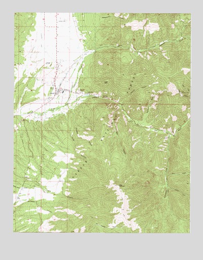
Questa, NM USGS Topographic Map
Click on map above to begin viewing in our Map Viewer.

This topographic map contains these locations and features:
Feature Name Type Latitude Longitude GNIS ID View Map
10023 Water WellWellN36.6667°W105.5978°927014View Map
10024 Water WellWellN36.7345°W105.5978°927015View Map
Almagre CanyonValleyN36.6942°W105.5833°903116View Map
Bear CanyonValleyN36.6967°W105.5497°903629View Map
Bear Canyon ProspectsMineN36.6975°W105.5514°917755View Map
Bernhardt ProspectsMineN36.7014°W105.5011°916650View Map
BJB ProspectsMineN36.6942°W105.5306°917777View Map
Black PointMineN36.7042°W105.5695°917779View Map
Blind GulchValleyN36.7003°W105.5000°903922View Map
Cabresto CreekStreamN36.6975°W105.5881°904286View Map
Capulin CanyonValleyN36.6986°W105.5481°904755View Map
Cerro Elementary SchoolSchoolN36.7039°W105.5950°933870View Map
Columbine CampgroundLocaleN36.6792°W105.5156°905268View Map
Columbine CreekStreamN36.6809°W105.5150°905269View Map
Columbine Creek ProspectMineN36.6772°W105.5153°916646View Map
Columbine-Hondo WildernessReserveN36.6294°W105.5033°2775399View Map
Costilla Elementary SchoolSchoolN36.7039°W105.5950°933989View Map
Deer CreekStreamN36.6581°W105.5175°905690View Map
Diversion ChannelLocaleN36.7200°W105.6206°2678238View Map
Eagle RockPillarN36.7106°W105.5608°905941View Map
Eagle Rock CampgroundLocaleN36.7017°W105.5620°905942View Map
Eagle Rock LakeLakeN36.7034°W105.5738°905943View Map
Embargo SpringSpringN36.6917°W105.6222°914265View Map
Embergo DitchCanalN36.7056°W105.5845°906145View Map
First Assembly of God ChurchChurchN36.7039°W105.5950°920479View Map
First Southern Baptist ChurchChurchN36.7039°W105.5950°920451View Map
Flag MountainSummitN36.6520°W105.5514°906293View Map
GarrapataMineN36.6320°W105.5956°916641View Map
Goathill CampgroundLocaleN36.6881°W105.5406°906596View Map
Goathill GulchValleyN36.6867°W105.5347°906597View Map
Gray Hawk ProspectMineN36.7089°W105.5375°916670View Map
HanoshMineN36.6914°W105.5433°916635View Map
Hercules GroupMineN36.7073°W105.5111°916636View Map
Horner ProspectMineN36.7078°W105.5044°917827View Map
Lake ForkStreamN36.7336°W105.5106°907824View Map
LamaPopulated PlaceN36.6497°W105.6183°907834View Map
Lama Fire DepartmentBuildingN36.6502°W105.6187°2657763View Map
Largo CanyonValleyN36.6931°W105.5903°907846View Map
Llano DitchCanalN36.7353°W105.5767°908088View Map
Log Cabin CanyonMineN36.6861°W105.5714°916633View Map
Lower Cabresto CanyonMineN36.7272°W105.5367°917832View Map
Nickel PlateMineN36.6775°W105.5122°916662View Map
Peñasquito CanyonValleyN36.7472°W105.5633°909553View Map
Placer ForkStreamN36.6517°W105.5158°909748View Map
QuestaPopulated PlaceN36.7039°W105.5950°909932View Map
Questa Christian AcademySchoolN36.7039°W105.5950°934061View Map
Questa Church of ChristChurchN36.7039°W105.5950°920506View Map
Questa Elementary SchoolSchoolN36.7039°W105.5950°933827View Map
Questa Fire Department Station 1BuildingN36.7088°W105.5956°2658168View Map
Questa Fire Department Station 2BuildingN36.7138°W105.5960°2658115View Map
Questa Fire Department Station 3BuildingN36.7324°W105.5942°2658051View Map
Questa First Baptist ChurchChurchN36.7039°W105.5950°902543View Map
Questa Health CenterHospitalN36.7039°W105.5950°901319View Map
Questa Health Center LibraryBuildingN36.7039°W105.5950°929347View Map
Questa High SchoolSchoolN36.7211°W105.5997°909934View Map
Questa Middle SchoolSchoolN36.7039°W105.5950°901449View Map
Questa Molybdenum MineMineN36.7042°W105.5069°909935View Map
Questa Police DepartmentBuildingN36.7137°W105.5960°2722507View Map
Questa Post OfficePost OfficeN36.7039°W105.5950°937896View Map
Questa Ranger StationLocaleN36.7020°W105.5656°909936View Map
Red RiverMineN36.7034°W105.5739°916410View Map
Saint Anthony CemeteryCemeteryN36.7070°W105.5956°910516View Map
Saint Anthonys Catholic ChurchChurchN36.7039°W105.5950°902584View Map
School of the North StarSchoolN36.7039°W105.5950°934235View Map
Silver MineMineN36.6856°W105.5047°916659View Map
Veterans CemeteryCemeteryN36.7061°W105.5786°912097View Map
Village of QuestaCivilN36.7115°W105.5936°2413580View Map
Williams ClaimsMineN36.7042°W105.5603°916655View Map

Note: Coordinates in the location and feature list above are referenced to NAD83 datum.


Copyright (C) 2008-2024 Ryan Niemi / Sunset Dynamics ... All Rights Reserved