TopoQuest Logo
Do you find TopoQuest useful?
Help keep TopoQuest running and adding new maps/features by donating!
Bitcoin:  19c7KJd3qBynnjoSw5npx9KScwjBe4ifkT
Litecoin:  LXs6TkuXGGXo1vDsWCkWVdjQX94eUKd6ui
Home View Maps Find Maps Find Places Resources & Links


Reid, North Carolina Topographic Map

USGS Map Title: Reid, NC
USGS Map MRC: 35082A8
DRG (GeoTIFF) Download: o35082a8.tif


Neighboring USGS Topographic Map Quads:


  Big Ridge, NC  
35083B1
 

  Lake Toxaway, NC  
35082B8
 

  Rosman, NC  
35082B7
 

  Cashiers, NC  
35083A1
 

  Reid, NC  
35082A8
 

  Eastatoe Gap, NC  
35082A7
 

  Tamassee, SC  
34083H1
 

  Salem, SC  
34082H8
 

  Sunset, SC  
34082H7


Map MRC Location:

N36°
W83°
N36°
W82°
H8 H7 H6 H5 H4 H3 H2 H1
G8 G7 G6 G5 G4 G3 G2 G1
F8 F7 F6 F5 F4 F3 F2 F1
E8 E7 E6 E5 E4 E3 E2 E1
D8 D7 D6 D5 D4 D3 D2 D1
C8 C7 C6 C5 C4 C3 C2 C1
B8 B7 B6 B5 B4 B3 B2 B1
A8 A7 A6 A5 A4 A3 A2 A1
N35°
W83°
N35°
W82°

Reid, NC USGS 1:24K Topographic Map Preview:
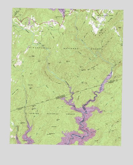
Reid, NC USGS Topographic Map
Click on map above to begin viewing in our Map Viewer.

This topographic map contains these locations and features:
Feature Name Type Latitude Longitude GNIS ID View Map
Auger Fork CreekStreamN35.0840°W82.8999°1008813View Map
Bear CreekStreamN35.0484°W82.9057°1008989View Map
Bear GapGapN35.0582°W82.9207°1009002View Map
Bear Wallow HollowPopulated PlaceN35.1098°W82.9560°1017695View Map
Bear Wallow SpringsPopulated PlaceN35.1118°W82.9590°1017696View Map
Bearcamp CreekStreamN35.0379°W82.9335°1009009View Map
Bearwallow CreekStreamN35.0820°W82.9046°1009049View Map
Bully MountainSummitN35.0040°W82.9004°1231104View Map
Burlingame CreekStreamN35.1076°W82.9932°1009831View Map
Cane BrakePopulated PlaceN35.0659°W82.8901°1019508View Map
Chestnut MountainSummitN35.0765°W82.9385°1019638View Map
Cobb CreekStreamN35.0552°W82.8990°1010347View Map
Coley CreekStreamN35.0143°W82.9774°1010410View Map
Crossroads MountainSummitN35.0462°W82.9193°1231207View Map
Devils Hole CreekStreamN35.0101°W82.9121°1222006View Map
Eastatoe FordStreamN35.0668°W82.8999°1017943View Map
Frozen KnobSummitN35.1082°W82.8771°1020370View Map
Gallbuster MountainSummitN35.0326°W82.9768°1231305View Map
Gorges State ParkParkN35.0833°W82.9125°2374754View Map
Grassy RidgeRidgeN35.0987°W82.9549°1011651View Map
Grindstone MountainSummitN35.0734°W82.9049°1020567View Map
Hester MountainSummitN35.0020°W82.9854°1231375View Map
Hickory GapGapN35.0168°W82.9535°1223132View Map
HogbackRidgeN35.1090°W82.9440°1012103View Map
Horse Pasture School (historical)SchoolN35.0493°W82.8799°1243391View Map
Horsepasture RiverStreamN35.0301°W82.9171°1012212View Map
Indian CreekStreamN35.1045°W82.9251°1012335View Map
Jackies BranchStreamN35.0320°W82.8963°1223484View Map
James CreekStreamN35.1040°W82.9776°1012432View Map
Lake Toxaway ChurchChurchN35.1232°W82.9351°1012656View Map
Lake Toxaway Fire Rescue Station 2BuildingN35.1069°W82.9586°2638676View Map
Laurel Fork CreekStreamN35.0295°W82.9146°1246304View Map
Laurel Fork MountainSummitN35.0201°W82.8824°1246305View Map
Licklog MountainSummitN35.0232°W82.9485°1231478View Map
Line Rock GapGapN35.0359°W82.9757°1012878View Map
Long Spur RidgeRidgeN35.0443°W82.9968°1013177View Map
Lower FallsFallsN35.0165°W82.9938°1246477View Map
Maple Spring BranchStreamN35.0923°W82.8957°1013316View Map
Mill CreekStreamN35.0393°W82.9360°1224543View Map
Misery MountainSummitN35.0520°W82.9793°1021496View Map
Morton CreekStreamN35.1182°W82.8957°1013710View Map
Musterground MountainSummitN35.0118°W82.9585°1231578View Map
Narrow Rock RidgeRidgeN35.0612°W82.9579°1013876View Map
OaklandPopulated PlaceN35.1134°W82.9754°1021708View Map
Oakland CemeteryCemeteryN35.1118°W82.9515°1014066View Map
Panther BranchStreamN35.0943°W82.9196°1014200View Map
Puncheon Camp MountainSummitN35.1176°W82.9524°1022104View Map
Rainbow FallsFallsN35.0907°W82.9660°1014717View Map
ReidPopulated PlaceN35.1159°W82.9029°1022216View Map
Reid BranchStreamN35.0673°W82.9854°1014820View Map
Rock CreekStreamN35.0507°W82.8951°1225924View Map
Rock CreekStreamN35.0587°W82.8954°1014992View Map
Rock CreekStreamN35.1068°W82.9885°1014993View Map
Rocky KnobsSummitN35.0812°W82.9779°1015049View Map
RoundtopSummitN35.1040°W82.9629°1022431View Map
Sapphire Post OfficePost OfficeN35.1135°W82.9560°2774282View Map
Tarkiln GapGapN35.0545°W82.9807°1016028View Map
Township of HogbackCivilN35.0980°W82.9566°1027234View Map
Toxaway CreekStreamN35.0709°W82.8862°1016207View Map
Toxaway FallsPopulated PlaceN35.1218°W82.9318°1017694View Map
Toxaway FallsFallsN35.1234°W82.9307°1016208View Map
Tri-State Club (historical)LocaleN35.0176°W82.9963°1243187View Map
Turkeypen GapGapN35.0701°W82.9210°1016283View Map
UnionPopulated PlaceN35.0887°W82.9815°1023034View Map
Whitewater FallsFallsN35.0712°W82.8868°1023589View Map
Whitewater MountainSummitN35.0190°W82.9888°1251439View Map
Whitewater PinesPopulated PlaceN35.0876°W82.9857°1017697View Map
Windy FallsFallsN35.0751°W82.9579°1016743View Map
Wright CreekStreamN35.0043°W82.9793°1227714View Map

Note: Coordinates in the location and feature list above are referenced to NAD83 datum.


Copyright (C) 2008-2024 Ryan Niemi / Sunset Dynamics ... All Rights Reserved