TopoQuest Logo
Do you find TopoQuest useful?
Help keep TopoQuest running and adding new maps/features by donating!
Bitcoin:  19c7KJd3qBynnjoSw5npx9KScwjBe4ifkT
Litecoin:  LXs6TkuXGGXo1vDsWCkWVdjQX94eUKd6ui
Home View Maps Find Maps Find Places Resources & Links


Riceville, Iowa Topographic Map

USGS Map Title: Riceville, IA
USGS Map MRC: 43092C5
DRG (GeoTIFF) Download: o43092c5.tif


Neighboring USGS Topographic Map Quads:


  Little Cedar, IA  
43092D6
 

  McIntire, IA  
43092D5
 

  Lime Springs NW, IA  
43092D4
 

  New Haven, IA  
43092C6
 

  Riceville, IA  
43092C5
 

  Saratoga, IA  
43092C4
 

  Floyd, IA  
43092B6
 

  Colwell, IA  
43092B5
 

  Elma, IA  
43092B4


Map MRC Location:

N44°
W93°
N44°
W92°
H8 H7 H6 H5 H4 H3 H2 H1
G8 G7 G6 G5 G4 G3 G2 G1
F8 F7 F6 F5 F4 F3 F2 F1
E8 E7 E6 E5 E4 E3 E2 E1
D8 D7 D6 D5 D4 D3 D2 D1
C8 C7 C6 C5 C4 C3 C2 C1
B8 B7 B6 B5 B4 B3 B2 B1
A8 A7 A6 A5 A4 A3 A2 A1
N43°
W93°
N43°
W92°

Riceville, IA USGS 1:24K Topographic Map Preview:
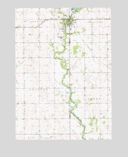
Riceville, IA USGS Topographic Map
Click on map above to begin viewing in our Map Viewer.

This topographic map contains these locations and features:
Feature Name Type Latitude Longitude GNIS ID View Map
Acme Post Office (historical)Post OfficeN43.3189°W92.5060°466691View Map
Calvary CemeteryCemeteryN43.3498°W92.5549°455089View Map
City of RicevilleCivilN43.3622°W92.5541°2396360View Map
Congregational ChurchChurchN43.3636°W92.5532°1948770View Map
Doran Post Office (historical)Post OfficeN43.3577°W92.5974°466430View Map
Farmers Feed and Grain Company ElevatorLocaleN43.3639°W92.5516°1948767View Map
Jamestown Highway Rest AreaLocaleN43.3639°W92.5024°1948703View Map
Jenkins Township CemeteryCemeteryN43.3681°W92.5579°1944944View Map
Lake HendricksReservoirN43.3735°W92.5460°457396View Map
Lake Hendricks DamDamN43.3708°W92.5496°463453View Map
Lake Hendricks ParkParkN43.3744°W92.5427°1948704View Map
Lowther Station (historical)Populated PlaceN43.3189°W92.5060°464054View Map
Mitchell County Regional CenterHospitalN43.3639°W92.5557°1944861View Map
Myers FarmLocaleN43.3192°W92.5528°2702371View Map
NelsonLocaleN43.3275°W92.6010°466321View Map
Nelson Post Office (historical)Post OfficeN43.3125°W92.6127°1944832View Map
Reckner CemeteryCemeteryN43.2743°W92.5154°460548View Map
RicevillePopulated PlaceN43.3639°W92.5541°460608View Map
Riceville Ambulance Service IncorporatedBuildingN43.3632°W92.5567°2599766View Map
Riceville City HallBuildingN43.3636°W92.5546°1944864View Map
Riceville Community CenterBuildingN43.3636°W92.5546°1944862View Map
Riceville Community Rest HomeHospitalN43.3547°W92.5549°1944866View Map
Riceville Country ClubLocaleN43.3666°W92.5488°1948772View Map
Riceville Elementary SchoolSchoolN43.3554°W92.5528°2719968View Map
Riceville Fire DepartmentBuildingN43.3636°W92.5555°1944863View Map
Riceville High SchoolSchoolN43.3554°W92.5528°1948771View Map
Riceville LibraryBuildingN43.3614°W92.5543°1944865View Map
Riceville Post OfficePost OfficeN43.3636°W92.5516°1948768View Map
Saint Peters CemeteryCemeteryN43.3160°W92.5548°461323View Map
Sleeping Duck PondLakeN43.3467°W92.5633°461672View Map
Township of DouglasCivilN43.2987°W92.6135°467731View Map
United Methodist ChurchChurchN43.3614°W92.5538°1948769View Map
Watsons CreekStreamN43.3647°W92.5621°462743View Map

Note: Coordinates in the location and feature list above are referenced to NAD83 datum.


Copyright (C) 2008-2024 Ryan Niemi / Sunset Dynamics ... All Rights Reserved