TopoQuest Logo
Do you find TopoQuest useful?
Help keep TopoQuest running and adding new maps/features by donating!
Bitcoin:  19c7KJd3qBynnjoSw5npx9KScwjBe4ifkT
Litecoin:  LXs6TkuXGGXo1vDsWCkWVdjQX94eUKd6ui
Home View Maps Find Maps Find Places Resources & Links


Saffold, Georgia Topographic Map

USGS Map Title: Saffold, GA
USGS Map MRC: 31085A1
DRG (GeoTIFF) Download: o31085a1.tif


Neighboring USGS Topographic Map Quads:


  Ashford, AL  
31085B2
 

  Gordon, AL  
31085B1
 

  Lucile, GA  
31084B8
 

  Grangeburg, AL  
31085A2
 

  Saffold, GA  
31085A1
 

  Donalsonville West, GA  
31084A8
 

  Malone, FL  
30085H2
 

  Bascom, FL  
30085H1
 

  Steam Mill, GA  
30084H8


Map MRC Location:

N32°
W86°
N32°
W85°
H8 H7 H6 H5 H4 H3 H2 H1
G8 G7 G6 G5 G4 G3 G2 G1
F8 F7 F6 F5 F4 F3 F2 F1
E8 E7 E6 E5 E4 E3 E2 E1
D8 D7 D6 D5 D4 D3 D2 D1
C8 C7 C6 C5 C4 C3 C2 C1
B8 B7 B6 B5 B4 B3 B2 B1
A8 A7 A6 A5 A4 A3 A2 A1
N31°
W86°
N31°
W85°

Saffold, GA USGS 1:24K Topographic Map Preview:
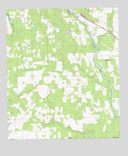
Saffold, GA USGS Topographic Map
Click on map above to begin viewing in our Map Viewer.

This topographic map contains these locations and features:
Feature Name Type Latitude Longitude GNIS ID View Map
Antioch ChurchChurchN31.0344°W85.0972°113116View Map
Bethlehem ChurchChurchN31.1213°W85.0341°354658View Map
Billy Byrd DamDamN31.0702°W85.0549°129632View Map
Bryans CreekStreamN31.0507°W85.0110°115078View Map
Bryants LandingLocaleN31.1080°W85.0366°156125View Map
Chandler Ferry (historical)CrossingN31.0993°W85.0310°344871View Map
Chandlers Ferry (historical)CrossingN31.0988°W85.0319°132239View Map
Chattahoochee State ParkParkN31.0074°W85.0330°115983View Map
CrosbyPopulated PlaceN31.0388°W85.0863°156230View Map
Crosby School (historical)SchoolN31.0355°W85.0908°132261View Map
Cypress CreekStreamN31.0666°W85.0744°116988View Map
Ely Landing (historical)LocaleN31.0210°W85.0049°132269View Map
Evans Store (historical)LocaleN31.0282°W85.0249°138632View Map
Friendship CemeteryCemeteryN31.0202°W85.1249°118658View Map
Friendship ChurchChurchN31.0199°W85.1244°118661View Map
Gordon DivisionCivilN31.0771°W85.1159°165803View Map
Jeffcoat School (historical)SchoolN31.0921°W85.0869°132316View Map
Jerusalem ChurchChurchN31.0638°W85.0522°120868View Map
Kirkland CreekStreamN31.0832°W85.0247°316475View Map
Longs Store (historical)LocaleN31.0099°W85.0410°132326View Map
LucyPopulated PlaceN31.0202°W85.0410°156635View Map
Lucy School (historical)SchoolN31.0199°W85.0416°132328View Map
Lucy Volunteer Fire DepartmentBuildingN31.0354°W85.0981°2331025View Map
Mount Nebo ChurchChurchN31.0818°W85.0505°152452View Map
Navy Yard LandingLocaleN31.0996°W85.0299°332467View Map
Perry Landing (historical)LocaleN31.0785°W85.0277°132367View Map
Pilgrims Rest ChurchChurchN31.0260°W85.1219°152903View Map
SaffoldPopulated PlaceN31.1202°W85.0333°332952View Map
Saint Johns ChurchChurchN31.0477°W85.0424°126119View Map
Sawhatchee CreekStreamN31.1249°W85.0547°322606View Map
Spring Hill Freewill Baptist ChurchChurchN31.0988°W85.1194°153531View Map
The Turnpike SwampSwampN31.1113°W85.1194°127845View Map
Whitehead School (historical)SchoolN31.0791°W85.1216°132430View Map
Willoughby Landing (historical)LocaleN31.0466°W85.0091°132433View Map

Note: Coordinates in the location and feature list above are referenced to NAD83 datum.


Copyright (C) 2008-2024 Ryan Niemi / Sunset Dynamics ... All Rights Reserved