TopoQuest Logo
Do you find TopoQuest useful?
Help keep TopoQuest running and adding new maps/features by donating!
Bitcoin:  19c7KJd3qBynnjoSw5npx9KScwjBe4ifkT
Litecoin:  LXs6TkuXGGXo1vDsWCkWVdjQX94eUKd6ui
Home View Maps Find Maps Find Places Resources & Links


San Rafael Mountain, California Topographic Map

USGS Map Title: San Rafael Mountain, CA
USGS Map MRC: 34119F7
DRG (GeoTIFF) Download: o34119f7.tif


Neighboring USGS Topographic Map Quads:


  Bald Mountain, CA  
34119G8
 

  Hurricane Deck, CA  
34119G7
 

  Salisbury Potrero, CA  
34119G6
 

  Figueroa Mountain, CA  
34119F8
 

  San Rafael Mountain, CA  
34119F7
 

  Big Pine Mountain, CA  
34119F6
 

  Lake Cachuma, CA  
34119E8
 

  San Marcos Pass, CA  
34119E7
 

  Little Pine Mountain, CA  
34119E6


Map MRC Location:

N35°
W120°
N35°
W119°
H8 H7 H6 H5 H4 H3 H2 H1
G8 G7 G6 G5 G4 G3 G2 G1
F8 F7 F6 F5 F4 F3 F2 F1
E8 E7 E6 E5 E4 E3 E2 E1
D8 D7 D6 D5 D4 D3 D2 D1
C8 C7 C6 C5 C4 C3 C2 C1
B8 B7 B6 B5 B4 B3 B2 B1
A8 A7 A6 A5 A4 A3 A2 A1
N34°
W120°
N34°
W119°

San Rafael Mountain, CA USGS 1:24K Topographic Map Preview:
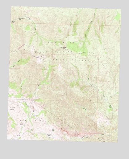
San Rafael Mountain, CA USGS Topographic Map
Click on map above to begin viewing in our Map Viewer.

This topographic map contains these locations and features:
Feature Name Type Latitude Longitude GNIS ID View Map
Big Cone Spruce CampLocaleN34.7258°W119.8462°275384View Map
Big Cone Spruce CampLocaleN34.7261°W119.8468°239283View Map
Black CanyonValleyN34.6322°W119.7660°239391View Map
Coche CreekStreamN34.6642°W119.7651°240738View Map
Cold SpringSpringN34.7067°W119.8462°240754View Map
Demesio SpringSpringN34.6304°W119.8274°241411View Map
Doty CabinLocaleN34.6292°W119.7865°241576View Map
East Fork Santa Cruz CreekStreamN34.6414°W119.7507°271001View Map
Flores CampLocaleN34.6583°W119.7590°242325View Map
Flores CampLocaleN34.6580°W119.7590°275387View Map
Grand SpringSpringN34.6644°W119.8687°242893View Map
La Jolla BasinBasinN34.6528°W119.8746°244408View Map
Live Oak SpringSpringN34.6396°W119.8616°244974View Map
Manzana CampLocaleN34.7355°W119.8740°275380View Map
Manzana CampLocaleN34.7353°W119.8746°245457View Map
Manzana Narrows CampLocaleN34.7380°W119.8663°275385View Map
Manzana Narrows CampLocaleN34.7383°W119.8668°245458View Map
McKinley MountainSummitN34.7025°W119.8457°1661002View Map
McKinley SpringSpringN34.7061°W119.8465°275383View Map
Mine CanyonValleyN34.6447°W119.8510°245950View Map
Mine Canyon SpringSpringN34.6600°W119.8618°245955View Map
Mission Pine CampLocaleN34.7080°W119.7965°275388View Map
Mission Pine CampLocaleN34.7067°W119.7957°246016View Map
Mud SpringSpringN34.6349°W119.8254°246326View Map
Peachtree CanyonValleyN34.6330°W119.8504°247326View Map
San Rafael MountainSummitN34.7108°W119.8151°248959View Map
San Rafael MountainsRangeN34.7108°W119.8143°273511View Map
Santa Cruz Guard StationLocaleN34.6317°W119.7632°249059View Map
Santa Cruz PeakSummitN34.6692°W119.8124°249061View Map
Santa Cruz Rustic CampsiteLocaleN34.6330°W119.7579°275386View Map
Santa Cruz TrailTrailN34.6258°W119.7696°249062View Map
West Fork Santa Cruz CreekStreamN34.6419°W119.7510°251350View Map

Note: Coordinates in the location and feature list above are referenced to NAD83 datum.


Copyright (C) 2008-2024 Ryan Niemi / Sunset Dynamics ... All Rights Reserved