TopoQuest Logo
Do you find TopoQuest useful?
Help keep TopoQuest running and adding new maps/features by donating!
Bitcoin:  19c7KJd3qBynnjoSw5npx9KScwjBe4ifkT
Litecoin:  LXs6TkuXGGXo1vDsWCkWVdjQX94eUKd6ui
Home View Maps Find Maps Find Places Resources & Links


Scott Creek, South Dakota Topographic Map

USGS Map Title: Scott Creek, SD
USGS Map MRC: 45103G8
DRG (GeoTIFF) Download: o45103g8.tif


Neighboring USGS Topographic Map Quads:


  Snider Hill, MT  
45104H1
 

  Doaks Butte, ND  
45103H8
 

  Dogie Butte, SD  
45103H7
 

  Humbolt Hills, MT  
45104G1
 

  Scott Creek, SD  
45103G8
 

  Chimney Butte, SD  
45103G7
 

  North Slick Creek, MT  
45104F1
 

  Caroline Butte, SD  
45103F8
 

  Gallup Creek, SD  
45103F7


Map MRC Location:

N46°
W104°
N46°
W103°
H8 H7 H6 H5 H4 H3 H2 H1
G8 G7 G6 G5 G4 G3 G2 G1
F8 F7 F6 F5 F4 F3 F2 F1
E8 E7 E6 E5 E4 E3 E2 E1
D8 D7 D6 D5 D4 D3 D2 D1
C8 C7 C6 C5 C4 C3 C2 C1
B8 B7 B6 B5 B4 B3 B2 B1
A8 A7 A6 A5 A4 A3 A2 A1
N45°
W104°
N45°
W103°

Scott Creek, SD USGS 1:24K Topographic Map Preview:
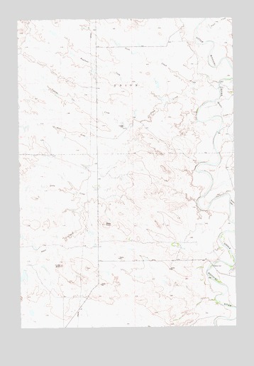
Scott Creek, SD USGS Topographic Map
Click on map above to begin viewing in our Map Viewer.

This topographic map contains these locations and features:
Feature Name Type Latitude Longitude GNIS ID View Map
Bleak ButteSummitN45.7919°W103.9510°1253964View Map
Dipping Vat CreekStreamN45.8325°W103.9319°1254695View Map
Dogie CreekStreamN45.8742°W103.8913°1266797View Map
Dry House CreekStreamN45.7789°W103.8763°1254769View Map
Kimble CreekStreamN45.8014°W103.8783°1255937View Map
Middle CreekStreamN45.8411°W103.8863°1256444View Map
Mud Butte DamDamN45.7733°W103.9988°1259805View Map
Profile ButteSummitN45.7751°W103.9764°1265330View Map
Salmen FordLocaleN45.7744°W103.8888°1257775View Map
Scott CreekStreamN45.8506°W103.8922°1258004View Map
Seal DrawValleyN45.8219°W103.9416°1258009View Map
Shaw CreekStreamN45.8486°W103.8838°1258033View Map
Stony CreekStreamN45.8036°W103.9613°1258375View Map
Tennant Ranch AirportAirportN45.8308°W103.9379°1260223View Map
Wagoneer CreekStreamN45.8400°W103.9152°1258791View Map
Watson (historical)LocaleN45.7689°W103.9449°1263409View Map
Willett (historical)LocaleN45.8147°W103.8935°1263410View Map

Note: Coordinates in the location and feature list above are referenced to NAD83 datum.


Copyright (C) 2008-2024 Ryan Niemi / Sunset Dynamics ... All Rights Reserved