TopoQuest Logo
Do you find TopoQuest useful?
Help keep TopoQuest running and adding new maps/features by donating!
Bitcoin:  19c7KJd3qBynnjoSw5npx9KScwjBe4ifkT
Litecoin:  LXs6TkuXGGXo1vDsWCkWVdjQX94eUKd6ui
Home View Maps Find Maps Find Places Resources & Links


Seale, Alabama Topographic Map

USGS Map Title: Seale, AL
USGS Map MRC: 32085C2
DRG (GeoTIFF) Download: o32085c2.tif


Neighboring USGS Topographic Map Quads:


  Marvyn, AL  
32085D3
 

  Crawford, AL  
32085D2
 

  Phenix City, AL  
32085D1
 

  Hatchechubbee, AL  
32085C3
 

  Seale, AL  
32085C2
 

  Fort Mitchell, AL  
32085C1
 

  Rutherford, AL  
32085B3
 

  Pittsview, AL  
32085B2
 

  Omaha, GA  
32085B1


Map MRC Location:

N33°
W86°
N33°
W85°
H8 H7 H6 H5 H4 H3 H2 H1
G8 G7 G6 G5 G4 G3 G2 G1
F8 F7 F6 F5 F4 F3 F2 F1
E8 E7 E6 E5 E4 E3 E2 E1
D8 D7 D6 D5 D4 D3 D2 D1
C8 C7 C6 C5 C4 C3 C2 C1
B8 B7 B6 B5 B4 B3 B2 B1
A8 A7 A6 A5 A4 A3 A2 A1
N32°
W86°
N32°
W85°

Seale, AL USGS 1:24K Topographic Map Preview:
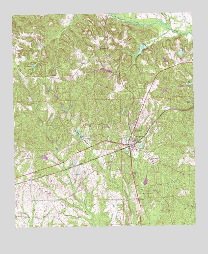
Seale, AL USGS Topographic Map
Click on map above to begin viewing in our Map Viewer.

This topographic map contains these locations and features:
Feature Name Type Latitude Longitude GNIS ID View Map
Bass CemeteryCemeteryN32.3403°W85.1513°138707View Map
Boykin CemeteryCemeteryN32.3586°W85.1739°133214View Map
Bush CemeteryCemeteryN32.3560°W85.2480°115296View Map
Carrol LakeReservoirN32.3435°W85.2211°133220View Map
Carroll Lake DamDamN32.2901°W85.2299°130381View Map
Chavale High SchoolSchoolN32.2999°W85.1672°115985View Map
ColbertPopulated PlaceN32.2826°W85.2366°116377View Map
Colbert ChurchChurchN32.2799°W85.2369°133226View Map
DudleysPopulated PlaceN32.3015°W85.1980°133234View Map
Dudleys LakeReservoirN32.3044°W85.2045°117633View Map
Friendship ChurchChurchN32.2518°W85.1630°118680View Map
Friendship ChurchChurchN32.2590°W85.2463°118681View Map
Friendship SchoolSchoolN32.2563°W85.2435°118718View Map
Goodhope Baptist ChurchChurchN32.3546°W85.1902°155079View Map
Greene Number 2 DamDamN32.3485°W85.1466°130468View Map
Horselot BranchStreamN32.3682°W85.1433°120413View Map
HyramPopulated PlaceN32.3529°W85.2480°166033View Map
Hyram Post OfficePost OfficeN32.3529°W85.2480°169267View Map
Key CemeteryCemeteryN32.3710°W85.1944°138717View Map
Lake LenoraReservoirN32.3453°W85.2352°133275View Map
Lake Lenora DamDamN32.3462°W85.2337°130463View Map
Lewis BranchStreamN32.3626°W85.1258°121514View Map
Lexington (historical)LocaleN32.3357°W85.2347°166034View Map
Lexington Post Office (historical)Post OfficeN32.3357°W85.2347°169278View Map
Matthews DamDamN32.3318°W85.1449°130443View Map
McCann LakeReservoirN32.3015°W85.1709°152263View Map
Ministries of Faith ChurchChurchN32.3385°W85.2247°133283View Map
Monte PondReservoirN32.3172°W85.1741°133285View Map
Mott Lake DamDamN32.3518°W85.1333°130472View Map
Mount Hebron Baptist ChurchChurchN32.3013°W85.1630°155158View Map
Mount Olive ChurchChurchN32.2885°W85.1541°123298View Map
Natural Bridge Post Office (historical)Post OfficeN32.3318°W85.1522°166035View Map
Perrys Steam Mill (historical)LocaleN32.2868°W85.1535°133303View Map
Porter BranchStreamN32.3649°W85.1405°153046View Map
Porter Branch Lake DamDamN32.3557°W85.1575°130478View Map
Porter CemeteryCemeteryN32.3471°W85.1771°125179View Map
Ross ChapelChurchN32.2746°W85.1524°125958View Map
Russell CountyCivilN32.2884°W85.1850°161583View Map
Russell County Farm (historical)LocaleN32.3185°W85.1702°154704View Map
Russell County Vocational SchoolSchoolN32.3154°W85.1694°133316View Map
Saint Matthews ChurchChurchN32.3057°W85.1672°153276View Map
Saint Peters CemeteryCemeteryN32.3504°W85.2441°133327View Map
Saint Peters ChurchChurchN32.3504°W85.2441°126201View Map
SandfortPopulated PlaceN32.3382°W85.2233°158079View Map
Sandfort Fire TowerTowerN32.3451°W85.2452°164455View Map
Sandfort SchoolSchoolN32.3465°W85.2016°158080View Map
SealePopulated PlaceN32.2974°W85.1688°153358View Map
Seale Post OfficePost OfficeN32.2976°W85.1741°168689View Map
Seale SchoolSchoolN32.2807°W85.1674°155332View Map
Seale Volunteer Fire DepartmentBuildingN32.2996°W85.1722°2691475View Map
Silver Run Baptist ChurchChurchN32.3257°W85.1577°155333View Map
Sumbry Memorial ChurchChurchN32.2993°W85.1822°133335View Map
Thomas Bridge (historical)BridgeN32.3726°W85.1758°133338View Map
VillulaPopulated PlaceN32.2660°W85.1647°128456View Map
Wadsworth Lake DamDamN32.2951°W85.1633°130385View Map
Williams CemeteryCemeteryN32.3171°W85.2435°129004View Map
Williams Dudley CemeteryCemeteryN32.3013°W85.2035°133346View Map

Note: Coordinates in the location and feature list above are referenced to NAD83 datum.


Copyright (C) 2008-2024 Ryan Niemi / Sunset Dynamics ... All Rights Reserved