TopoQuest Logo
Do you find TopoQuest useful?
Help keep TopoQuest running and adding new maps/features by donating!
Bitcoin:  19c7KJd3qBynnjoSw5npx9KScwjBe4ifkT
Litecoin:  LXs6TkuXGGXo1vDsWCkWVdjQX94eUKd6ui
Home View Maps Find Maps Find Places Resources & Links


Searsboro, Iowa Topographic Map

USGS Map Title: Searsboro, IA
USGS Map MRC: 41092E6
DRG (GeoTIFF) Download: o41092e6.tif


Neighboring USGS Topographic Map Quads:


  Oakland Acres, IA  
41092F7
 

  Grinnell South, IA  
41092F6
 

  Malcom, IA  
41092F5
 

  Sully, IA  
41092E7
 

  Searsboro, IA  
41092E6
 

  Montezuma, IA  
41092E5
 

  Peoria, IA  
41092D7
 

  New Sharon, IA  
41092D6
 

  Union Mills, IA  
41092D5


Map MRC Location:

N42°
W93°
N42°
W92°
H8 H7 H6 H5 H4 H3 H2 H1
G8 G7 G6 G5 G4 G3 G2 G1
F8 F7 F6 F5 F4 F3 F2 F1
E8 E7 E6 E5 E4 E3 E2 E1
D8 D7 D6 D5 D4 D3 D2 D1
C8 C7 C6 C5 C4 C3 C2 C1
B8 B7 B6 B5 B4 B3 B2 B1
A8 A7 A6 A5 A4 A3 A2 A1
N41°
W93°
N41°
W92°

Searsboro, IA USGS 1:24K Topographic Map Preview:
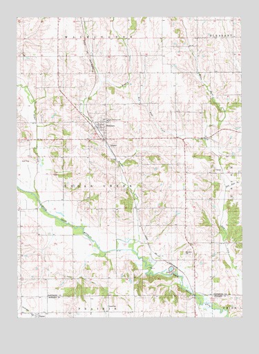
Searsboro, IA USGS Topographic Map
Click on map above to begin viewing in our Map Viewer.

This topographic map contains these locations and features:
Feature Name Type Latitude Longitude GNIS ID View Map
Cemetery Hill CemeteryCemeteryN41.5576°W92.7255°1997440View Map
City of SearsboroCivilN41.5792°W92.7043°2396565View Map
East Buck CreekStreamN41.5542°W92.6330°456133View Map
English CreekStreamN41.5281°W92.6855°456377View Map
McDowell BridgeBridgeN41.5208°W92.6760°1997454View Map
Middle Buck CreekStreamN41.5536°W92.6341°459031View Map
Mill Grove CemeteryCemeteryN41.5272°W92.6566°459093View Map
Mill Grove Post Office (historical)Post OfficeN41.5228°W92.6710°466486View Map
Millgrove AccessLocaleN41.5172°W92.6794°1997442View Map
Moore Siding (historical)LocaleN41.5239°W92.6685°1997262View Map
Robertson AccessLocaleN41.5083°W92.6488°1970705View Map
SearsboroLocaleN41.5806°W92.7035°1997430View Map
SearsboroPopulated PlaceN41.5806°W92.7035°461495View Map
Searsboro Community CenterBuildingN41.5806°W92.7035°1997428View Map
Searsboro Community Fire DepartmentBuildingN41.5793°W92.7045°1997429View Map
Searsboro International Order of Odd Fellows CemeteryCemeteryN41.5824°W92.7018°1997441View Map
Searsboro Post OfficePost OfficeN41.5806°W92.7035°1997427View Map
Searsboro Sully Lynville SchoolSchoolN41.5822°W92.6999°461496View Map
Stewart CemeteryCemeteryN41.5048°W92.6998°461990View Map
StillwellPopulated PlaceN41.5239°W92.6685°464225View Map
Stilwell Post Office (historical)Post OfficeN41.5239°W92.6685°1997261View Map
Sugar CreekStreamN41.5472°W92.7369°462057View Map
Sully Co-operative Exchange ElevatorLocaleN41.5011°W92.7385°1970836View Map
TaintorPopulated PlaceN41.5011°W92.7385°462172View Map
Taintor (historical)LocaleN41.5011°W92.7385°1970838View Map
Taintor Community ChurchChurchN41.5011°W92.7385°1970835View Map
Taintor Post Office (historical)Post OfficeN41.5011°W92.7385°1970837View Map
Township of Sugar CreekCivilN41.5553°W92.6995°468757View Map
Tyro Post Office (historical)Post OfficeN41.6094°W92.7288°466485View Map
West Buck CreekStreamN41.5731°W92.6452°462826View Map
West Liberty CemeteryCemeteryN41.5740°W92.6434°1997435View Map
West Liberty ChurchChurchN41.5744°W92.6432°1823450View Map

Note: Coordinates in the location and feature list above are referenced to NAD83 datum.


Copyright (C) 2008-2024 Ryan Niemi / Sunset Dynamics ... All Rights Reserved