TopoQuest Logo
Do you find TopoQuest useful?
Help keep TopoQuest running and adding new maps/features by donating!
Bitcoin:  19c7KJd3qBynnjoSw5npx9KScwjBe4ifkT
Litecoin:  LXs6TkuXGGXo1vDsWCkWVdjQX94eUKd6ui
Home View Maps Find Maps Find Places Resources & Links


Sessoms, Georgia Topographic Map

USGS Map Title: Sessoms, GA
USGS Map MRC: 31082E5
DRG (GeoTIFF) Download: o31082e5.tif


Neighboring USGS Topographic Map Quads:


  Denton, GA  
31082F6
 

  Nicholls NE, GA  
31082F5
 

  Alma NW, GA  
31082F4
 

  Nicholls, GA  
31082E6
 

  Sessoms, GA  
31082E5
 

  Alma, GA  
31082E4
 

  Wilsonville, GA  
31082D6
 

  Beach, GA  
31082D5
 

  Crawley, GA  
31082D4


Map MRC Location:

N32°
W83°
N32°
W82°
H8 H7 H6 H5 H4 H3 H2 H1
G8 G7 G6 G5 G4 G3 G2 G1
F8 F7 F6 F5 F4 F3 F2 F1
E8 E7 E6 E5 E4 E3 E2 E1
D8 D7 D6 D5 D4 D3 D2 D1
C8 C7 C6 C5 C4 C3 C2 C1
B8 B7 B6 B5 B4 B3 B2 B1
A8 A7 A6 A5 A4 A3 A2 A1
N31°
W83°
N31°
W82°

Sessoms, GA USGS 1:24K Topographic Map Preview:
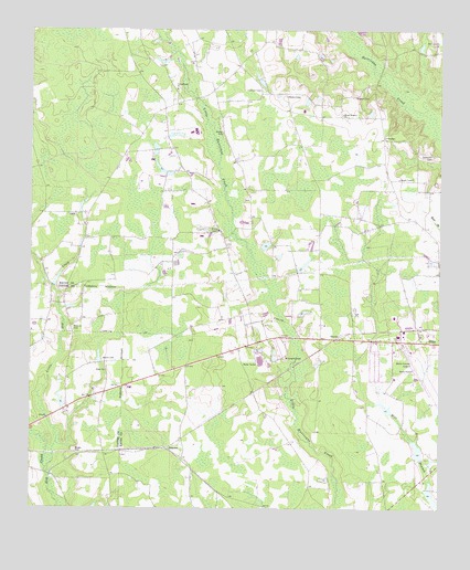
Sessoms, GA USGS Topographic Map
Click on map above to begin viewing in our Map Viewer.

This topographic map contains these locations and features:
Feature Name Type Latitude Longitude GNIS ID View Map
Alma DivisionCivilN31.5377°W82.5187°1936076View Map
Bacon County AirportAirportN31.5416°W82.5087°351654View Map
Bryant and Futch LakeReservoirN31.5265°W82.5161°337727View Map
Bryant and Futch Lake DamDamN31.5252°W82.5149°337726View Map
Camp Ground CemeteryCemeteryN31.6096°W82.5796°1986506View Map
Campground ChurchChurchN31.6096°W82.5804°312272View Map
Douglas ChapelChurchN31.5396°W82.5465°313595View Map
Douglas Chapel CemeteryCemeteryN31.5394°W82.5468°1986507View Map
Elam Primitive Baptist ChurchChurchN31.5363°W82.6018°355655View Map
GuysiePopulated PlaceN31.5444°W82.5315°331890View Map
Jones LakeReservoirN31.5152°W82.5063°337731View Map
Jones Lake DamDamN31.5135°W82.5065°337730View Map
Little Hog CreekStreamN31.5105°W82.6196°317086View Map
Meeks CemeteryCemeteryN31.5158°W82.6112°317998View Map
Meeks CemeteryCemeteryN31.5391°W82.6026°317999View Map
Mercer CemeteryCemeteryN31.5982°W82.5662°318033View Map
Mount Pleasant ChurchChurchN31.6030°W82.5299°318834View Map
Mullis LakeReservoirN31.5025°W82.5010°337723View Map
Patterson CemeteryCemeteryN31.5924°W82.5024°320274View Map
Pine Level CemeteryCemeteryN31.6216°W82.5021°1986510View Map
Pine Level ChurchChurchN31.6213°W82.5012°320626View Map
Roberts CemeteryCemeteryN31.5471°W82.6118°321675View Map
Saint Raymonns ChurchChurchN31.5441°W82.5149°344795View Map
SessomsPopulated PlaceN31.5158°W82.5829°333007View Map
Stewart CemeteryCemeteryN31.6074°W82.5268°323602View Map
Taylor Town Volunteer Fire StationBuildingN31.6082°W82.5469°2604268View Map
Wesley ChapelChurchN31.5727°W82.5676°325004View Map
Wesley Chapel CemeteryCemeteryN31.5716°W82.5665°1986512View Map
Whiddons Millpond DamDamN31.5435°W82.6082°338089View Map
WKXH-FM (Alma)TowerN31.6074°W82.5460°352607View Map

Note: Coordinates in the location and feature list above are referenced to NAD83 datum.


Copyright (C) 2008-2024 Ryan Niemi / Sunset Dynamics ... All Rights Reserved