TopoQuest Logo
Do you find TopoQuest useful?
Help keep TopoQuest running and adding new maps/features by donating!
Bitcoin:  19c7KJd3qBynnjoSw5npx9KScwjBe4ifkT
Litecoin:  LXs6TkuXGGXo1vDsWCkWVdjQX94eUKd6ui
Home View Maps Find Maps Find Places Resources & Links


Sharon, Connecticut Topographic Map

USGS Map Title: Sharon, CT
USGS Map MRC: 41073H4
DRG (GeoTIFF) Download: o41073h4.tif


Neighboring USGS Topographic Map Quads:


  Copake, NY  
42073A5


  Millerton, NY  
41073H5
 

  Sharon, CT  
41073H4
 

  South Canaan, CT  
41073H3
 

  Amenia, NY  
41073G5
 

  Ellsworth, CT  
41073G4
 

  Cornwall, CT  
41073G3


Map MRC Location:

N42°
W74°
N42°
W73°
H8 H7 H6 H5 H4 H3 H2 H1
G8 G7 G6 G5 G4 G3 G2 G1
F8 F7 F6 F5 F4 F3 F2 F1
E8 E7 E6 E5 E4 E3 E2 E1
D8 D7 D6 D5 D4 D3 D2 D1
C8 C7 C6 C5 C4 C3 C2 C1
B8 B7 B6 B5 B4 B3 B2 B1
A8 A7 A6 A5 A4 A3 A2 A1
N41°
W74°
N41°
W73°

Sharon, CT USGS 1:24K Topographic Map Preview:
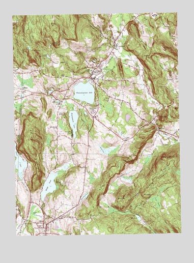
Sharon, CT USGS Topographic Map
Click on map above to begin viewing in our Map Viewer.

This topographic map contains these locations and features:
Feature Name Type Latitude Longitude GNIS ID View Map
AmesvillePopulated PlaceN41.9629°W73.3760°205084View Map
Bauer PondLakeN41.9289°W73.4149°205317View Map
Beardsley PondLakeN41.8967°W73.4476°205357View Map
Beardsley Pond BrookStreamN41.8862°W73.4887°205358View Map
Beeslick BrookStreamN41.9420°W73.4501°205420View Map
Beeslick PondLakeN41.9229°W73.4331°205421View Map
Bird PeakSummitN41.9790°W73.4835°205523View Map
Brook HillSummitN41.9801°W73.4504°1931824View Map
Buckley PondReservoirN41.9251°W73.3879°1771342View Map
Buckley Pond DamDamN41.9251°W73.3879°1771341View Map
Bunker HillSummitN41.9998°W73.4365°1931830View Map
Burton BrookStreamN41.9662°W73.4290°205875View Map
Camp EastonLocaleN41.9051°W73.4643°205946View Map
Camp SloaneLocaleN41.9437°W73.4618°205978View Map
Cemetery HillSummitN41.8826°W73.4785°1931866View Map
Cobble ParkParkN41.9887°W73.4196°1931887View Map
Congregational Church of ChristChurchN41.9815°W73.4226°1931901View Map
Deep LakeReservoirN41.9511°W73.4662°206648View Map
Edsel Ford Memorial LibraryBuildingN41.9454°W73.4396°1931944View Map
Factory BrookStreamN41.9748°W73.4096°206988View Map
Falls MountainSummitN41.9529°W73.3835°207020View Map
Fink HillSummitN41.9998°W73.3932°1931958View Map
First Congregational ChurchChurchN41.8770°W73.4776°1931963View Map
Forge MountainSummitN41.9404°W73.3868°207140View Map
Gallows HillSummitN41.9456°W73.3760°207237View Map
Garnett BrookStreamN41.9970°W73.4165°207255View Map
Gay Woods HillSummitN41.9262°W73.4271°1931989View Map
Gay-Holt House MuseumBuildingN41.8768°W73.4768°1931990View Map
Holley Williams House MuseumBuildingN41.9659°W73.4415°1932056View Map
Hotchkiss Library of SharonBuildingN41.8787°W73.4760°1932060View Map
Indian LakeLakeN41.9183°W73.4967°208076View Map
Indian MountainSummitN41.9287°W73.4876°208081View Map
Indian Mountain SchoolSchoolN41.9359°W73.4673°208082View Map
Interlaken EstatesPopulated PlaceN41.9487°W73.4398°1932082View Map
Kelsey BrookStreamN41.9518°W73.4996°208246View Map
King HillSummitN41.8829°W73.4896°1932109View Map
Lake TavolanReservoirN41.9412°W73.4136°1771344View Map
Lake Tayolan DamDamN41.9434°W73.4129°1771343View Map
Lakeview Post OfficePost OfficeN41.9656°W73.4404°1932120View Map
Lakeview United Methodist ChurchChurchN41.9670°W73.4401°1932119View Map
LakevillePopulated PlaceN41.9645°W73.4401°208366View Map
Lakeville Census Designated PlaceCensusN41.9594°W73.4467°2631567View Map
Lakeville Hose CompanyBuildingN41.9729°W73.4322°2420258View Map
Lakeville Post OfficePost OfficeN41.9656°W73.4405°2783303View Map
Lakeville Reservoir Number 1ReservoirN41.9833°W73.4711°212942View Map
Lakeville Reservoir Number 2ReservoirN41.9765°W73.4731°212943View Map
Lakeville Reservoir Number 2 DamDamN41.9754°W73.4718°1771628View Map
Lime RockPopulated PlaceN41.9337°W73.3893°208472View Map
Lime Rock Historic DistrictParkN41.9337°W73.3901°1932131View Map
Lime Rock ParkParkN41.9268°W73.3843°1932133View Map
Lime Rock Park AmbulanceBuildingN41.9297°W73.3775°2660905View Map
Long Pond BrookStreamN41.9090°W73.4696°1932157View Map
Lorenzo PondReservoirN41.9320°W73.4190°208608View Map
McDuffee BrookStreamN41.9731°W73.4590°208793View Map
Medical Arts BuildingBuildingN41.8793°W73.4807°1932175View Map
Memorial Clock TowerTowerN41.8759°W73.4768°1932178View Map
Miles PondReservoirN41.8842°W73.4070°208881View Map
Miles Pond DamDamN41.8826°W73.4057°1771358View Map
Miles Wildlife SanctuaryParkN41.8823°W73.4037°1932182View Map
Mine MountainSummitN41.8943°W73.4210°208946View Map
Moore BrookStreamN41.9968°W73.4165°209018View Map
Mount EasterSummitN41.8968°W73.4015°209099View Map
Mount ProspectSummitN41.9793°W73.3846°209102View Map
Mount RigaSummitN41.9945°W73.4687°209104View Map
Mudge PondLakeN41.9029°W73.4744°209129View Map
Mudge Pond BrookStreamN41.8868°W73.4860°209130View Map
Mudge Pond Town BeachBeachN41.9106°W73.4712°1932208View Map
MudgetownPopulated PlaceN41.8956°W73.4762°1932209View Map
Ore HillPopulated PlaceN41.9573°W73.4671°212533View Map
Ore Hill BrookStreamN41.9495°W73.4629°209528View Map
Ore Hill PondLakeN41.9570°W73.4715°209529View Map
Pettee BrookStreamN41.9740°W73.4221°209726View Map
Pine SwampSwampN41.8936°W73.3932°209805View Map
Raccoon HillSummitN41.9754°W73.3957°210078View Map
Red MountainSummitN41.9084°W73.4248°210141View Map
Red RocksPillarN41.9170°W73.4135°210145View Map
Reed HillSummitN41.9556°W73.4590°1932315View Map
SalisburyPopulated PlaceN41.9834°W73.4212°210608View Map
Salisbury Fire Marshal's OfficeBuildingN41.9846°W73.4223°2420351View Map
Salisbury SchoolSchoolN41.9987°W73.3926°210610View Map
Salisbury Volunteer Ambulance ServiceBuildingN41.9841°W73.4227°2660850View Map
SharonPopulated PlaceN41.8793°W73.4768°210778View Map
Sharon Census Designated PlaceCensusN41.8784°W73.4720°2631575View Map
Sharon Fire Department Station 1BuildingN41.8796°W73.4784°2420454View Map
Sharon Fire Marshal's OfficeBuildingN41.8785°W73.4773°2420303View Map
Sharon HospitalHospitalN41.8803°W73.4815°2660306View Map
Sharon Hospital HeliportAirportN41.8812°W73.4804°213113View Map
Sharon MountainSummitN41.9173°W73.3804°210781View Map
Sharon ValleyPopulated PlaceN41.8840°W73.4923°210782View Map
Sharon Valley Historic DistrictParkN41.8843°W73.4926°1943292View Map
Spruce Swamp CreekStreamN41.9718°W73.4065°211108View Map
State LineLocaleN41.9581°W73.4926°211150View Map
State LinePopulated PlaceN41.9584°W73.4935°966271View Map
Sucker BrookStreamN41.9493°W73.4398°211276View Map
Tan Fat HillSummitN41.8859°W73.4415°211352View Map
Taylor PondLakeN41.9651°W73.4637°211376View Map
The CedarsPopulated PlaceN41.9323°W73.4551°211406View Map
The Hotchkiss SchoolSchoolN41.9454°W73.4390°211420View Map
Thorpe MountainSummitN41.9906°W73.4876°211457View Map
Town of SalisburyCivilN41.9860°W73.4256°213500View Map
Trinity Church Lime RockChurchN41.9310°W73.3795°2705159View Map
Wachocastinook CreekStreamN41.9743°W73.4101°205027View Map
Wetauwanchu MountainSummitN41.9856°W73.4012°212039View Map
White Hollow BrookStreamN41.9270°W73.3760°212074View Map
Wononpakook LakeLakeN41.9395°W73.4547°212225View Map
Wononpakook Lake DamDamN41.9381°W73.4546°1771347View Map
Wononskopomuc LakeLakeN41.9557°W73.4458°212226View Map

Note: Coordinates in the location and feature list above are referenced to NAD83 datum.


Copyright (C) 2008-2024 Ryan Niemi / Sunset Dynamics ... All Rights Reserved