TopoQuest Logo
Do you find TopoQuest useful?
Help keep TopoQuest running and adding new maps/features by donating!
Bitcoin:  19c7KJd3qBynnjoSw5npx9KScwjBe4ifkT
Litecoin:  LXs6TkuXGGXo1vDsWCkWVdjQX94eUKd6ui
Home View Maps Find Maps Find Places Resources & Links


Shelby, Nebraska Topographic Map

USGS Map Title: Shelby, NE
USGS Map MRC: 41097B4
DRG (GeoTIFF) Download: o41097b4.tif


Neighboring USGS Topographic Map Quads:


  Silver Creek SE, NE  
41097C5
 

  Columbus SW, NE  
41097C4
 

  Columbus SE, NE  
41097C3
 

  Osceola, NE  
41097B5
 

  Shelby, NE  
41097B4
 

  Rising City, NE  
41097B3
 

  Stromsburg, NE  
41097A5
 

  Gresham, NE  
41097A4
 

  Surprise, NE  
41097A3


Map MRC Location:

N42°
W98°
N42°
W97°
H8 H7 H6 H5 H4 H3 H2 H1
G8 G7 G6 G5 G4 G3 G2 G1
F8 F7 F6 F5 F4 F3 F2 F1
E8 E7 E6 E5 E4 E3 E2 E1
D8 D7 D6 D5 D4 D3 D2 D1
C8 C7 C6 C5 C4 C3 C2 C1
B8 B7 B6 B5 B4 B3 B2 B1
A8 A7 A6 A5 A4 A3 A2 A1
N41°
W98°
N41°
W97°

Shelby, NE USGS 1:24K Topographic Map Preview:
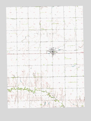
Shelby, NE USGS Topographic Map
Click on map above to begin viewing in our Map Viewer.

This topographic map contains these locations and features:
Feature Name Type Latitude Longitude GNIS ID View Map
Farmers Co-op Business Association ElevatorLocaleN41.1922°W97.4253°1881525View Map
Golden West FeedyardsLocaleN41.2011°W97.4078°2581901View Map
Graceland CemeteryCemeteryN41.1983°W97.4214°829609View Map
North Canada Election Precinct (historical)CivilN41.2283°W97.4356°1929102View Map
Palo CemeteryCemeteryN41.1836°W97.4250°831962View Map
Sacred Heart Catholic ChurchChurchN41.1903°W97.4250°1881530View Map
Sacred Heart SchoolSchoolN41.1900°W97.4250°1881529View Map
ShelbyPopulated PlaceN41.1922°W97.4253°833371View Map
ShelbyLocaleN41.1956°W97.4253°1881527View Map
Shelby ClinicHospitalN41.1922°W97.4253°1881522View Map
Shelby Dental Care CenterHospitalN41.1922°W97.4253°1881521View Map
Shelby Post OfficePost OfficeN41.1941°W97.4257°1881526View Map
Shelby Public LibraryBuildingN41.1922°W97.4253°1881523View Map
Shelby Public SchoolsSchoolN41.1986°W97.4242°1881531View Map
Shelby Volunteer Fire and RescueBuildingN41.1940°W97.4255°1881524View Map
South Canada Election PrecinctCivilN41.1558°W97.4354°1929289View Map
Thelen CemeteryCemeteryN41.1425°W97.4314°1881482View Map
Thelen DamDamN41.1331°W97.4394°1767039View Map
Thelen ReservoirLakeN41.1325°W97.4393°1767040View Map
Township of CanadaCivilN41.2167°W97.4337°1881477View Map
United Methodist ChurchChurchN41.1970°W97.4262°1881528View Map
Village of ShelbyCivilN41.1939°W97.4261°2399796View Map
Wesley Chapel CemeteryCemeteryN41.2350°W97.4853°834556View Map

Note: Coordinates in the location and feature list above are referenced to NAD83 datum.


Copyright (C) 2008-2024 Ryan Niemi / Sunset Dynamics ... All Rights Reserved