TopoQuest Logo
Do you find TopoQuest useful?
Help keep TopoQuest running and adding new maps/features by donating!
Bitcoin:  19c7KJd3qBynnjoSw5npx9KScwjBe4ifkT
Litecoin:  LXs6TkuXGGXo1vDsWCkWVdjQX94eUKd6ui
Home View Maps Find Maps Find Places Resources & Links


Skyland, North Carolina Topographic Map

USGS Map Title: Skyland, NC
USGS Map MRC: 35082D5
DRG (GeoTIFF) Download: o35082d5.tif


Neighboring USGS Topographic Map Quads:


  Enka, NC  
35082E6
 

  Asheville, NC  
35082E5
 

  Oteen, NC  
35082E4
 

  Dunsmore Mountain, NC  
35082D6
 

  Skyland, NC  
35082D5
 

  Fruitland, NC  
35082D4
 

  Pisgah Forest, NC  
35082C6
 

  Horse Shoe, NC  
35082C5
 

  Hendersonville, NC  
35082C4


Map MRC Location:

N36°
W83°
N36°
W82°
H8 H7 H6 H5 H4 H3 H2 H1
G8 G7 G6 G5 G4 G3 G2 G1
F8 F7 F6 F5 F4 F3 F2 F1
E8 E7 E6 E5 E4 E3 E2 E1
D8 D7 D6 D5 D4 D3 D2 D1
C8 C7 C6 C5 C4 C3 C2 C1
B8 B7 B6 B5 B4 B3 B2 B1
A8 A7 A6 A5 A4 A3 A2 A1
N35°
W83°
N35°
W82°

Skyland, NC USGS 1:24K Topographic Map Preview:
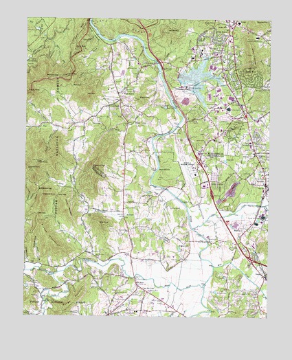
Skyland, NC USGS Topographic Map
Click on map above to begin viewing in our Map Viewer.

This topographic map contains these locations and features:
Feature Name Type Latitude Longitude GNIS ID View Map
Allen GapGapN35.4176°W82.6185°1008685View Map
ArdenPopulated PlaceN35.4662°W82.5165°1018846View Map
Arden Post OfficePost OfficeN35.4628°W82.5153°2773806View Map
Asheville Fire Department Station 4BuildingN35.4848°W82.5241°2639572View Map
Asheville Regional AirportAirportN35.4373°W82.5390°1016914View Map
Asheville Regional Airport Department of Public Safety Rescue Fire StationsBuildingN35.4361°W82.5383°2638712View Map
Asheville Steam PlantLocaleN35.4715°W82.5421°1008798View Map
Ashley BranchStreamN35.4904°W82.5823°1008801View Map
Avery CreekPopulated PlaceN35.4634°W82.5826°1018880View Map
Avery CreekStreamN35.4515°W82.5565°1008821View Map
Avery Creek Census Designated PlaceCensusN35.4651°W82.5718°2402655View Map
Baker CemeteryCemeteryN35.4659°W82.5860°1008858View Map
Ball GapGapN35.4723°W82.6007°1008894View Map
Ball MountainSummitN35.4684°W82.5940°1018940View Map
Bethel ChurchChurchN35.4284°W82.5737°1009215View Map
Big F Shopping CenterLocaleN35.4282°W82.5026°1017773View Map
Biltmore FarmsLocaleN35.4086°W82.5300°2633193View Map
Blake MountainSummitN35.4962°W82.5268°1019213View Map
Boiling Springs ChurchChurchN35.4318°W82.5296°1009530View Map
Brandy BranchStreamN35.3876°W82.5565°1009579View Map
BricktonPopulated PlaceN35.4090°W82.5135°1019293View Map
Brickton ChurchChurchN35.4126°W82.5029°1009593View Map
Britton MountainSummitN35.4665°W82.5668°1009621View Map
Brown MountainSummitN35.4854°W82.5093°1009662View Map
Bryson MountainSummitN35.4087°W82.6140°1019350View Map
Buck ShoalsBarN35.4371°W82.5565°1009751View Map
BusbeePopulated PlaceN35.4984°W82.5179°1019437View Map
Busbee Community CenterBuildingN35.4912°W82.5035°1009857View Map
Busbee Post Office (historical)Post OfficeN35.4984°W82.5179°1940236View Map
Butler BridgeBridgeN35.4068°W82.5310°1009860View Map
Calvary ChurchChurchN35.4432°W82.5043°1009924View Map
Camp Clark-KennedyLocaleN35.4912°W82.5918°1009948View Map
Camp Deer LakeReservoirN35.4951°W82.6182°1009957View Map
Cane CreekStreamN35.4123°W82.5385°1010002View Map
Caney MountainSummitN35.4204°W82.6035°1019516View Map
Capps LakeReservoirN35.4466°W82.5021°1010033View Map
Chestnut TopSummitN35.4379°W82.5901°1019657View Map
Clayton CreekStreamN35.4909°W82.5796°1010308View Map
Crescent HillSummitN35.4565°W82.5165°1019856View Map
Crosspoint ChurchChurchN35.4557°W82.6001°1014055View Map
Cushion BranchStreamN35.4221°W82.5015°1019889View Map
Double KnobSummitN35.4368°W82.6232°1020008View Map
Dubose LakeReservoirN35.4561°W82.5867°1010928View Map
Ducker CreekStreamN35.4823°W82.5587°1010933View Map
Ducker MountainSummitN35.4946°W82.5537°1010934View Map
Emmanuel ChurchChurchN35.4021°W82.5901°1011086View Map
Fanning BridgeBridgeN35.4287°W82.5526°1011174View Map
Fanning ChapelChurchN35.4204°W82.5735°1011175View Map
FletcherPopulated PlaceN35.4307°W82.5012°1020286View Map
Fletcher Fire and Rescue Department Station 1BuildingN35.4310°W82.5003°2639731View Map
Fletcher Fire and Rescue Department Station 3BuildingN35.3894°W82.5028°2638793View Map
Fletcher First Baptist ChurchChurchN35.4357°W82.5013°2674830View Map
Fletcher PlazaLocaleN35.4462°W82.5096°1017774View Map
Fletcher Post OfficePost OfficeN35.4325°W82.5008°2773975View Map
Fletcher QuarryMineN35.4286°W82.5189°2648495View Map
Fletcher SchoolSchoolN35.4357°W82.5004°1011284View Map
Fletcher United Methodist ChurchChurchN35.4353°W82.5032°2674827View Map
Foster CreekStreamN35.3965°W82.5826°1011349View Map
Frady LakeReservoirN35.4407°W82.5223°1011366View Map
Frady MountainSummitN35.4979°W82.5348°1020349View Map
Glen Arden Elementary SchoolSchoolN35.4604°W82.5185°1017518View Map
Glenn BaldSummitN35.4871°W82.6001°1011532View Map
Glenn BridgeBridgeN35.4532°W82.5496°1011533View Map
Graham CemeteryCemeteryN35.4556°W82.6020°2761056View Map
Grassy Knob TunnelTunnelN35.4693°W82.6223°2035913View Map
Hayes MillLocaleN35.4179°W82.5735°1011924View Map
Higgins BranchStreamN35.4229°W82.5248°1012033View Map
Hogback KnobSummitN35.4251°W82.6162°1020790View Map
Hollaman LakeReservoirN35.4033°W82.5453°1012128View Map
Holloman Pond DamDamN35.4051°W82.5448°1017192View Map
Hunter CemeteryCemeteryN35.4754°W82.5237°1012283View Map
Innisfree LakeReservoirN35.3857°W82.5264°1012364View Map
Jones CemeteryCemeteryN35.3990°W82.5454°1012546View Map
Kates ParkParkN35.4345°W82.5032°2674829View Map
Kimsey CreekStreamN35.4215°W82.5418°1012626View Map
Lake ComaReservoirN35.4631°W82.5533°1010423View Map
Lake JulianReservoirN35.4752°W82.5370°1017210View Map
Lake Powhatan DamDamN35.4826°W82.6235°1017212View Map
Lance MountainSummitN35.4759°W82.6043°1012673View Map
Ledford BranchStreamN35.4851°W82.6212°1012780View Map
Line CreekStreamN35.4440°W82.5585°1012877View Map
Long ShoalsBarN35.4798°W82.5571°1013174View Map
Long Shoals BridgeBridgeN35.4815°W82.5579°1013175View Map
Long Shoals CemeteryCemeteryN35.4787°W82.5682°1013176View Map
Looking Glass Montessori School - RosmanSchoolN35.4231°W82.5658°2612101View Map
Lutheridge CampLocaleN35.4546°W82.5179°1013261View Map
Lutheridge ChapelChurchN35.4562°W82.5162°1013262View Map
McCall BranchStreamN35.3951°W82.6171°1013393View Map
McDowell CreekStreamN35.4254°W82.5476°1013419View Map
MidwayPopulated PlaceN35.4432°W82.5062°1021441View Map
Mills KnobSummitN35.4140°W82.5868°1021472View Map
Mills RiverStreamN35.3887°W82.5321°1013598View Map
Mills RiverPopulated PlaceN35.3884°W82.5668°1021475View Map
Mills River BridgeBridgeN35.3915°W82.5682°1013599View Map
Mills River CemeteryCemeteryN35.3829°W82.6173°1013600View Map
Mills River ChapelChurchN35.3848°W82.5773°1021476View Map
Mills River ChurchChurchN35.3812°W82.6132°1013601View Map
Mills River ChurchChurchN35.3784°W82.5715°1021477View Map
Mills River Fire and RescueBuildingN35.3774°W82.5741°2639713View Map
Mills River SchoolSchoolN35.3768°W82.5671°1013602View Map
Mount Carmel ChurchChurchN35.4643°W82.5282°1013732View Map
Mount Gilead ChurchChurchN35.4107°W82.5723°1013736View Map
Mount Zion ChurchChurchN35.4876°W82.5382°1013786View Map
Mountain ViewPopulated PlaceN35.4723°W82.5040°1021576View Map
Mud CreekStreamN35.3965°W82.5276°1013816View Map
Mullinax CoveValleyN35.3970°W82.6174°1013839View Map
NaplesPopulated PlaceN35.3926°W82.5007°1013873View Map
Naples ChurchChurchN35.3868°W82.5051°1013874View Map
Naples Post OfficePost OfficeN35.3930°W82.5018°2774216View Map
Nativity ChurchChurchN35.4857°W82.5390°1013880View Map
NC Noname Two-Hundred Sixty DamDamN35.4768°W82.5465°1017211View Map
New Salem ChurchChurchN35.4857°W82.5215°1013933View Map
Newman BranchStreamN35.4540°W82.6090°1013946View Map
North Fork Mills RiverStreamN35.3926°W82.6104°1014003View Map
Oak ForestPopulated PlaceN35.4918°W82.5279°1021684View Map
Oak Grove Christian ChurchChurchN35.4736°W82.5681°2761036View Map
Oak Hill CourtPopulated PlaceN35.3862°W82.5629°1021697View Map
Oak ParkPopulated PlaceN35.4479°W82.5082°1021701View Map
Orton BranchStreamN35.4918°W82.5865°1014138View Map
Poplar CoveValleyN35.4884°W82.6105°1014583View Map
Reynolds GapGapN35.4759°W82.6079°1014831View Map
Ritter Airpark (historical)AirportN35.3798°W82.5762°1016901View Map
Roberts LakeReservoirN35.4833°W82.5698°1014966View Map
Royal PinesPopulated PlaceN35.4751°W82.5160°1022437View Map
Royal Pines Census Designated PlaceCensusN35.4783°W82.5038°2403497View Map
Saint Barnabas ChurchChurchN35.4621°W82.5148°1015153View Map
Saint Johns ChurchChurchN35.4357°W82.5087°1015156View Map
Sandy BottomBendN35.4948°W82.5907°1015226View Map
Shepherd Memorial ParkCemeteryN35.3851°W82.5070°1015425View Map
Shut-in RidgeRidgeN35.4951°W82.5973°1015505View Map
Sitton-Gillespie CemeteryCemeteryN35.3754°W82.6235°1015558View Map
SkylandPopulated PlaceN35.4893°W82.5243°1022654View Map
Skyland Fire and RescueBuildingN35.4846°W82.5241°2638646View Map
Skyland Fire and Rescue District 2BuildingN35.4638°W82.5743°2639635View Map
Skyland Post OfficePost OfficeN35.4911°W82.5221°2774358View Map
Soapstone BranchStreamN35.4301°W82.6007°1015658View Map
Soapstone GapGapN35.4279°W82.6179°1015661View Map
South Fork Mills RiverStreamN35.3926°W82.6104°1015690View Map
Spain BranchStreamN35.4557°W82.5982°995265View Map
Taylor DamDamN35.4884°W82.5115°1017215View Map
TC Roberson High SchoolSchoolN35.4862°W82.5351°1016002View Map
Terry GapGapN35.4257°W82.6082°1016075View Map
Town of FletcherCivilN35.4316°W82.5040°2406499View Map
Town of Mills RiverCivilN35.3853°W82.5854°2406166View Map
Township of Avery CreekCivilN35.4767°W82.6065°1026443View Map
Township of LimestoneCivilN35.4911°W82.5127°1026451View Map
Valley Springs SchoolSchoolN35.4843°W82.5398°1016357View Map
Wesley CreekStreamN35.4998°W82.6029°1016511View Map
West HavenPopulated PlaceN35.4693°W82.5765°1023165View Map
West KnobSummitN35.4401°W82.6182°1016545View Map
Whitaker CemeteryCemeteryN35.3890°W82.6207°1016577View Map
Whitaker CoveValleyN35.3973°W82.6236°1016579View Map
William W Estes Elementary SchoolSchoolN35.4871°W82.5396°1017519View Map
Wolf BranchStreamN35.4912°W82.6143°1016771View Map

Note: Coordinates in the location and feature list above are referenced to NAD83 datum.


Copyright (C) 2008-2024 Ryan Niemi / Sunset Dynamics ... All Rights Reserved