TopoQuest Logo
Do you find TopoQuest useful?
Help keep TopoQuest running and adding new maps/features by donating!
Bitcoin:  19c7KJd3qBynnjoSw5npx9KScwjBe4ifkT
Litecoin:  LXs6TkuXGGXo1vDsWCkWVdjQX94eUKd6ui
Home View Maps Find Maps Find Places Resources & Links


Smithville, Missouri Topographic Map

USGS Map Title: Smithville, MO
USGS Map MRC: 39094D5
DRG (GeoTIFF) Download: o39094d5.tif


Neighboring USGS Topographic Map Quads:


  Edgerton, MO  
39094E6
 

  Gower, MO  
39094E5
 

  Plattsburg, MO  
39094E4
 

  Camden Point, MO  
39094D6
 

  Smithville, MO  
39094D5
 

  Arley, MO  
39094D4
 

  Ferrelview, MO  
39094C6
 

  Nashua, MO  
39094C5
 

  Kearney SW, MO  
39094C4


Map MRC Location:

N40°
W95°
N40°
W94°
H8 H7 H6 H5 H4 H3 H2 H1
G8 G7 G6 G5 G4 G3 G2 G1
F8 F7 F6 F5 F4 F3 F2 F1
E8 E7 E6 E5 E4 E3 E2 E1
D8 D7 D6 D5 D4 D3 D2 D1
C8 C7 C6 C5 C4 C3 C2 C1
B8 B7 B6 B5 B4 B3 B2 B1
A8 A7 A6 A5 A4 A3 A2 A1
N39°
W95°
N39°
W94°

Smithville, MO USGS 1:24K Topographic Map Preview:
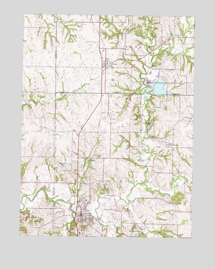
Smithville, MO USGS Topographic Map
Click on map above to begin viewing in our Map Viewer.

This topographic map contains these locations and features:
Feature Name Type Latitude Longitude GNIS ID View Map
Bainbridge Lake DamDamN39.4217°W94.5719°761123View Map
Benson SchoolSchoolN39.3903°W94.5122°742372View Map
Brooks CemeteryCemeteryN39.3753°W94.5702°714747View Map
Camp BranchStreamN39.4056°W94.5355°715250View Map
City of SmithvilleCivilN39.3918°W94.5750°2395903View Map
City of TrimbleCivilN39.4762°W94.5612°2397053View Map
Crows CreekStreamN39.3953°W94.5488°716560View Map
Davenport CemeteryCemeteryN39.4375°W94.5558°716686View Map
Duncan BranchStreamN39.4189°W94.5313°717175View Map
Edgerton - Trimble Fire Protection District Station 2BuildingN39.4744°W94.5682°2620725View Map
Fry School (historical)LocaleN39.4344°W94.6013°742370View Map
Gaus CemeteryCemeteryN39.4119°W94.5924°718373View Map
H and H LakeReservoirN39.4138°W94.5906°761126View Map
H and H Lake DamDamN39.4133°W94.5886°761125View Map
H and H LakesReservoirN39.4128°W94.5888°718949View Map
Helvely Park DamDamN39.3817°W94.5669°761142View Map
Helvely Park LakeReservoirN39.3817°W94.5677°761143View Map
Hixson Bridge (historical)LocaleN39.4833°W94.5094°742367View Map
Hixson Mill (historical)LocaleN39.4836°W94.5097°746577View Map
J C Ranch LakeReservoirN39.4348°W94.5868°762539View Map
Johnson DamDamN39.4350°W94.5869°762538View Map
Kings LakeReservoirN39.4562°W94.5529°720624View Map
Lake RemoteLakeN39.3982°W94.5632°725213View Map
Lake Wahoo WatersReservoirN39.3778°W94.5374°728243View Map
Lingenfelter BranchStreamN39.4561°W94.5330°739517View Map
Linn BranchStreamN39.4769°W94.5302°721122View Map
Linn Branch BridgeBridgeN39.4789°W94.5327°755289View Map
Lott School (historical)LocaleN39.4711°W94.5963°742369View Map
MeccaPopulated PlaceN39.4842°W94.5230°722189View Map
Miller LakeReservoirN39.4192°W94.5336°722382View Map
Mitchell BranchStreamN39.3772°W94.5338°722481View Map
Mononame 160 ReservoirReservoirN39.4212°W94.5707°761124View Map
Mononame 162 DamDamN39.3917°W94.5902°761129View Map
Mononame 163 DamDamN39.4183°W94.5336°761130View Map
Norman Fann Farm Airport (historical)AirportN39.4083°W94.5586°758943View Map
Owens BranchStreamN39.3931°W94.5877°723905View Map
ParadisePopulated PlaceN39.4275°W94.5158°730173View Map
Paradise CemeteryCemeteryN39.4244°W94.5158°2089635View Map
Pleasant Hill ChurchChurchN39.4700°W94.5191°724539View Map
Prairie Point School (historical)LocaleN39.4589°W94.5063°742368View Map
Reed CemeteryCemeteryN39.4950°W94.5827°725185View Map
Roberts BranchStreamN39.4869°W94.5322°725394View Map
Rock BranchStreamN39.4572°W94.5391°725429View Map
Rocky Point School (historical)LocaleN39.4192°W94.5722°742371View Map
Ross Mills (historical)LocaleN39.4344°W94.5347°746578View Map
Saint Luke's North Hospital - SmithvilleHospitalN39.3764°W94.5816°2655095View Map
Second CreekStreamN39.3889°W94.5863°726175View Map
Shady Hollow Dams Dam (historical)DamN39.4375°W94.5312°761132View Map
Shady Hollow Lakes (historical)ReservoirN39.4367°W94.5333°726252View Map
SmithvillePopulated PlaceN39.3869°W94.5811°730218View Map
Smithville Area Fire Protection District Station 1BuildingN39.3882°W94.5789°2621610View Map
Smithville DamDamN39.3972°W94.5677°758372View Map
Smithville High SchoolSchoolN39.3754°W94.5765°2545461View Map
Smithville LakeReservoirN39.3972°W94.5677°735989View Map
Smithville Police DepartmentBuildingN39.3869°W94.5816°2752336View Map
Smithville Primary Elementary SchoolSchoolN39.3958°W94.5777°2545146View Map
Starr AirportAirportN39.4971°W94.5811°2679396View Map
Stony Point SchoolSchoolN39.4894°W94.5111°742366View Map
Township of HardinCivilN39.4972°W94.5380°766514View Map
Township of PlatteCivilN39.3797°W94.5366°766509View Map
TrimblePopulated PlaceN39.4711°W94.5647°730235View Map
Trimble Post OfficePost OfficeN39.4734°W94.5681°2779484View Map
Trimble Wildlife DamDamN39.4583°W94.5286°763057View Map
Trimble Wildlife LakeReservoirN39.4583°W94.5286°763058View Map
Trimble Wildlife Management AreaParkN39.4608°W94.5211°727776View Map
Wilkerson CreekStreamN39.3853°W94.5705°728863View Map

Note: Coordinates in the location and feature list above are referenced to NAD83 datum.


Copyright (C) 2008-2024 Ryan Niemi / Sunset Dynamics ... All Rights Reserved