TopoQuest Logo
Do you find TopoQuest useful?
Help keep TopoQuest running and adding new maps/features by donating!
Bitcoin:  19c7KJd3qBynnjoSw5npx9KScwjBe4ifkT
Litecoin:  LXs6TkuXGGXo1vDsWCkWVdjQX94eUKd6ui
Home View Maps Find Maps Find Places Resources & Links


Soldier Key, Florida Topographic Map

USGS Map Title: Soldier Key, FL
USGS Map MRC: 25080E2
DRG (GeoTIFF) Download: o25080e2.tif


Neighboring USGS Topographic Map Quads:


  South Miami, FL  
25080F3
 

  Key Biscayne, FL  
25080F2


  Perrine, FL  
25080E3
 

  Soldier Key, FL  
25080E2


  Arsenicker Keys, FL  
25080D3
 

  Elliott Key, FL  
25080D2


Map MRC Location:

N26°
W81°
N26°
W80°
H8 H7 H6 H5 H4 H3 H2 H1
G8 G7 G6 G5 G4 G3 G2 G1
F8 F7 F6 F5 F4 F3 F2 F1
E8 E7 E6 E5 E4 E3 E2 E1
D8 D7 D6 D5 D4 D3 D2 D1
C8 C7 C6 C5 C4 C3 C2 C1
B8 B7 B6 B5 B4 B3 B2 B1
A8 A7 A6 A5 A4 A3 A2 A1
N25°
W81°
N25°
W80°

Soldier Key, FL USGS 1:24K Topographic Map Preview:
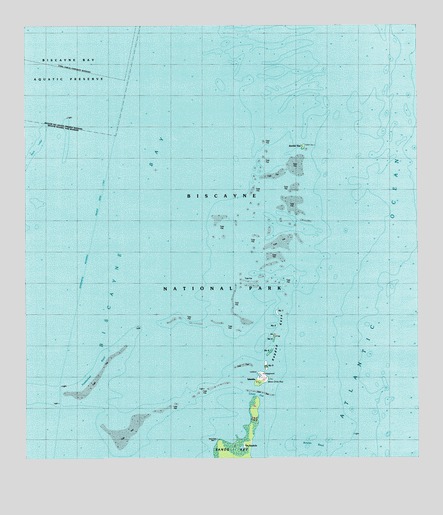
Soldier Key, FL USGS Topographic Map
Click on map above to begin viewing in our Map Viewer.

This topographic map contains these locations and features:
Feature Name Type Latitude Longitude GNIS ID View Map
Biscayne BayBayN25.5775°W80.2346°294305View Map
Black LedgeBarN25.5915°W80.2462°278918View Map
Boca Chita KeyIslandN25.5065°W80.1737°304707View Map
Bowles BankBarN25.5040°W80.1587°279292View Map
Featherbed BankBarN25.5248°W80.2278°282399View Map
Lewis CutBayN25.5198°W80.1764°297443View Map
Our Lady of the Holy Rosary Catholic ChurchChurchN25.5073°W80.1887°303059View Map
Ragged KeysIslandN25.5312°W80.1720°289432View Map
Safety ValveGutN25.5837°W80.1664°293633View Map
Sands KeyIslandN25.5021°W80.1839°290608View Map
Soldier KeyIslandN25.5901°W80.1612°291325View Map
The KeyholePopulated PlaceN25.5037°W80.1809°304708View Map

Note: Coordinates in the location and feature list above are referenced to NAD83 datum.


Copyright (C) 2008-2024 Ryan Niemi / Sunset Dynamics ... All Rights Reserved