TopoQuest Logo
Do you find TopoQuest useful?
Help keep TopoQuest running and adding new maps/features by donating!
Bitcoin:  19c7KJd3qBynnjoSw5npx9KScwjBe4ifkT
Litecoin:  LXs6TkuXGGXo1vDsWCkWVdjQX94eUKd6ui
Home View Maps Find Maps Find Places Resources & Links


Springville, Iowa Topographic Map

USGS Map Title: Springville, IA
USGS Map MRC: 42091A4
DRG (GeoTIFF) Download: o42091a4.tif


Neighboring USGS Topographic Map Quads:


  Central City, IA  
42091B5
 

  Prairieburg, IA  
42091B4
 

  Anamosa NE, IA  
42091B3
 

  Marion, IA  
42091A5
 

  Springville, IA  
42091A4
 

  Anamosa, IA  
42091A3
 

  Bertram, IA  
41091H5
 

  Mount Vernon, IA  
41091H4
 

  Mechanicsville, IA  
41091H3


Map MRC Location:

N43°
W92°
N43°
W91°
H8 H7 H6 H5 H4 H3 H2 H1
G8 G7 G6 G5 G4 G3 G2 G1
F8 F7 F6 F5 F4 F3 F2 F1
E8 E7 E6 E5 E4 E3 E2 E1
D8 D7 D6 D5 D4 D3 D2 D1
C8 C7 C6 C5 C4 C3 C2 C1
B8 B7 B6 B5 B4 B3 B2 B1
A8 A7 A6 A5 A4 A3 A2 A1
N42°
W92°
N42°
W91°

Springville, IA USGS 1:24K Topographic Map Preview:
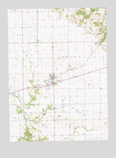
Springville, IA USGS Topographic Map
Click on map above to begin viewing in our Map Viewer.

This topographic map contains these locations and features:
Feature Name Type Latitude Longitude GNIS ID View Map
Bowser QuarryMineN42.0531°W91.4608°2571510View Map
Carlton Mobile Home CourtPopulated PlaceN42.0500°W91.4682°2047956View Map
City of SpringvilleCivilN42.0530°W91.4457°2395944View Map
Crab AppleLocaleN42.0458°W91.4991°466170View Map
Crabapple CreekStreamN42.0314°W91.4841°455690View Map
Crabapple Post Office (historical)Post OfficeN42.1028°W91.4991°2046621View Map
East Big CreekStreamN42.0511°W91.4638°456116View Map
Elbow CreekStreamN42.0028°W91.4843°456262View Map
Faith Christian FellowshipChurchN42.0594°W91.4427°2047949View Map
Gillilan CemeteryCemeteryN42.1236°W91.4377°456901View Map
Hopewell CemeteryCemeteryN42.0722°W91.3779°2048107View Map
Linn Grove CemeteryCemeteryN42.0064°W91.4041°2048108View Map
Linn Grove ChurchChurchN42.0058°W91.4377°458418View Map
Nathan Brown Historical MarkerParkN42.0561°W91.4377°2048146View Map
ParaltaPopulated PlaceN42.0314°W91.4427°460020View Map
Paralta (historical)LocaleN42.0314°W91.4427°2046619View Map
Paralta CemeteryCemeteryN42.0314°W91.4427°2048109View Map
Paralta Post Office (historical)Post OfficeN42.0314°W91.4427°2046620View Map
Saint Isdore CemeteryCemeteryN42.0550°W91.4377°460984View Map
Saint Isidore Catholic ChurchChurchN42.0625°W91.4474°2047950View Map
Simmons CreekStreamN42.0142°W91.4788°461642View Map
SpringvillePopulated PlaceN42.0594°W91.4427°461923View Map
Springville (historical)LocaleN42.0600°W91.4435°2047944View Map
Springville CemeteryCemeteryN42.0561°W91.4377°461924View Map
Springville City HallBuildingN42.0597°W91.4429°2047948View Map
Springville Elementary SchoolSchoolN42.0544°W91.4475°2047955View Map
Springville Fire DepartmentBuildingN42.0606°W91.4432°2047946View Map
Springville Memorial LibraryBuildingN42.0597°W91.4429°2047947View Map
Springville Middle / High SchoolSchoolN42.0554°W91.4448°2047954View Map
Springville Post OfficePost OfficeN42.0589°W91.4429°2047945View Map
Springville Presbyterian ChurchChurchN42.0575°W91.4435°2047951View Map
Township of BrownCivilN42.0784°W91.4232°467493View Map
United Methodist ChurchChurchN42.0578°W91.4435°2047952View Map
ViolaPopulated PlaceN42.0919°W91.3873°462581View Map
Viola (historical)LocaleN42.0906°W91.3854°2046616View Map
Viola Post OfficePost OfficeN42.0908°W91.3863°2046617View Map
WhittierPopulated PlaceN42.0947°W91.4627°463015View Map
Whittier CemeteryCemeteryN42.0934°W91.4642°2048110View Map
Whittier Friends MeetingChurchN42.0933°W91.4635°2047953View Map
Whittier Post Office (historical)Post OfficeN42.0947°W91.4627°2046615View Map
Wires CornersLocaleN42.0492°W91.4377°463143View Map

Note: Coordinates in the location and feature list above are referenced to NAD83 datum.


Copyright (C) 2008-2024 Ryan Niemi / Sunset Dynamics ... All Rights Reserved