TopoQuest Logo
Do you find TopoQuest useful?
Help keep TopoQuest running and adding new maps/features by donating!
Bitcoin:  19c7KJd3qBynnjoSw5npx9KScwjBe4ifkT
Litecoin:  LXs6TkuXGGXo1vDsWCkWVdjQX94eUKd6ui
Home View Maps Find Maps Find Places Resources & Links


Strauss, New Mexico Topographic Map

USGS Map Title: Strauss, NM
USGS Map MRC: 31106G6
DRG (GeoTIFF) Download: o31106g6.tif


Neighboring USGS Topographic Map Quads:


  Lanark, NM  
31106H7
 

  La Union, NM  
31106H6
 

  Canutillo, TX  
31106H5
 

  Noria, NM  
31106G7
 

  Strauss, NM  
31106G6
 

  Smeltertown, TX  
31106G5


Map MRC Location:

N32°
W107°
N32°
W106°
H8 H7 H6 H5 H4 H3 H2 H1
G8 G7 G6 G5 G4 G3 G2 G1
F8 F7 F6 F5 F4 F3 F2 F1
E8 E7 E6 E5 E4 E3 E2 E1
D8 D7 D6 D5 D4 D3 D2 D1
C8 C7 C6 C5 C4 C3 C2 C1
B8 B7 B6 B5 B4 B3 B2 B1
A8 A7 A6 A5 A4 A3 A2 A1
N31°
W107°
N31°
W106°

Strauss, NM USGS 1:24K Topographic Map Preview:
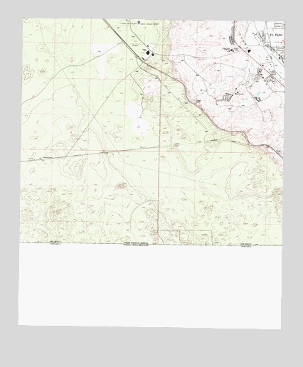
Strauss, NM USGS Topographic Map
Click on map above to begin viewing in our Map Viewer.

This topographic map contains these locations and features:
Feature Name Type Latitude Longitude GNIS ID View Map
10067 Water WellWellN31.8504°W106.6858°919582View Map
10141 Water WellWellN31.8623°W106.6619°918929View Map
10143 Water WellWellN31.8551°W106.7078°918927View Map
10144 Water WellWellN31.8371°W106.6653°918935View Map
10154 Water WellWellN31.8457°W106.6361°919579View Map
10156 Water WellWellN31.8540°W106.6567°919583View Map
10157 Water WellWellN31.8623°W106.6905°918930View Map
10161 Water WellWellN31.8312°W106.6936°918933View Map
10166 Water WellWellN31.8390°W106.6505°918936View Map
10167 Water WellWellN31.8462°W106.6650°919580View Map
10169 Water WellWellN31.8473°W106.6475°919581View Map
10174 Water WellWellN31.8698°W106.7030°918931View Map
10175 Water WellWellN31.8568°W106.6839°918928View Map
10176 Water WellWellN31.8362°W106.6355°918934View Map
Alliance Hospital of Santa TeresaHospitalN31.8629°W106.6364°933925View Map
Crawford LateralCanalN31.8693°W106.6378°888054View Map
LizardPopulated PlaceN31.8218°W106.6289°920634View Map
MastodonPopulated PlaceN31.8221°W106.6958°920643View Map
NM 4911302 Water WellWellN31.8620°W106.6353°919348View Map
OrangePopulated PlaceN31.8609°W106.6361°920656View Map
Orange Post Office (historical)Post OfficeN31.8609°W106.6361°938235View Map
P 16 Water WellWellN31.8651°W106.6961°919349View Map
Q 268 Water WellWellN31.8470°W106.6272°919347View Map
Q-70 Water WellWellN31.8240°W106.6325°919344View Map
Santa Niņa ChurchChurchN31.8629°W106.6364°894578View Map
Santa TeresaCivilN31.8568°W106.6417°894584View Map
Santa TeresaPopulated PlaceN31.8559°W106.6392°933190View Map
Santa Teresa Census Designated PlaceCensusN31.8697°W106.6710°2409282View Map
Santa Teresa Volunteer Fire DepartmentBuildingN31.8547°W106.6425°2657806View Map
StraussPopulated PlaceN31.8643°W106.6989°920713View Map
Strauss Post Office (historical)Post OfficeN31.8643°W106.6989°937273View Map
Sunland Park Fire Department Station 2BuildingN31.8611°W106.6419°2657944View Map
West DrainCanalN31.8679°W106.6328°1376691View Map

Note: Coordinates in the location and feature list above are referenced to NAD83 datum.


Copyright (C) 2008-2024 Ryan Niemi / Sunset Dynamics ... All Rights Reserved