TopoQuest Logo
Do you find TopoQuest useful?
Help keep TopoQuest running and adding new maps/features by donating!
Bitcoin:  19c7KJd3qBynnjoSw5npx9KScwjBe4ifkT
Litecoin:  LXs6TkuXGGXo1vDsWCkWVdjQX94eUKd6ui
Home View Maps Find Maps Find Places Resources & Links


Superstition Mountains SW, Arizona Topographic Map

USGS Map Title: Superstition Mountains SW, AZ
USGS Map MRC: 33111C4
DRG (GeoTIFF) Download: o33111c4.tif


Neighboring USGS Topographic Map Quads:


  Apache Junction, AZ  
33111D5
 

  Goldfield, AZ  
33111D4
 

  Weavers Needle, AZ  
33111D3
 

  Desert Well, AZ  
33111C5
 

  Superstition Mountains SW, AZ  
33111C4
 

  Florence Junction, AZ  
33111C3
 

  Sacaton NE, AZ  
33111B5
 

  Magma, AZ  
33111B4
 

  Florence NE, AZ  
33111B3


Map MRC Location:

N34°
W112°
N34°
W111°
H8 H7 H6 H5 H4 H3 H2 H1
G8 G7 G6 G5 G4 G3 G2 G1
F8 F7 F6 F5 F4 F3 F2 F1
E8 E7 E6 E5 E4 E3 E2 E1
D8 D7 D6 D5 D4 D3 D2 D1
C8 C7 C6 C5 C4 C3 C2 C1
B8 B7 B6 B5 B4 B3 B2 B1
A8 A7 A6 A5 A4 A3 A2 A1
N33°
W112°
N33°
W111°

Superstition Mountains SW, AZ USGS 1:24K Topographic Map Preview:
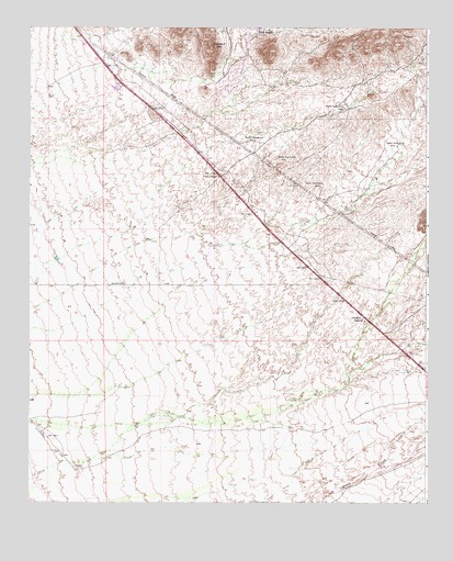
Superstition Mountains SW, AZ USGS Topographic Map
Click on map above to begin viewing in our Map Viewer.

This topographic map contains these locations and features:
Feature Name Type Latitude Longitude GNIS ID View Map
Dinosaur MountainSummitN33.3689°W111.4426°28480View Map
Gold CanyonPopulated PlaceN33.3646°W111.4616°2652385View Map
Gold Canyon Census Designated PlaceCensusN33.3715°W111.4369°2408303View Map
Gold Canyon Elementary SchoolSchoolN33.3619°W111.4392°2545018View Map
Gold Canyon Golf ResortLocaleN33.3610°W111.4472°2670574View Map
Gold Canyon RanchLocaleN33.3553°W111.4379°41313View Map
Gold Canyon Recreational Vehicle Ranch Golf CourseLocaleN33.3536°W111.4725°2669748View Map
Gold Canyon United Methodist ChurchChurchN33.3545°W111.4561°2671072View Map
KVVA-FM (Apache Junction)TowerN33.3489°W111.4621°45707View Map
Mountain Brook Golf ClubLocaleN33.3637°W111.4714°2670363View Map
Navajo StationLocaleN33.2992°W111.3951°32251View Map
Peralta Trail Elementary SchoolSchoolN33.3427°W111.4270°2545000View Map
Pinal County Sheriff's Office Gold Canyon Region ABuildingN33.3630°W111.4347°2751704View Map
RRR RanchLocaleN33.3734°W111.4287°33301View Map
Sandpointe Mobile Home ParkPopulated PlaceN33.3601°W111.4733°2669676View Map
Sandpointe Recreational Vehicle ParkLocaleN33.3601°W111.4733°2670448View Map
Superstition Fire and Medical District Station 264BuildingN33.3545°W111.4642°2672443View Map
Superstition Foothills Baptist ChurchChurchN33.3573°W111.4532°2671843View Map
Superstition Mountain MonumentParkN33.3356°W111.4405°40438View Map

Note: Coordinates in the location and feature list above are referenced to NAD83 datum.


Copyright (C) 2008-2024 Ryan Niemi / Sunset Dynamics ... All Rights Reserved