TopoQuest Logo
Do you find TopoQuest useful?
Help keep TopoQuest running and adding new maps/features by donating!
Bitcoin:  19c7KJd3qBynnjoSw5npx9KScwjBe4ifkT
Litecoin:  LXs6TkuXGGXo1vDsWCkWVdjQX94eUKd6ui
Home View Maps Find Maps Find Places Resources & Links


Swearengin, Alabama Topographic Map

USGS Map Title: Swearengin, AL
USGS Map MRC: 34086E2
DRG (GeoTIFF) Download: o34086e2.tif


Neighboring USGS Topographic Map Quads:


  Paint Rock, AL  
34086F3
 

  Lim Rock, AL  
34086F2
 

  Scottsboro, AL  
34086F1
 

  Grant, AL  
34086E3
 

  Swearengin, AL  
34086E2
 

  Langston, AL  
34086E1
 

  Mount Carmel, AL  
34086D3
 

  Columbus City, AL  
34086D2
 

  Grove Oak, AL  
34086D1


Map MRC Location:

N35°
W87°
N35°
W86°
H8 H7 H6 H5 H4 H3 H2 H1
G8 G7 G6 G5 G4 G3 G2 G1
F8 F7 F6 F5 F4 F3 F2 F1
E8 E7 E6 E5 E4 E3 E2 E1
D8 D7 D6 D5 D4 D3 D2 D1
C8 C7 C6 C5 C4 C3 C2 C1
B8 B7 B6 B5 B4 B3 B2 B1
A8 A7 A6 A5 A4 A3 A2 A1
N34°
W87°
N34°
W86°

Swearengin, AL USGS 1:24K Topographic Map Preview:
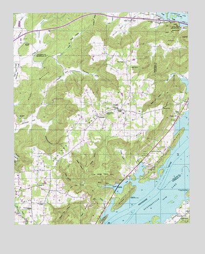
Swearengin, AL USGS Topographic Map
Click on map above to begin viewing in our Map Viewer.

This topographic map contains these locations and features:
Feature Name Type Latitude Longitude GNIS ID View Map
Alabama State Prison Camp (historical)LocaleN34.5487°W86.1403°139088View Map
AspelPopulated PlaceN34.6209°W86.1655°113258View Map
Baker Spring BranchStreamN34.5093°W86.1853°113393View Map
Barkley SpringSpringN34.5955°W86.2299°149231View Map
Basin CoveValleyN34.5793°W86.1425°113548View Map
Battle HollowValleyN34.5323°W86.1989°113577View Map
Beulah ChurchChurchN34.5229°W86.2328°114190View Map
Black HollowValleyN34.5915°W86.2130°114428View Map
Black Lake (historical)LakeN34.5223°W86.1303°1700367View Map
Blowing Wind Cave National Wildlife RefugeParkN34.6140°W86.1291°149279View Map
Boshart CreekStreamN34.5226°W86.1614°114744View Map
Breezeway BayPopulated PlaceN34.5051°W86.1889°148894View Map
Burns ReservationParkN34.6181°W86.1322°115258View Map
Cave MountainSummitN34.6123°W86.1380°115720View Map
Cedar Grove School (historical)SchoolN34.5931°W86.2380°1700370View Map
Chambless HollowValleyN34.5920°W86.2066°115925View Map
Cooleys Landing (historical)LocaleN34.5451°W86.1325°139142View Map
Cowley Landing (historical)LocaleN34.5343°W86.1419°139145View Map
Dobbins GapGapN34.5673°W86.1428°117325View Map
Dodds CoveValleyN34.5312°W86.1644°117336View Map
Dry BranchStreamN34.5856°W86.2169°117508View Map
Dry Cove (historical)Populated PlaceN34.6215°W86.1419°139155View Map
Dunn CemeteryCemeteryN34.5281°W86.1705°163837View Map
Fish PondLakeN34.5879°W86.1366°1700409View Map
Free Home Baptist ChurchChurchN34.5126°W86.2294°118616View Map
Free Home Church CemeteryCemeteryN34.5120°W86.2289°139385View Map
Goodwin SubdivisionPopulated PlaceN34.5465°W86.1372°148799View Map
Gross CemeteryCemeteryN34.5651°W86.1316°119440View Map
Guffey HollowValleyN34.5323°W86.1989°119454View Map
Gunters MountainSummitN34.5662°W86.1775°119505View Map
Haygood ChurchChurchN34.5029°W86.1311°119896View Map
John Law HollowValleyN34.5237°W86.1994°120913View Map
Kelly ChapelChurchN34.5954°W86.1711°121120View Map
Kennamer CoveValleyN34.5981°W86.2453°121143View Map
Kight HollowValleyN34.5243°W86.2055°121188View Map
Kirby CemeteryCemeteryN34.5065°W86.1255°121248View Map
KirbytownPopulated PlaceN34.5048°W86.1286°156564View Map
Kirkland FarmsLocaleN34.5150°W86.2444°2711268View Map
Lakeview BeachPopulated PlaceN34.5679°W86.1269°148795View Map
Mannings Store (historical)LocaleN34.5181°W86.1805°139428View Map
Maple CemeteryCemeteryN34.6079°W86.1347°122266View Map
McCamy CemeteryCemeteryN34.5417°W86.1528°122463View Map
McFarland CemeteryCemeteryN34.5040°W86.1497°148897View Map
McFarlane CemeteryCemeteryN34.5040°W86.1494°122540View Map
McLemore Point SubdivisionPopulated PlaceN34.5620°W86.1330°148796View Map
Mount Olive CemeteryCemeteryN34.6076°W86.2403°1700410View Map
Mount Olive ChurchChurchN34.6073°W86.2408°123324View Map
Mount Olive School (historical)SchoolN34.6070°W86.2405°1959055View Map
Mount Pisgah Primitive Baptist ChurchChurchN34.5637°W86.2461°152489View Map
Mount Zion ChurchChurchN34.5248°W86.1753°139445View Map
New Home ChurchChurchN34.5012°W86.2303°139448View Map
New Prospect SchoolSchoolN34.5654°W86.1841°123892View Map
Oak GrovePopulated PlaceN34.5701°W86.1711°139453View Map
Oak Grove ChurchChurchN34.5679°W86.1758°124103View Map
Oar ReservationReserveN34.5434°W86.1511°124174View Map
Old Barclay MillLocaleN34.5951°W86.2300°1700381View Map
Old Union CemeteryCemeteryN34.5076°W86.2480°147499View Map
Old Union ChurchChurchN34.5076°W86.2478°152802View Map
Parkell CreekStreamN34.5965°W86.2500°124434View Map
Pine Grove Church (historical)ChurchN34.5259°W86.2239°1700382View Map
Pisgah CemeteryCemeteryN34.5615°W86.2466°152956View Map
Pisgah MountainSummitN34.5815°W86.2358°124918View Map
Pleasant HillPopulated PlaceN34.5637°W86.1330°156911View Map
PrestonPopulated PlaceN34.5259°W86.1725°156934View Map
Preston Cabin Site AreaLocaleN34.5159°W86.1678°125251View Map
Preston CemeteryCemeteryN34.5248°W86.1753°139467View Map
Preston Sights SubdivisionPopulated PlaceN34.5090°W86.1794°148895View Map
Preston SubdivisionPopulated PlaceN34.5187°W86.1653°148896View Map
Prospect CemeteryCemeteryN34.5667°W86.1758°1700383View Map
Prospect ChurchChurchN34.5673°W86.1764°125310View Map
Rice CoveValleyN34.5231°W86.1797°125594View Map
River RidgeRidgeN34.5120°W86.1750°125665View Map
Roman Landing (historical)LocaleN34.5195°W86.1453°139479View Map
Romans BarBarN34.5181°W86.1500°139480View Map
Saint Bernard College CampLocaleN34.5273°W86.1650°148898View Map
Saltpeter CoveValleyN34.6168°W86.1278°1700411View Map
Sauta Cave National Wildlife RefugeParkN34.6131°W86.1319°2765497View Map
Scotts Chapel (historical)ChurchN34.5240°W86.1733°139482View Map
Shell SpringSpringN34.5924°W86.1657°126676View Map
Smiths ChapelChurchN34.6204°W86.1661°153482View Map
State Prison Camp C (historical)LocaleN34.5593°W86.1411°1700413View Map
Stillhouse HollowValleyN34.5568°W86.2275°127402View Map
SwearenginPopulated PlaceN34.5634°W86.1903°157135View Map
Swearengin ChurchChurchN34.5651°W86.1855°139491View Map
Swearengin Volunteer Fire DepartmentBuildingN34.5662°W86.1838°2682719View Map
Thomas CoveValleyN34.5959°W86.2439°127864View Map
Town of GrantCivilN34.5267°W86.2377°2406603View Map
Uncle George McLean PointCapeN34.5295°W86.1872°128249View Map
Upper BarBarN34.5056°W86.1744°139499View Map
Vernon CoveValleyN34.6245°W86.1628°128438View Map
Welcome Home ChurchChurchN34.5095°W86.2383°128729View Map
White Lake (historical)LakeN34.5184°W86.1355°1700386View Map
Wrights CoveValleyN34.5920°W86.2066°129250View Map
Zions Rest CemeteryCemeteryN34.6212°W86.1469°129362View Map

Note: Coordinates in the location and feature list above are referenced to NAD83 datum.


Copyright (C) 2008-2024 Ryan Niemi / Sunset Dynamics ... All Rights Reserved