TopoQuest Logo
Do you find TopoQuest useful?
Help keep TopoQuest running and adding new maps/features by donating!
Bitcoin:  19c7KJd3qBynnjoSw5npx9KScwjBe4ifkT
Litecoin:  LXs6TkuXGGXo1vDsWCkWVdjQX94eUKd6ui
Home View Maps Find Maps Find Places Resources & Links


Tobias, Nebraska Topographic Map

USGS Map Title: Tobias, NE
USGS Map MRC: 40097D3
DRG (GeoTIFF) Download: o40097d3.tif


Neighboring USGS Topographic Map Quads:


  Friend SW, NE  
40097E4
 

  Friend SE, NE  
40097E3
 

  Dorchester SW, NE  
40097E2
 

  Ohiowa, NE  
40097D4
 

  Tobias, NE  
40097D3
 

  Western, NE  
40097D2
 

  Tobias SW, NE  
40097C4
 

  Daykin, NE  
40097C3
 

  Western SW, NE  
40097C2


Map MRC Location:

N41°
W98°
N41°
W97°
H8 H7 H6 H5 H4 H3 H2 H1
G8 G7 G6 G5 G4 G3 G2 G1
F8 F7 F6 F5 F4 F3 F2 F1
E8 E7 E6 E5 E4 E3 E2 E1
D8 D7 D6 D5 D4 D3 D2 D1
C8 C7 C6 C5 C4 C3 C2 C1
B8 B7 B6 B5 B4 B3 B2 B1
A8 A7 A6 A5 A4 A3 A2 A1
N40°
W98°
N40°
W97°

Tobias, NE USGS 1:24K Topographic Map Preview:
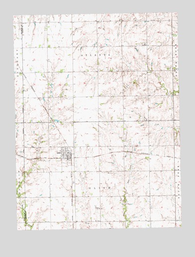
Tobias, NE USGS Topographic Map
Click on map above to begin viewing in our Map Viewer.

This topographic map contains these locations and features:
Feature Name Type Latitude Longitude GNIS ID View Map
Atlanta CemeteryCemeteryN40.4806°W97.3103°827111View Map
Atlanta Election PrecinctCivilN40.4808°W97.3118°1928702View Map
Farmers Co-op Association ElevatorLocaleN40.4169°W97.3359°1882543View Map
Old Zion CemeteryCemeteryN40.3786°W97.3236°831863View Map
Olive Election PrecinctCivilN40.3938°W97.3118°1929119View Map
Saint Joseph Catholic ChurchChurchN40.4219°W97.3373°1882551View Map
Sergeant Leodegar Schnyder Historical MarkerParkN40.4228°W97.3337°1882614View Map
TobiasLocaleN40.4178°W97.3331°1882545View Map
TobiasPopulated PlaceN40.4181°W97.3362°834126View Map
Tobias CemeteryCemeteryN40.4022°W97.3320°837272View Map
Tobias Community ChurchChurchN40.4181°W97.3387°1882550View Map
Tobias Community Historical MuseumBuildingN40.4186°W97.3359°1882546View Map
Tobias Post OfficePost OfficeN40.4180°W97.3364°1882544View Map
Tobias Public LibraryBuildingN40.4175°W97.3364°1882549View Map
Tobias Volunteer Fire and RescueBuildingN40.4186°W97.3359°2553277View Map
Township of AtlantaCivilN40.4806°W97.3087°1882310View Map
Township of OliveCivilN40.3931°W97.3100°1882622View Map
Village of TobiasCivilN40.4185°W97.3366°2399990View Map
Ward SchoolSchoolN40.4814°W97.2742°834474View Map
Zion Lutheran CemeteryCemeteryN40.3867°W97.3125°1882468View Map
Zion SchoolSchoolN40.3869°W97.3125°834967View Map

Note: Coordinates in the location and feature list above are referenced to NAD83 datum.


Copyright (C) 2008-2024 Ryan Niemi / Sunset Dynamics ... All Rights Reserved