TopoQuest Logo
Do you find TopoQuest useful?
Help keep TopoQuest running and adding new maps/features by donating!
Bitcoin:  19c7KJd3qBynnjoSw5npx9KScwjBe4ifkT
Litecoin:  LXs6TkuXGGXo1vDsWCkWVdjQX94eUKd6ui
Home View Maps Find Maps Find Places Resources & Links


Upham, New Mexico Topographic Map

USGS Map Title: Upham, NM
USGS Map MRC: 32107H1
DRG (GeoTIFF) Download: o32107h1.tif


Neighboring USGS Topographic Map Quads:


  Palomas Gap, NM  
33107A2
 

  Cutter, NM  
33107A1
 

  Polecat Tank, NM  
33106A8
 

  Apache Gap, NM  
32107H2
 

  Upham, NM  
32107H1
 

  Prisor Hill, NM  
32106H8
 

  McLeod Tank, NM  
32107G2
 

  Alivio, NM  
32107G1
 

  Upham Hills, NM  
32106G8


Map MRC Location:

N33°
W108°
N33°
W107°
H8 H7 H6 H5 H4 H3 H2 H1
G8 G7 G6 G5 G4 G3 G2 G1
F8 F7 F6 F5 F4 F3 F2 F1
E8 E7 E6 E5 E4 E3 E2 E1
D8 D7 D6 D5 D4 D3 D2 D1
C8 C7 C6 C5 C4 C3 C2 C1
B8 B7 B6 B5 B4 B3 B2 B1
A8 A7 A6 A5 A4 A3 A2 A1
N32°
W108°
N32°
W107°

Upham, NM USGS 1:24K Topographic Map Preview:
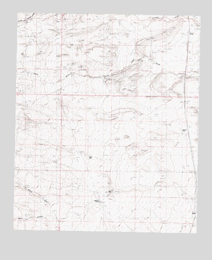
Upham, NM USGS Topographic Map
Click on map above to begin viewing in our Map Viewer.

This topographic map contains these locations and features:
Feature Name Type Latitude Longitude GNIS ID View Map
AlemanLocaleN32.9898°W107.0075°901047View Map
Aleman Post Office (historical)Post OfficeN32.9898°W107.0075°938097View Map
Aleman Weather StationLocaleN32.9898°W107.0075°931844View Map
Birner WindmillLocaleN32.9740°W107.0325°886938View Map
C C TankReservoirN32.9751°W107.1214°887011View Map
Federal M Number OneMineN32.9898°W107.0170°914597View Map
Foraker WellWellN32.9987°W107.0270°889128View Map
Highline TankReservoirN32.8926°W107.0671°889980View Map
Jornada DikesLeveeN32.9692°W107.0928°890566View Map
Jornada Number Three DamDamN32.8917°W107.0472°923876View Map
Lyons-Slater RanchLocaleN32.9395°W107.1239°891509View Map
Miller TankReservoirN32.8986°W107.0583°892063View Map
Rabbit TankReservoirN32.9183°W107.0740°900422View Map
Sun Ray Midcontinent New Mexico Federal M Number 1 SpringSpringN32.9750°W107.0306°929461View Map
UphamPopulated PlaceN32.8865°W107.0022°899972View Map
Wetback TankReservoirN32.9340°W107.0111°900389View Map
Yoast WindmillLocaleN32.9645°W107.0636°896824View Map

Note: Coordinates in the location and feature list above are referenced to NAD83 datum.


Copyright (C) 2008-2024 Ryan Niemi / Sunset Dynamics ... All Rights Reserved