TopoQuest Logo
Do you find TopoQuest useful?
Help keep TopoQuest running and adding new maps/features by donating!
Bitcoin:  19c7KJd3qBynnjoSw5npx9KScwjBe4ifkT
Litecoin:  LXs6TkuXGGXo1vDsWCkWVdjQX94eUKd6ui
Home View Maps Find Maps Find Places Resources & Links


Valley, Nebraska Topographic Map

USGS Map Title: Valley, NE
USGS Map MRC: 41096C3
DRG (GeoTIFF) Download: o41096c3.tif


Neighboring USGS Topographic Map Quads:


  Fremont East, NE  
41096D4
 

  Arlington, NE  
41096D3
 

  Kennard, NE  
41096D2
 

  Leshara, NE  
41096C4
 

  Valley, NE  
41096C3
 

  Elkhorn, NE  
41096C2
 

  Mead, NE  
41096B4
 

  Wann, NE  
41096B3
 

  Gretna, NE  
41096B2


Map MRC Location:

N42°
W97°
N42°
W96°
H8 H7 H6 H5 H4 H3 H2 H1
G8 G7 G6 G5 G4 G3 G2 G1
F8 F7 F6 F5 F4 F3 F2 F1
E8 E7 E6 E5 E4 E3 E2 E1
D8 D7 D6 D5 D4 D3 D2 D1
C8 C7 C6 C5 C4 C3 C2 C1
B8 B7 B6 B5 B4 B3 B2 B1
A8 A7 A6 A5 A4 A3 A2 A1
N41°
W97°
N41°
W96°

Valley, NE USGS 1:24K Topographic Map Preview:
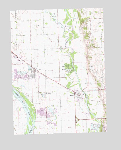
Valley, NE USGS Topographic Map
Click on map above to begin viewing in our Map Viewer.

This topographic map contains these locations and features:
Feature Name Type Latitude Longitude GNIS ID View Map
3M Valley Emergency Medical ServicesBuildingN41.3065°W96.3381°2553751View Map
Baptist Presbyterian ChurchChurchN41.3131°W96.3503°1900444View Map
Bethel Baptist ChurchChurchN41.3064°W96.3467°1900442View Map
Big SloughStreamN41.3275°W96.2970°827430View Map
C and K Mobile Home ParkPopulated PlaceN41.3058°W96.3503°1900439View Map
Church of ChristChurchN41.2831°W96.2906°1900311View Map
Circle Lane School (historical)SchoolN41.2781°W96.3217°836260View Map
City of Elkhorn (historical)CivilN41.2581°W96.2539°2394656View Map
City of ValleyCivilN41.3175°W96.3481°2397110View Map
Douglas County West Elementary SchoolSchoolN41.3108°W96.3433°1900446View Map
Douglas County West High SchoolSchoolN41.3090°W96.3428°1900447View Map
Douglas County West Middle SchoolSchoolN41.2907°W96.2910°1900317View Map
Elk CityPopulated PlaceN41.3717°W96.2678°829050View Map
Elk City CemeteryCemeteryN41.3725°W96.2767°829051View Map
Elk City Post Office (historical)Post OfficeN41.3717°W96.2678°1899364View Map
Elk City School (historical)SchoolN41.3719°W96.2678°1899935View Map
Fairview Public SchoolSchoolN41.3278°W96.2647°836710View Map
Faith United Methodist ParishChurchN41.2886°W96.2847°1900316View Map
First United Methodist ChurchChurchN41.3106°W96.3472°1900440View Map
King LakePopulated PlaceN41.3136°W96.3011°830510View Map
King Lake Census Designated PlaceCensusN41.3135°W96.3017°2583885View Map
King Lake School (historical)SchoolN41.3136°W96.3011°1899931View Map
Kings LakeLakeN41.3172°W96.3047°830514View Map
Lake ClagusLakeN41.2608°W96.3280°828148View Map
Lake TaorminaLakeN41.2903°W96.3317°834031View Map
Physicians ClinicBuildingN41.3067°W96.3436°1900445View Map
Platte Valley Election PrecinctCivilN41.3499°W96.3620°1929152View Map
Pleasure LakeLakeN41.3158°W96.3513°832270View Map
Primrose Post Office (historical)Post OfficeN41.2833°W96.3003°1899343View Map
Prospect Hill CemeteryCemeteryN41.2921°W96.2570°832402View Map
Rawhide CreekStreamN41.3425°W96.2995°832473View Map
Riverside LakesLakeN41.2538°W96.2674°832586View Map
Rogert Airstrip (historical)AirportN41.2733°W96.3445°837740View Map
Saint John SeminarySchoolN41.3167°W96.2695°832887View Map
Saint John the Evangelist Catholic ChurchChurchN41.3056°W96.3434°1900441View Map
Saint Marks Lutheran ChurchChurchN41.3056°W96.3481°1900443View Map
The Pines Country ClubLocaleN41.3328°W96.3656°1900448View Map
Timber Lodge LakeLakeN41.2886°W96.3341°834114View Map
Valhaven Nursing CenterHospitalN41.3069°W96.3520°1900438View Map
ValleyLocaleN41.3161°W96.3461°1900437View Map
ValleyPopulated PlaceN41.3128°W96.3461°834325View Map
Valley Fire and Rescue Department and Civil Defense HeliportAirportN41.3108°W96.3478°837741View Map
Valley Historical MuseumBuildingN41.3111°W96.3497°1900318View Map
Valley Post OfficePost OfficeN41.3137°W96.3444°1900436View Map
Valley Public LibraryBuildingN41.3144°W96.3467°1900435View Map
Valley Suburban Fire Protection District 5BuildingN41.3141°W96.3471°2553310View Map
Valmont Emergency RescueBuildingN41.3255°W96.3676°2553753View Map
Village of WaterlooCivilN41.2856°W96.2851°2400103View Map
WaterlooPopulated PlaceN41.2869°W96.2856°834501View Map
WaterlooLocaleN41.2867°W96.2850°1900312View Map
Waterloo Election PrecinctCivilN41.2523°W96.3157°1929365View Map
Waterloo LibraryBuildingN41.2875°W96.2847°1900314View Map
Waterloo Police StationBuildingN41.2878°W96.2897°1900310View Map
Waterloo Post OfficePost OfficeN41.2878°W96.2843°1900315View Map
Waterloo Volunteer Rescue and Fire DepartmentBuildingN41.2886°W96.2916°1900313View Map

Note: Coordinates in the location and feature list above are referenced to NAD83 datum.


Copyright (C) 2008-2024 Ryan Niemi / Sunset Dynamics ... All Rights Reserved