TopoQuest Logo
Do you find TopoQuest useful?
Help keep TopoQuest running and adding new maps/features by donating!
Bitcoin:  19c7KJd3qBynnjoSw5npx9KScwjBe4ifkT
Litecoin:  LXs6TkuXGGXo1vDsWCkWVdjQX94eUKd6ui
Home View Maps Find Maps Find Places Resources & Links


Boekerton, Missouri Topographic Map

USGS Map Title: Boekerton, MO
USGS Map MRC: 36089D7
DRG (GeoTIFF) Download: o36089d7.tif


Neighboring USGS Topographic Map Quads:


  Malden, MO  
36089E8
 

  Parma, MO  
36089E7
 

  Catron, MO  
36089E6
 

  Gideon, MO  
36089D8
 

  Boekerton, MO  
36089D7
 

  Portageville, MO  
36089D6
 

  Bragg City, MO  
36089C8
 

  Wardell, MO  
36089C7
 

  Stanley, MO  
36089C6


Map MRC Location:

N37°
W90°
N37°
W89°
H8 H7 H6 H5 H4 H3 H2 H1
G8 G7 G6 G5 G4 G3 G2 G1
F8 F7 F6 F5 F4 F3 F2 F1
E8 E7 E6 E5 E4 E3 E2 E1
D8 D7 D6 D5 D4 D3 D2 D1
C8 C7 C6 C5 C4 C3 C2 C1
B8 B7 B6 B5 B4 B3 B2 B1
A8 A7 A6 A5 A4 A3 A2 A1
N36°
W90°
N36°
W89°

Boekerton, MO USGS 1:24K Topographic Map Preview:
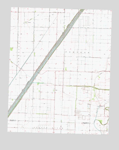
Boekerton, MO USGS Topographic Map
Click on map above to begin viewing in our Map Viewer.

This topographic map contains these locations and features:
Feature Name Type Latitude Longitude GNIS ID View Map
BoekertonPopulated PlaceN36.4040°W89.7620°714475View Map
Cottrell School (historical)SchoolN36.4387°W89.8595°746750View Map
Ditch Number 1CanalN36.4553°W89.8237°755051View Map
Ditch Number 256CanalN36.4603°W89.8165°755087View Map
Ditch Number 290CanalN36.4512°W89.8293°755091View Map
Ditch Number 55CanalN36.4887°W89.7723°755123View Map
Ditch Number 55-ACanalN36.4965°W89.7804°755124View Map
Ditch Number 56CanalN36.4815°W89.7820°755125View Map
Ditch Number 57CanalN36.4401°W89.8215°755126View Map
Ditch Number 59CanalN36.4092°W89.8404°755127View Map
Ditch Number 60CanalN36.4117°W89.7906°755131View Map
Ditch Number 61CanalN36.4523°W89.7784°755132View Map
Ditch Number 62CanalN36.4103°W89.8079°755133View Map
Ditch Number 63CanalN36.3792°W89.8523°755134View Map
Ditch Number 8CanalN36.4898°W89.8262°755157View Map
Ditch Number 9CanalN36.4434°W89.8565°755164View Map
Flagland School (historical)SchoolN36.3853°W89.8615°746751View Map
Floodway School (historical)SchoolN36.4659°W89.8273°746749View Map
FrailiePopulated PlaceN36.4181°W89.8173°718154View Map
Frailie SchoolSchoolN36.4228°W89.8293°741843View Map
GarverPopulated PlaceN36.3862°W89.8179°739552View Map
HartzellPopulated PlaceN36.4853°W89.8559°719188View Map
Hildreth Church (historical)ChurchN36.3806°W89.7740°746753View Map
Hildreth School (historical)SchoolN36.3792°W89.7740°746754View Map
Hill SchoolSchoolN36.3792°W89.7873°746752View Map
Huie ChurchChurchN36.4292°W89.8612°719981View Map
Lateral School (historical)SchoolN36.4512°W89.7773°741681View Map
New GarverPopulated PlaceN36.4012°W89.8179°739551View Map
Portage Open BayStreamN36.3898°W89.7662°724758View Map
Township of PortageCivilN36.4485°W89.7745°767067View Map

Note: Coordinates in the location and feature list above are referenced to NAD83 datum.


Copyright (C) 2008-2024 Ryan Niemi / Sunset Dynamics ... All Rights Reserved