TopoQuest Logo
Do you find TopoQuest useful?
Help keep TopoQuest running and adding new maps/features by donating!
Bitcoin:  19c7KJd3qBynnjoSw5npx9KScwjBe4ifkT
Litecoin:  LXs6TkuXGGXo1vDsWCkWVdjQX94eUKd6ui
Home View Maps Find Maps Find Places Resources & Links


Vichy, Missouri Topographic Map

USGS Map Title: Vichy, MO
USGS Map MRC: 38091A7
DRG (GeoTIFF) Download: o38091a7.tif


Neighboring USGS Topographic Map Quads:


  Vienna, MO  
38091B8
 

  Paydown, MO  
38091B7
 

  High Gate, MO  
38091B6
 

  Nagogami Lodge, MO  
38091A8
 

  Vichy, MO  
38091A7
 

  Safe, MO  
38091A6
 

  Newburg, MO  
37091H8
 

  Rolla, MO  
37091H7
 

  Dillon, MO  
37091H6


Map MRC Location:

N39°
W92°
N39°
W91°
H8 H7 H6 H5 H4 H3 H2 H1
G8 G7 G6 G5 G4 G3 G2 G1
F8 F7 F6 F5 F4 F3 F2 F1
E8 E7 E6 E5 E4 E3 E2 E1
D8 D7 D6 D5 D4 D3 D2 D1
C8 C7 C6 C5 C4 C3 C2 C1
B8 B7 B6 B5 B4 B3 B2 B1
A8 A7 A6 A5 A4 A3 A2 A1
N38°
W92°
N38°
W91°

Vichy, MO USGS 1:24K Topographic Map Preview:
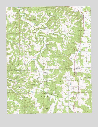
Vichy, MO USGS Topographic Map
Click on map above to begin viewing in our Map Viewer.

This topographic map contains these locations and features:
Feature Name Type Latitude Longitude GNIS ID View Map
Bailey ChurchChurchN38.0978°W91.7849°713543View Map
Balance CemeteryCemeteryN38.0509°W91.8490°713582View Map
Cadmus (historical)LocaleN38.0581°W91.8479°744666View Map
Davis CemeteryCemeteryN38.0670°W91.8352°716717View Map
Davis ChurchChurchN38.0673°W91.8352°741852View Map
Davis FordPopulated PlaceN38.0714°W91.8246°740795View Map
Davis SchoolSchoolN38.0684°W91.8449°716736View Map
Dyer CemeteryCemeteryN38.0061°W91.8136°715410View Map
Feeler SchoolSchoolN38.1095°W91.8696°717875View Map
Fet CemeteryCemeteryN38.0159°W91.8665°2724079View Map
Hazzard CemeteryCemeteryN38.0020°W91.8443°2724080View Map
Hodge CemeteryCemeteryN38.0864°W91.8304°719660View Map
Little Spring CreekStreamN38.1242°W91.8541°721324View Map
Macedonia (historical)LocaleN38.0231°W91.7696°744610View Map
Macedonia CemeteryCemeteryN38.0320°W91.7700°2723873View Map
Macedonia ChurchChurchN38.0320°W91.7690°729773View Map
Macedonia School (historical)SchoolN38.0310°W91.7713°721723View Map
Maxwell CemeteryCemeteryN38.0327°W91.8550°2724055View Map
Mill CreekStreamN38.0984°W91.8168°722324View Map
Miller BranchStreamN38.0459°W91.8229°722369View Map
Miller CemeteryCemeteryN38.0461°W91.8210°722374View Map
Miller SchoolSchoolN38.0339°W91.8388°722388View Map
Morresy BranchStreamN38.0714°W91.8249°722634View Map
Murry RidgeRidgeN38.0425°W91.8488°739169View Map
Pea RidgeRidgeN38.0331°W91.8613°724120View Map
Pilot KnobSummitN38.0437°W91.8078°2437189View Map
Pleasant Ridge SchoolSchoolN38.0734°W91.7988°724594View Map
Riley CemeteryCemeteryN38.0700°W91.7746°730013View Map
Rocky BranchStreamN38.1020°W91.8199°725498View Map
Signal (historical)Populated PlaceN38.0312°W91.8154°740042View Map
Spencer CemeteryCemeteryN38.0511°W91.8310°726849View Map
Spring Creek ChurchChurchN38.0234°W91.8171°729657View Map
Tennison CemeteryCemeteryN38.1109°W91.8299°727532View Map
Tennison CemeteryCemeteryN38.1234°W91.8485°727533View Map
Tennison SchoolSchoolN38.1164°W91.8293°729671View Map
Township of MillerCivilN38.0067°W91.8526°767182View Map
Township of Spring CreekCivilN38.1031°W91.8471°766998View Map
Veto (historical)LocaleN38.0678°W91.7802°744691View Map
VichyPopulated PlaceN38.1114°W91.7604°728179View Map
Vichy Post OfficePost OfficeN38.1145°W91.7603°2783087View Map
Vichy Volunteer Fire DepartmentBuildingN38.1141°W91.7604°2621104View Map
Weaver RidgeRidgeN38.0948°W91.8327°728452View Map
Wildcat BranchStreamN38.0203°W91.8040°752886View Map
Wo He Lo Woods CampLocaleN38.0462°W91.8741°743265View Map
Wynn CemeteryCemeteryN38.0325°W91.8310°741853View Map
Wynn Church (historical)ChurchN38.0317°W91.8318°729178View Map

Note: Coordinates in the location and feature list above are referenced to NAD83 datum.


Copyright (C) 2008-2024 Ryan Niemi / Sunset Dynamics ... All Rights Reserved