TopoQuest Logo
Do you find TopoQuest useful?
Help keep TopoQuest running and adding new maps/features by donating!
Bitcoin:  19c7KJd3qBynnjoSw5npx9KScwjBe4ifkT
Litecoin:  LXs6TkuXGGXo1vDsWCkWVdjQX94eUKd6ui
Home View Maps Find Maps Find Places Resources & Links


Wahoo, Florida Topographic Map

USGS Map Title: Wahoo, FL
USGS Map MRC: 28082F2
DRG (GeoTIFF) Download: o28082f2.tif


Neighboring USGS Topographic Map Quads:


  Inverness, FL  
28082G3
 

  Rutland, FL  
28082G2
 

  Wildwood, FL  
28082G1
 

  Nobleton, FL  
28082F3
 

  Wahoo, FL  
28082F2
 

  Bushnell, FL  
28082F1
 

  Brooksville SE, FL  
28082E3
 

  Saint Catherine, FL  
28082E2
 

  Webster, FL  
28082E1


Map MRC Location:

N29°
W83°
N29°
W82°
H8 H7 H6 H5 H4 H3 H2 H1
G8 G7 G6 G5 G4 G3 G2 G1
F8 F7 F6 F5 F4 F3 F2 F1
E8 E7 E6 E5 E4 E3 E2 E1
D8 D7 D6 D5 D4 D3 D2 D1
C8 C7 C6 C5 C4 C3 C2 C1
B8 B7 B6 B5 B4 B3 B2 B1
A8 A7 A6 A5 A4 A3 A2 A1
N28°
W83°
N28°
W82°

Wahoo, FL USGS 1:24K Topographic Map Preview:
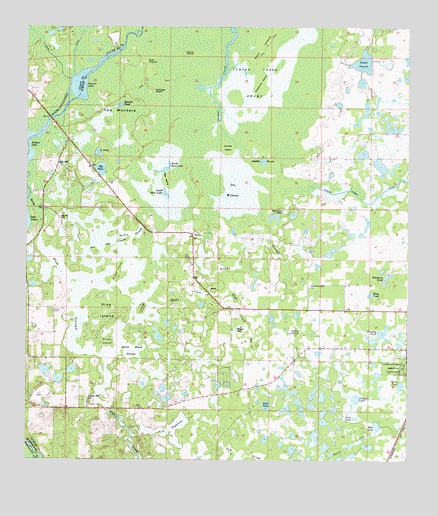
Wahoo, FL USGS Topographic Map
Click on map above to begin viewing in our Map Viewer.

This topographic map contains these locations and features:
Feature Name Type Latitude Longitude GNIS ID View Map
Baptizing HoleLakeN28.6952°W82.1688°278089View Map
Battle SloughSwampN28.6756°W82.2226°278178View Map
Bay HillPopulated PlaceN28.7103°W82.2398°295115View Map
Bay Hill CemeteryCemeteryN28.6953°W82.2387°278205View Map
Bear CreekGutN28.6586°W82.1756°278296View Map
Bear IslandIslandN28.7461°W82.1698°278330View Map
Bee IslandIslandN28.7061°W82.2037°278384View Map
Beville DitchSwampN28.6294°W82.1434°278603View Map
Big PondLakeN28.7098°W82.2257°278727View Map
Bonnet LakeLakeN28.7332°W82.2325°279217View Map
Buck PrairieFlatN28.7408°W82.2109°279590View Map
Buck SawgrassSwampN28.6340°W82.2001°279591View Map
Burnt IslandIslandN28.7425°W82.1984°279710View Map
Cabbage IslandIslandN28.6689°W82.2115°279795View Map
Cabbage IslandIslandN28.7319°W82.2090°279796View Map
Clabber CreekSwampN28.6722°W82.1970°280475View Map
Connell's Wahoo AirportAirportN28.6335°W82.1572°2676646View Map
Dade Battlefield Historic State ParkParkN28.6522°W82.1268°281253View Map
Deacon PondLakeN28.7274°W82.2197°281374View Map
DeWitt ScrubWoodsN28.7105°W82.1720°281372View Map
Drawdy PondSwampN28.6621°W82.1318°281752View Map
Fish PondLakeN28.6411°W82.1710°282487View Map
Flying W AirranchAirportN28.6806°W82.1591°2676687View Map
Goose PondSwampN28.6466°W82.1276°283197View Map
Grant SloughSwampN28.6785°W82.1848°283286View Map
Grass Patch AirportAirportN28.6450°W82.2222°2676631View Map
Gum SloughStreamN28.6967°W82.2434°283550View Map
Gun Tube IslandsIslandN28.6864°W82.2229°283564View Map
Hayes CreekGutN28.6694°W82.1795°283835View Map
Hayes SinkBasinN28.6633°W82.1806°283837View Map
Indian Hill CemeteryCemeteryN28.6424°W82.2289°2768096View Map
Indian Hill ChurchChurchN28.6428°W82.2293°284504View Map
Indian PrairieSwampN28.7399°W82.1396°284528View Map
Jumper Creek SwampSwampN28.7336°W82.1759°284972View Map
Jumper IslandIslandN28.7155°W82.1840°284973View Map
King PondLakeN28.6729°W82.1368°285113View Map
L PondLakeN28.7134°W82.2261°298079View Map
Little PondLakeN28.7134°W82.2261°285764View Map
Majestic Oaks Mobile Home ParkPopulated PlaceN28.6586°W82.1419°2447925View Map
Millard IslandIslandN28.6789°W82.2195°286910View Map
Mud LakeLakeN28.6352°W82.1346°287407View Map
North Bear LakeLakeN28.7093°W82.2044°287785View Map
Oliver IslandIslandN28.6592°W82.2231°288143View Map
Orange LakeLakeN28.6430°W82.1416°288213View Map
Pine IslandIslandN28.6680°W82.2234°288859View Map
Pleasant Hill CemeteryCemeteryN28.6752°W82.1572°2768101View Map
Pleasant Hill ChurchChurchN28.6753°W82.1570°289061View Map
Rock LakeLakeN28.6373°W82.1418°289837View Map
Rosewood Mobile Home ParkPopulated PlaceN28.6678°W82.1485°2447926View Map
Simmons PondSwampN28.6778°W82.1318°291148View Map
Soapstone IslandIslandN28.7333°W82.1729°291317View Map
South Bear LakeLakeN28.7023°W82.2045°291345View Map
Southgate Shopping CenterLocaleN28.7353°W82.2223°296046View Map
Spring RunStreamN28.6997°W82.2493°291565View Map
Sumter County Fire and Rescue Department Station 29 Tri County Fire DistrictBuildingN28.6397°W82.2320°2131645View Map
Sumter Fire Department and EMS Services Station 22 - West BushnellBuildingN28.6739°W82.1476°2768107View Map
The WillowsSwampN28.7030°W82.1806°292184View Map
The WondersSwampN28.7205°W82.2234°292185View Map
WahooPopulated PlaceN28.6905°W82.1956°294963View Map
WKFL-AM (Bushnell)TowerN28.7089°W82.1265°310029View Map
Wynn Haven Mobile Home ParkPopulated PlaceN28.7214°W82.2409°2447927View Map

Note: Coordinates in the location and feature list above are referenced to NAD83 datum.


Copyright (C) 2008-2024 Ryan Niemi / Sunset Dynamics ... All Rights Reserved