TopoQuest Logo
Do you find TopoQuest useful?
Help keep TopoQuest running and adding new maps/features by donating!
Bitcoin:  19c7KJd3qBynnjoSw5npx9KScwjBe4ifkT
Litecoin:  LXs6TkuXGGXo1vDsWCkWVdjQX94eUKd6ui
Home View Maps Find Maps Find Places Resources & Links


Wallace, West Virginia Topographic Map

USGS Map Title: Wallace, WV
USGS Map MRC: 39080D4
DRG (GeoTIFF) Download: o39080d4.tif


Neighboring USGS Topographic Map Quads:


  Big Run, WV  
39080E5
 

  Glover Gap, WV  
39080E4
 

  Mannington, WV  
39080E3
 

  Folsom, WV  
39080D5
 

  Wallace, WV  
39080D4
 

  Shinnston, WV  
39080D3
 

  Salem, WV  
39080C5
 

  Wolf Summit, WV  
39080C4
 

  Clarksburg, WV  
39080C3


Map MRC Location:

N40°
W81°
N40°
W80°
H8 H7 H6 H5 H4 H3 H2 H1
G8 G7 G6 G5 G4 G3 G2 G1
F8 F7 F6 F5 F4 F3 F2 F1
E8 E7 E6 E5 E4 E3 E2 E1
D8 D7 D6 D5 D4 D3 D2 D1
C8 C7 C6 C5 C4 C3 C2 C1
B8 B7 B6 B5 B4 B3 B2 B1
A8 A7 A6 A5 A4 A3 A2 A1
N39°
W81°
N39°
W80°

Wallace, WV USGS 1:24K Topographic Map Preview:
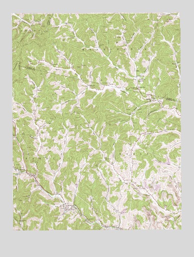
Wallace, WV USGS Topographic Map
Click on map above to begin viewing in our Map Viewer.

This topographic map contains these locations and features:
Feature Name Type Latitude Longitude GNIS ID View Map
AlliancePopulated PlaceN39.4565°W80.4809°1553714View Map
Baker HollowValleyN39.4584°W80.4426°1535149View Map
Barnes RunStreamN39.4062°W80.4968°1535261View Map
Bennett CemeteryCemeteryN39.4573°W80.4823°1535631View Map
Bennett RunStreamN39.3759°W80.4218°1535638View Map
Bethany Baptist ChurchChurchN39.3881°W80.4595°1718364View Map
Bethel Church (historical)ChurchN39.4865°W80.4529°1956474View Map
Big Elk CreekStreamN39.4062°W80.4829°1535836View Map
Big Indian RunStreamN39.4487°W80.3965°1535867View Map
Big RunStreamN39.4445°W80.3793°1535936View Map
Big RunPopulated PlaceN39.4709°W80.3773°1549593View Map
Bingamon ChurchChurchN39.4565°W80.4065°1536018View Map
Boggess CemeteryCemeteryN39.4017°W80.4137°1536190View Map
BrownPopulated PlaceN39.3876°W80.4609°1553986View Map
Caldwell RunStreamN39.3809°W80.4368°1536857View Map
Caldwell School (historical)SchoolN39.3831°W80.4370°1956330View Map
Camp RunStreamN39.3951°W80.4659°1536947View Map
Coal Lick RunStreamN39.4623°W80.4087°1537458View Map
Coal Lick School (historical)SchoolN39.4731°W80.4101°1956471View Map
Community CemeteryCemeteryN39.3867°W80.4543°1718370View Map
Crabapple RunStreamN39.4634°W80.4079°1537768View Map
Cunningham CemeteryCemeteryN39.4598°W80.4270°1537910View Map
DolaPopulated PlaceN39.3765°W80.4218°1538252View Map
Duncan School (historical)SchoolN39.4709°W80.4698°1538433View Map
Elizabeth Mason Memorial ParkCemeteryN39.4617°W80.4059°1538610View Map
Eslar ChapelChurchN39.4387°W80.4834°1538736View Map
Esler School (historical)SchoolN39.4415°W80.4831°1956337View Map
Glade ForkStreamN39.4554°W80.4065°1539429View Map
Glade School (historical)SchoolN39.4940°W80.4581°1539443View Map
Goose RunStreamN39.4343°W80.4801°1539524View Map
GrangevillePopulated PlaceN39.4562°W80.4062°1539581View Map
Grangeville School (historical)SchoolN39.4606°W80.4062°1539582View Map
Griffin CemeteryCemeteryN39.4084°W80.3879°1539740View Map
Grim CemeteryCemeteryN39.4570°W80.3754°1539751View Map
Hall CemeteryCemeteryN39.4401°W80.4979°1539862View Map
Harbert School (historical)SchoolN39.3881°W80.3898°1956344View Map
Harris ForkStreamN39.4568°W80.4434°1540010View Map
Hildreth CemeteryCemeteryN39.4681°W80.4501°1540277View Map
Independent Order of Oddfellows CemeteryCemeteryN39.3854°W80.4534°1718389View Map
Jake RunStreamN39.3901°W80.4618°1540796View Map
JimtownPopulated PlaceN39.3987°W80.4034°1549761View Map
JoetownPopulated PlaceN39.4631°W80.4076°1540946View Map
Laurel RunStreamN39.3893°W80.4545°1541520View Map
Left Fork Big Elk CreekStreamN39.4420°W80.4848°1541633View Map
Little Elk CreekStreamN39.3959°W80.4668°1542092View Map
Little Elk School (historical)SchoolN39.4198°W80.4623°1956455View Map
Little Indian RunStreamN39.4454°W80.3887°1542128View Map
Little Rock Camp Baptist ChurchChurchN39.3804°W80.4943°1542199View Map
Little RunStreamN39.4123°W80.4262°1542203View Map
Little RunStreamN39.4123°W80.4265°1534771View Map
Long ForkStreamN39.4087°W80.4931°1542373View Map
Lower Glade School (historical)SchoolN39.4801°W80.4359°1956473View Map
Lyon CemeteryCemeteryN39.4131°W80.4106°1542656View Map
MargaretPopulated PlaceN39.4584°W80.4434°1549806View Map
Marsh CemeteryCemeteryN39.3887°W80.4615°1542779View Map
Mason ChapelChurchN39.4665°W80.4079°1542848View Map
Middle RunStreamN39.4084°W80.4904°1543222View Map
Middle Run School (historical)SchoolN39.4365°W80.4976°1956458View Map
Mill RunStreamN39.3856°W80.4618°1543349View Map
Mine 95 Water Supply ReservoirReservoirN39.4131°W80.3874°1558904View Map
Mount TaborPopulated PlaceN39.4168°W80.4315°1549839View Map
Neely HollowValleyN39.4826°W80.4140°1544078View Map
Nolan Run Slurry ImpoundmentReservoirN39.4053°W80.3832°1558908View Map
Nolan Run Slurry Impoundment DamDamN39.4051°W80.3815°1558907View Map
OakdalePopulated PlaceN39.4493°W80.3959°1544304View Map
Oakdale CemeteryCemeteryN39.4498°W80.3943°1544305View Map
Painter ForkStreamN39.4526°W80.4509°1544525View Map
Pleasant Dale School (historical)SchoolN39.4318°W80.3987°1956461View Map
Point Pleasant ChurchChurchN39.3812°W80.4445°1545102View Map
Price ForkStreamN39.4968°W80.4934°1545258View Map
Price Fork School (historical)SchoolN39.4959°W80.4831°1956475View Map
Quaker ForkStreamN39.4568°W80.4434°1545330View Map
Right Fork Big Elk CreekStreamN39.4420°W80.4845°1545609View Map
Rittenhouse CemeteryCemeteryN39.3795°W80.4370°1545765View Map
Road ForkStreamN39.4720°W80.4090°1545815View Map
Robinson CemeteryCemeteryN39.4237°W80.4126°1545863View Map
Robinson CemeteryCemeteryN39.4312°W80.4784°1545864View Map
Robinson Run Mine Number 95 W S DamDamN39.4151°W80.3831°1558903View Map
Rogers HollowValleyN39.4284°W80.4812°1546044View Map
Scritchfield CemeteryCemeteryN39.4815°W80.4348°1546531View Map
Shaffer School (historical)SchoolN39.4951°W80.3918°1956472View Map
Shaw CemeteryCemeteryN39.4381°W80.4190°1546636View Map
Shaw CemeteryCemeteryN39.4879°W80.4184°1546637View Map
Shinn RunStreamN39.4031°W80.4129°1546691View Map
Shinn RunStreamN39.4748°W80.4287°1546692View Map
Shinn Run School (historical)SchoolN39.4062°W80.4115°1956465View Map
Smith Baptist ChurchChurchN39.4009°W80.4798°1546987View Map
Swiger CemeteryCemeteryN39.4009°W80.4534°1547805View Map
Tucker ForkStreamN39.4790°W80.4356°1548301View Map
WallacePopulated PlaceN39.4095°W80.4898°1548735View Map
Wallace Census Designated PlaceCensusN39.4072°W80.4911°2586898View Map
Wallace Post OfficePost OfficeN39.4104°W80.4900°1718423View Map
Wallace Volunteer Fire DepartmentBuildingN39.4155°W80.4919°2577675View Map
Wetzel CemeteryCemeteryN39.4292°W80.4984°1548974View Map
Wolfpit RunStreamN39.4673°W80.4559°1549361View Map

Note: Coordinates in the location and feature list above are referenced to NAD83 datum.


Copyright (C) 2008-2024 Ryan Niemi / Sunset Dynamics ... All Rights Reserved