TopoQuest Logo
Do you find TopoQuest useful?
Help keep TopoQuest running and adding new maps/features by donating!
Bitcoin:  19c7KJd3qBynnjoSw5npx9KScwjBe4ifkT
Litecoin:  LXs6TkuXGGXo1vDsWCkWVdjQX94eUKd6ui
Home View Maps Find Maps Find Places Resources & Links


West Branch, Iowa Topographic Map

USGS Map Title: West Branch, IA
USGS Map MRC: 41091F3
DRG (GeoTIFF) Download: o41091f3.tif


Neighboring USGS Topographic Map Quads:


  Solon, IA  
41091G4
 

  Cedar Bluff, IA  
41091G3
 

  Tipton West, IA  
41091G2
 

  Iowa City East, IA  
41091F4
 

  West Branch, IA  
41091F3
 

  Rochester, IA  
41091F2
 

  West Liberty SW, IA  
41091E4
 

  West Liberty, IA  
41091E3
 

  Atalissa, IA  
41091E2


Map MRC Location:

N42°
W92°
N42°
W91°
H8 H7 H6 H5 H4 H3 H2 H1
G8 G7 G6 G5 G4 G3 G2 G1
F8 F7 F6 F5 F4 F3 F2 F1
E8 E7 E6 E5 E4 E3 E2 E1
D8 D7 D6 D5 D4 D3 D2 D1
C8 C7 C6 C5 C4 C3 C2 C1
B8 B7 B6 B5 B4 B3 B2 B1
A8 A7 A6 A5 A4 A3 A2 A1
N41°
W92°
N41°
W91°

West Branch, IA USGS 1:24K Topographic Map Preview:
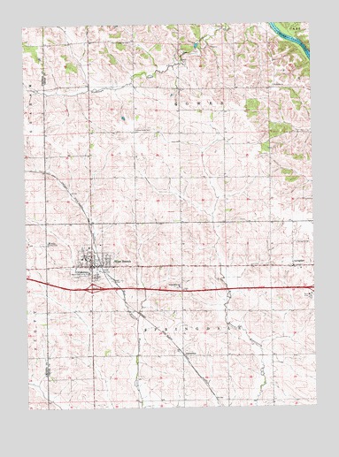
West Branch, IA USGS Topographic Map
Click on map above to begin viewing in our Map Viewer.

This topographic map contains these locations and features:
Feature Name Type Latitude Longitude GNIS ID View Map
Bethany Lutheran ChurchChurchN41.6689°W91.3441°2001596View Map
CenterdalePopulated PlaceN41.6420°W91.3071°464494View Map
Centerdale (historical)LocaleN41.6420°W91.3071°2001532View Map
Centerdale Post Office (historical)Post OfficeN41.6420°W91.3071°2001531View Map
Chamness CemeteryCemeteryN41.6597°W91.3182°2001672View Map
City of West BranchCivilN41.6628°W91.3406°2397261View Map
Cookson Memorial HomeHospitalN41.6670°W91.3452°2001595View Map
Crestview Nursing and Rehabilitation CenterHospitalN41.6775°W91.3477°2001594View Map
Fox Run Golf and Country ClubLocaleN41.6786°W91.3663°465864View Map
Friends ChurchChurchN41.6722°W91.3471°2001597View Map
Herbert Hoover National Historic SiteParkN41.6679°W91.3524°457629View Map
Herbert Hoover Presidential Library and MuseumBuildingN41.6692°W91.3477°2001604View Map
Hickory Grove CemeteryCemeteryN41.6637°W91.3074°2001671View Map
Honey Grove CemeteryCemeteryN41.7157°W91.3267°457621View Map
Hoover CreekStreamN41.6700°W91.3430°2649018View Map
Hoover Elementary SchoolSchoolN41.6739°W91.3494°2001602View Map
Howard CemeteryCemeteryN41.7486°W91.2918°2001668View Map
Interchange 254CrossingN41.6639°W91.3463°2001715View Map
KIIN-TV (Iowa City)TowerN41.7209°W91.3418°467189View Map
KSUI-FM (Iowa City)TowerN41.7206°W91.3416°463677View Map
Old Friends CemeteryCemeteryN41.6733°W91.3469°2001673View Map
PlatoPopulated PlaceN41.7381°W91.3085°464232View Map
Plato (historical)LocaleN41.7381°W91.3085°2001530View Map
Plato Post Office (historical)Post OfficeN41.7381°W91.3085°2001529View Map
President Herbert Hoover's Birthplace Historical MarkerParkN41.6692°W91.3474°2001703View Map
Saint Bernadette Catholic ChurchChurchN41.6756°W91.3396°2001599View Map
Saint Joseph ChurchChurchN41.7300°W91.2666°461100View Map
Saint Josephs CemeteryCemeteryN41.7295°W91.2668°2001675View Map
Scattergood Friends SchoolSchoolN41.6643°W91.3087°461456View Map
SpringdalePopulated PlaceN41.6706°W91.2590°461914View Map
Springdale CemeteryCemeteryN41.6786°W91.2582°461916View Map
Springdale Methodist ChurchChurchN41.6703°W91.2585°2001600View Map
Springdale Post Office (historical)Post OfficeN41.6706°W91.2590°2001528View Map
Township of GowerCivilN41.7263°W91.3092°467918View Map
Township of SpringdaleCivilN41.6417°W91.3080°468739View Map
Underground Railroad Station Historical MarkerParkN41.6709°W91.2585°2001702View Map
United Methodist ChurchChurchN41.6728°W91.3463°2001598View Map
West BranchPopulated PlaceN41.6714°W91.3466°462807View Map
West Branch (historical)LocaleN41.6722°W91.3432°2001592View Map
West Branch CemeteryCemeteryN41.6768°W91.3511°2001674View Map
West Branch Family Practice CenterHospitalN41.6700°W91.3435°2001593View Map
West Branch Fire DepartmentBuildingN41.6710°W91.3439°2001587View Map
West Branch Heritage MuseumBuildingN41.6714°W91.3466°2001520View Map
West Branch High SchoolSchoolN41.6698°W91.3644°2001603View Map
West Branch Middle SchoolSchoolN41.6729°W91.3493°2001601View Map
West Branch Mobile Home VillagePopulated PlaceN41.6714°W91.3466°2001590View Map
West Branch Police DepartmentBuildingN41.6708°W91.3439°2001589View Map
West Branch Post OfficePost OfficeN41.6714°W91.3466°2001586View Map
West Branch Public LibraryBuildingN41.6734°W91.3471°2001588View Map
ZoarLocaleN41.7297°W91.3557°466077View Map
Zoar Post Office (historical)Post OfficeN41.7297°W91.3557°2001543View Map

Note: Coordinates in the location and feature list above are referenced to NAD83 datum.


Copyright (C) 2008-2024 Ryan Niemi / Sunset Dynamics ... All Rights Reserved