TopoQuest Logo
Do you find TopoQuest useful?
Help keep TopoQuest running and adding new maps/features by donating!
Bitcoin:  19c7KJd3qBynnjoSw5npx9KScwjBe4ifkT
Litecoin:  LXs6TkuXGGXo1vDsWCkWVdjQX94eUKd6ui
Home View Maps Find Maps Find Places Resources & Links


Wheaton East, Minnesota Topographic Map

USGS Map Title: Wheaton East, MN
USGS Map MRC: 45096G4
DRG (GeoTIFF) Download: o45096g4.tif


Neighboring USGS Topographic Map Quads:


  Boisberg, MN  
45096H5
 

  Wheaton NW, MN  
45096H4
 

  Charlesville, MN  
45096H3
 

  Wheaton West, MN  
45096G5
 

  Wheaton East, MN  
45096G4
 

  Wheaton SE, MN  
45096G3
 

  Beardsley NE, MN  
45096F5
 

  Dumont, MN  
45096F4
 

  Graceville NE, MN  
45096F3


Map MRC Location:

N46°
W97°
N46°
W96°
H8 H7 H6 H5 H4 H3 H2 H1
G8 G7 G6 G5 G4 G3 G2 G1
F8 F7 F6 F5 F4 F3 F2 F1
E8 E7 E6 E5 E4 E3 E2 E1
D8 D7 D6 D5 D4 D3 D2 D1
C8 C7 C6 C5 C4 C3 C2 C1
B8 B7 B6 B5 B4 B3 B2 B1
A8 A7 A6 A5 A4 A3 A2 A1
N45°
W97°
N45°
W96°

Wheaton East, MN USGS 1:24K Topographic Map Preview:
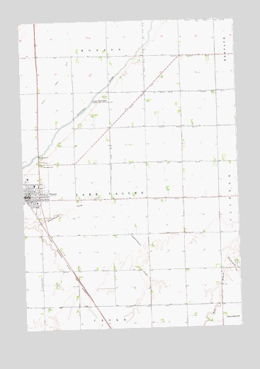
Wheaton East, MN USGS Topographic Map
Click on map above to begin viewing in our Map Viewer.

This topographic map contains these locations and features:
Feature Name Type Latitude Longitude GNIS ID View Map
Ave Maria Catholic ChurchChurchN45.8028°W96.4947°2067067View Map
Bergs Mobile Home ParkPopulated PlaceN45.8136°W96.4997°2067065View Map
Bethlehem Covenant ChurchChurchN45.8097°W96.4936°2067068View Map
City of WheatonCivilN45.8059°W96.4981°2397295View Map
County Ditch Number EighteenCanalN45.8183°W96.4484°641747View Map
County Ditch Number FortyoneCanalN45.7589°W96.4323°642077View Map
County Ditch Number FourCanalN45.8436°W96.4306°642054View Map
County Ditch Number NineteenCanalN45.8455°W96.3851°641768View Map
County Ditch Number OneCanalN45.8022°W96.4023°641559View Map
County Ditch Number SeventeenCanalN45.8313°W96.4026°641735View Map
County Ditch Number SixteenCanalN45.8172°W96.4026°641719View Map
County Ditch Number ThirtyCanalN45.8600°W96.3926°641940View Map
County Ditch Number TwentyCanalN45.8458°W96.4253°641797View Map
County Ditch Number TwentynineCanalN45.8744°W96.3876°641919View Map
Good Shepherd Lutheran ChurchChurchN45.8117°W96.4969°2067071View Map
JE Pearson Elementary SchoolSchoolN45.8089°W96.4931°2067074View Map
Johnsons Aero Repair AirportAirportN45.7736°W96.3898°660472View Map
Kingdom Hall of Jehovahs WitnessesChurchN45.8056°W96.4881°2067070View Map
Presbyterian ChurchChurchN45.8028°W96.4958°2067072View Map
Saint Johns CemeteryCemeteryN45.8030°W96.4598°650688View Map
School Number 39 (historical)SchoolN45.8169°W96.4169°2110027View Map
School Number 45 (historical)SchoolN45.7669°W96.4697°2110031View Map
School Number 54 (historical)SchoolN45.8608°W96.4492°2110023View Map
School Number 55 (historical)SchoolN45.7592°W96.4064°2110030View Map
Schultz Trailer ParkPopulated PlaceN45.8044°W96.4989°2067059View Map
Township of Lake ValleyCivilN45.8026°W96.4501°664706View Map
Traverse Care CenterHospitalN45.8022°W96.4925°2067075View Map
Traverse CountyCivilN45.7722°W96.4716°659522View Map
Traverse County JailBuildingN45.8066°W96.4934°2758810View Map
Traverse County Sheriff's OfficeBuildingN45.8065°W96.4934°2067060View Map
West Branch Twelvemile CreekStreamN45.7750°W96.3781°653941View Map
WheatonPopulated PlaceN45.8044°W96.4992°654055View Map
Wheaton (historical)LocaleN45.8047°W96.4997°2067066View Map
Wheaton City HallBuildingN45.8058°W96.4950°2067063View Map
Wheaton Community LibraryBuildingN45.8056°W96.4953°2067057View Map
Wheaton Fire DepartmentBuildingN45.8051°W96.4951°2067062View Map
Wheaton Police DepartmentBuildingN45.8065°W96.4934°2067061View Map
Wheaton Post OfficePost OfficeN45.8044°W96.4992°2067064View Map
Wildwood CemeteryCemeteryN45.8166°W96.4889°654146View Map

Note: Coordinates in the location and feature list above are referenced to NAD83 datum.


Copyright (C) 2008-2024 Ryan Niemi / Sunset Dynamics ... All Rights Reserved