TopoQuest Logo
Do you find TopoQuest useful?
Help keep TopoQuest running and adding new maps/features by donating!
Bitcoin:  19c7KJd3qBynnjoSw5npx9KScwjBe4ifkT
Litecoin:  LXs6TkuXGGXo1vDsWCkWVdjQX94eUKd6ui
Home View Maps Find Maps Find Places Resources & Links


Whitleyville, Tennessee Topographic Map

USGS Map Title: Whitleyville, TN
USGS Map MRC: 36085D6
DRG (GeoTIFF) Download: o36085d6.tif


Neighboring USGS Topographic Map Quads:


  Red Boiling Springs, TN  
36085E7
 

  Union Hill, TN  
36085E6
 

  Celina, TN  
36085E5
 

  Willette, TN  
36085D7
 

  Whitleyville, TN  
36085D6
 

  Burristown, TN  
36085D5
 

  Granville, TN  
36085C7
 

  Gainesboro, TN  
36085C6
 

  Dodson Branch, TN  
36085C5


Map MRC Location:

N37°
W86°
N37°
W85°
H8 H7 H6 H5 H4 H3 H2 H1
G8 G7 G6 G5 G4 G3 G2 G1
F8 F7 F6 F5 F4 F3 F2 F1
E8 E7 E6 E5 E4 E3 E2 E1
D8 D7 D6 D5 D4 D3 D2 D1
C8 C7 C6 C5 C4 C3 C2 C1
B8 B7 B6 B5 B4 B3 B2 B1
A8 A7 A6 A5 A4 A3 A2 A1
N36°
W86°
N36°
W85°

Whitleyville, TN USGS 1:24K Topographic Map Preview:
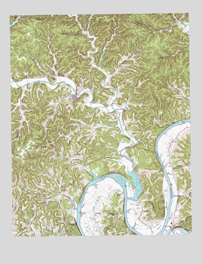
Whitleyville, TN USGS Topographic Map
Click on map above to begin viewing in our Map Viewer.

This topographic map contains these locations and features:
Feature Name Type Latitude Longitude GNIS ID View Map
Allen School (historical)SchoolN36.4903°W85.6972°1320734View Map
Arbor School (historical)SchoolN36.4362°W85.6791°1320738View Map
Aunt Sal HollowValleyN36.4320°W85.7102°1275983View Map
Big SpringSpringN36.4453°W85.6786°1277407View Map
Blue Ash Cut HillSummitN36.3859°W85.6822°1277742View Map
Buck HollowValleyN36.3782°W85.6681°1278822View Map
Buzzard Bluff KnobSummitN36.3803°W85.7080°1279211View Map
Cane Island (historical)IslandN36.4095°W85.6789°1311979View Map
Chimney KnobSummitN36.3978°W85.6778°1280473View Map
Clark CemeteryCemeteryN36.3903°W85.6611°1280600View Map
Columbus HillSummitN36.3848°W85.6261°1269485View Map
Commissioner District 6CivilN36.4148°W85.7410°2464546View Map
Cub CreekPopulated PlaceN36.4003°W85.7158°1281790View Map
Cub CreekStreamN36.3895°W85.7047°1281793View Map
Cub Creek CemeteryCemeteryN36.3948°W85.7247°1281795View Map
Cub Creek Island (historical)IslandN36.3898°W85.7036°1311983View Map
Cub Creek School (historical)SchoolN36.3995°W85.7180°1320749View Map
Cub Creek ShoalsBarN36.4089°W85.6822°1311984View Map
Diamond Hicks HollowValleyN36.4284°W85.6623°1282417View Map
Dodd HollowValleyN36.4764°W85.6957°1282555View Map
Draper-Naff CemeteryCemeteryN36.3892°W85.6600°1282784View Map
Drapers HollowValleyN36.4237°W85.6763°1647567View Map
Dry BranchStreamN36.4948°W85.6316°1282868View Map
Free StateLocaleN36.3867°W85.6928°1284876View Map
Free State School (historical)SchoolN36.3898°W85.6936°1320758View Map
Germany BranchStreamN36.4439°W85.6744°1285320View Map
Gum Springs School (historical)SchoolN36.4601°W85.7394°1320767View Map
Happy HollowValleyN36.4472°W85.6703°1286769View Map
HaydenburgPopulated PlaceN36.4206°W85.7433°1287208View Map
Haydenburg RidgeRidgeN36.4270°W85.7247°1269634View Map
Hensley CreekStreamN36.4076°W85.6908°1287464View Map
Hensley Creek ChurchChurchN36.4209°W85.7064°1287465View Map
Hensley Creek School (historical)SchoolN36.4212°W85.7061°1320770View Map
Hicks BranchStreamN36.4692°W85.6894°1287648View Map
Hicks Ferry (historical)CrossingN36.4387°W85.6286°1311997View Map
Hicks HollowValleyN36.4007°W85.7163°1287667View Map
Horsehead KnobSummitN36.4745°W85.6480°1288418View Map
Hunting CreekStreamN36.4598°W85.7411°1269512View Map
HurricanePopulated PlaceN36.4128°W85.6380°1315278View Map
Hurricane BranchStreamN36.3964°W85.6383°1288787View Map
Hurricane ChurchChurchN36.4137°W85.6380°1320773View Map
Hurricane School (historical)SchoolN36.4103°W85.6375°1320774View Map
Jackson County AirportAirportN36.3970°W85.6424°1301424View Map
Jackson County Central Volunteer Fire DepartmentBuildingN36.3783°W85.6410°2654834View Map
Jennings CreekStreamN36.3964°W85.6700°1269689View Map
Jennings Creek Volunteer Fire DepartmentBuildingN36.4495°W85.6790°2654833View Map
Jennings Creek Watershed Dam Number FourDamN36.4967°W85.6950°1302640View Map
Jennings Creek Watershed Dam Number ThreeDamN36.4734°W85.6883°1302611View Map
Jennings Creek Watershed Number Ten LakeReservoirN36.4937°W85.7500°1302632View Map
Keeling BranchStreamN36.4645°W85.6836°1289953View Map
Kentucky SpringSpringN36.4987°W85.7453°1290093View Map
Lake Number ThreeReservoirN36.4765°W85.6859°1302612View Map
Lake Site Number FourReservoirN36.4997°W85.6921°1302639View Map
Lees Landing (historical)LocaleN36.3881°W85.6708°1320779View Map
Lock BranchStreamN36.4367°W85.6394°1291755View Map
Lock Branch LandingLocaleN36.4367°W85.6386°1645073View Map
Lock Branch School (historical)SchoolN36.4376°W85.6403°1320783View Map
Mashlick BranchStreamN36.4912°W85.6986°1292874View Map
McCormick RidgeRidgeN36.4826°W85.6489°1647573View Map
Mill BranchStreamN36.4659°W85.7189°1293808View Map
Mill HillSummitN36.4328°W85.6508°1293861View Map
Moccasin GapGapN36.4231°W85.6536°1294139View Map
Moore BottomBendN36.3862°W85.6503°1294237View Map
North Fork Jennings CreekStreamN36.4620°W85.7150°1295892View Map
North of the River Division (historical)CensusN36.4106°W85.7400°1648794View Map
Pigeonroost BranchStreamN36.4095°W85.6419°1297445View Map
Pilot KnobSummitN36.4639°W85.7216°1297492View Map
Pine Lick CreekStreamN36.4459°W85.6780°1297561View Map
Raccoon HollowValleyN36.3980°W85.6288°1298796View Map
Riley CreekStreamN36.4362°W85.6739°1299457View Map
Roaring River Recreational AreaParkN36.3792°W85.6311°1645078View Map
Sal BranchStreamN36.4414°W85.6753°1300531View Map
Simpson Island (historical)IslandN36.4067°W85.6744°1312021View Map
Sinkhole HollowValleyN36.4320°W85.7098°1270372View Map
South Fork ChurchChurchN36.4545°W85.7041°1270854View Map
South Fork Jennings CreekStreamN36.4551°W85.7050°1270873View Map
SouthFork School (historical)SchoolN36.4545°W85.7036°1320809View Map
Spivey HollowValleyN36.4388°W85.6337°1312023View Map
StonePopulated PlaceN36.3942°W85.6608°1271468View Map
Stone School (historical)SchoolN36.3937°W85.6603°1320810View Map
Sycamore ForkStreamN36.4889°W85.6966°1272003View Map
Tennessee Department of Agriculture Division of Forestry Haydenburg Fire TowerBuildingN36.4275°W85.7222°2654786View Map
Toney CemeteryCemeteryN36.3987°W85.6300°1272764View Map
Vanhoosier HollowValleyN36.3933°W85.6603°1273376View Map
West Fork Riley CreekStreamN36.4353°W85.6911°1647582View Map
WhitleyvillePopulated PlaceN36.4453°W85.6719°1274422View Map
Whitleyville Post OfficePost OfficeN36.4462°W85.6724°1651591View Map
Whitleyville School (historical)SchoolN36.4495°W85.6789°1320819View Map
Willow Grove ChurchChurchN36.4698°W85.6750°1274761View Map
Willow Grove School (historical)SchoolN36.4826°W85.6816°1320820View Map

Note: Coordinates in the location and feature list above are referenced to NAD83 datum.


Copyright (C) 2008-2024 Ryan Niemi / Sunset Dynamics ... All Rights Reserved