TopoQuest Logo
Do you find TopoQuest useful?
Help keep TopoQuest running and adding new maps/features by donating!
Bitcoin:  19c7KJd3qBynnjoSw5npx9KScwjBe4ifkT
Litecoin:  LXs6TkuXGGXo1vDsWCkWVdjQX94eUKd6ui
Home View Maps Find Maps Find Places Resources & Links


Winton, California Topographic Map

USGS Map Title: Winton, CA
USGS Map MRC: 37120D5
DRG (GeoTIFF) Download: o37120d5.tif


Neighboring USGS Topographic Map Quads:


  Montpelier, CA  
37120E6
 

  Turlock Lake, CA  
37120E5
 

  Snelling, CA  
37120E4
 

  Cressey, CA  
37120D6
 

  Winton, CA  
37120D5
 

  Yosemite Lake, CA  
37120D4
 

  Arena, CA  
37120C6
 

  Atwater, CA  
37120C5
 

  Merced, CA  
37120C4


Map MRC Location:

N38°
W121°
N38°
W120°
H8 H7 H6 H5 H4 H3 H2 H1
G8 G7 G6 G5 G4 G3 G2 G1
F8 F7 F6 F5 F4 F3 F2 F1
E8 E7 E6 E5 E4 E3 E2 E1
D8 D7 D6 D5 D4 D3 D2 D1
C8 C7 C6 C5 C4 C3 C2 C1
B8 B7 B6 B5 B4 B3 B2 B1
A8 A7 A6 A5 A4 A3 A2 A1
N37°
W121°
N37°
W120°

Winton, CA USGS 1:24K Topographic Map Preview:
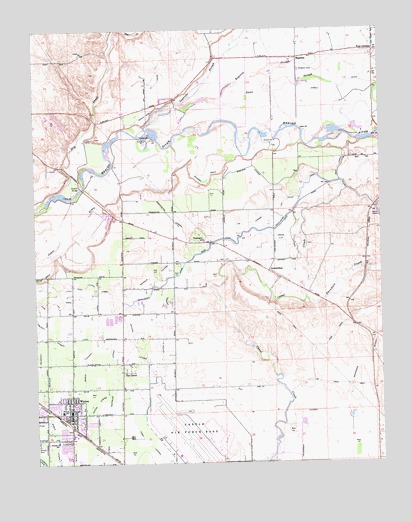
Winton, CA USGS Topographic Map
Click on map above to begin viewing in our Map Viewer.

This topographic map contains these locations and features:
Feature Name Type Latitude Longitude GNIS ID View Map
AmsterdamPopulated PlaceN37.4302°W120.5421°1657927View Map
Arundel (historical)Populated PlaceN37.4485°W120.5994°1661962View Map
Arundel LateralCanalN37.4102°W120.5913°218417View Map
Arundel School (historical)SchoolN37.3799°W120.5958°1661963View Map
Atwater DivisionCivilN37.3881°W120.5754°1935019View Map
Borland LateralCanalN37.4599°W120.5494°219663View Map
Casad LateralCanalN37.3805°W120.5860°233641View Map
Castle Air Force Base (historical)MilitaryN37.3786°W120.5669°1988679View Map
Caton LateralCanalN37.4330°W120.5946°220735View Map
Church of God in ChristChurchN37.3908°W120.6094°1812931View Map
Cotton LateralCanalN37.4155°W120.5802°221625View Map
Cowell DitchCanalN37.4822°W120.5166°221716View Map
Crane LateralCanalN37.4391°W120.5349°221797View Map
Cressey Lateral EastCanalN37.4108°W120.6146°221826View Map
Dana SloughGutN37.4849°W120.5288°222006View Map
Davis LateralCanalN37.4597°W120.5163°222053View Map
Edendale (historical)Populated PlaceN37.4485°W120.5038°1661974View Map
Edendale CreekStreamN37.4222°W120.5288°222974View Map
Escaladian Shaw CanalCanalN37.4269°W120.5791°223240View Map
First Southern Baptist Church of WintonChurchN37.3935°W120.6183°1812937View Map
Fisher LateralCanalN37.4460°W120.5413°223545View Map
Four CornersLocaleN37.4935°W120.5030°223737View Map
Frank Sparkes Elementary SchoolSchoolN37.3813°W120.6183°218158View Map
Gertrude LateralCanalN37.3994°W120.5980°224136View Map
Henderson LateralCanalN37.4055°W120.5066°225163View Map
HopetonPopulated PlaceN37.4916°W120.5310°1658777View Map
Hopeton CemeteryCemeteryN37.4880°W120.5305°225562View Map
Hopeton SchoolSchoolN37.4916°W120.5260°1661986View Map
Hopeton SloughGutN37.4883°W120.5435°225563View Map
Ingalsbe SloughStreamN37.4708°W120.5860°225925View Map
Little Ward CanalCanalN37.4258°W120.6088°227405View Map
Merced County Fire Department Station 63 WintonBuildingN37.3868°W120.6139°2624218View Map
Merced County Sheriff's Office WintonBuildingN37.3829°W120.6130°2755894View Map
Middle LateralCanalN37.3841°W120.6199°234294View Map
Milk Made DairyLocaleN37.4600°W120.6233°2707857View Map
P H RanchLocaleN37.4453°W120.5994°2707859View Map
Pachaud LateralCanalN37.4297°W120.5816°230190View Map
Pentecostal Church of GodChurchN37.3910°W120.6135°1812955View Map
Reinero DrainCanalN37.4563°W120.5644°231487View Map
Shaffer BridgeBridgeN37.4541°W120.6091°252053View Map
Sherman DairyLocaleN37.4203°W120.5897°2707905View Map
Sybil N Crookham Elementary SchoolSchoolN37.3897°W120.6163°238058View Map
The GrovePopulated PlaceN37.4038°W120.5949°236174View Map
Town and Country Shopping CenterLocaleN37.3833°W120.6121°1812963View Map
United States Penitentiary AtwaterBuildingN37.3840°W120.5588°2739974View Map
Washington Elementary SchoolSchoolN37.4390°W120.5650°237296View Map
Washington LateralCanalN37.4463°W120.5777°237282View Map
WintonPopulated PlaceN37.3894°W120.6133°1660195View Map
Winton Census Designated PlaceCensusN37.3854°W120.6174°2409616View Map
Winton Community ParkParkN37.3960°W120.6158°1812966View Map
Winton LateralCanalN37.3927°W120.6046°238056View Map
Winton Middle SchoolSchoolN37.3863°W120.6219°1812967View Map
Winton Post OfficePost OfficeN37.3823°W120.6132°1812968View Map

Note: Coordinates in the location and feature list above are referenced to NAD83 datum.


Copyright (C) 2008-2024 Ryan Niemi / Sunset Dynamics ... All Rights Reserved