TopoQuest Logo
Do you find TopoQuest useful?
Help keep TopoQuest running and adding new maps/features by donating!
Bitcoin:  19c7KJd3qBynnjoSw5npx9KScwjBe4ifkT
Litecoin:  LXs6TkuXGGXo1vDsWCkWVdjQX94eUKd6ui
Home View Maps Find Maps Find Places Resources & Links


Woodlawn, Missouri Topographic Map

USGS Map Title: Woodlawn, MO
USGS Map MRC: 39092E2
DRG (GeoTIFF) Download: o39092e2.tif


Neighboring USGS Topographic Map Quads:


  Clarence, MO  
39092F3
 

  Lentner, MO  
39092F2
 

  Shelbina, MO  
39092F1
 

  Duncans Bridge, MO  
39092E3
 

  Woodlawn, MO  
39092E2
 

  Granville, MO  
39092E1
 

  Middle Grove, MO  
39092D3
 

  Madison, MO  
39092D2
 

  Paris West, MO  
39092D1


Map MRC Location:

N40°
W93°
N40°
W92°
H8 H7 H6 H5 H4 H3 H2 H1
G8 G7 G6 G5 G4 G3 G2 G1
F8 F7 F6 F5 F4 F3 F2 F1
E8 E7 E6 E5 E4 E3 E2 E1
D8 D7 D6 D5 D4 D3 D2 D1
C8 C7 C6 C5 C4 C3 C2 C1
B8 B7 B6 B5 B4 B3 B2 B1
A8 A7 A6 A5 A4 A3 A2 A1
N39°
W93°
N39°
W92°

Woodlawn, MO USGS 1:24K Topographic Map Preview:
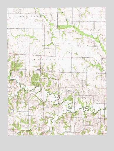
Woodlawn, MO USGS Topographic Map
Click on map above to begin viewing in our Map Viewer.

This topographic map contains these locations and features:
Feature Name Type Latitude Longitude GNIS ID View Map
Atterberry CemeteryCemeteryN39.5425°W92.1729°713475View Map
Bear BranchStreamN39.5174°W92.1936°713779View Map
Big BranchStreamN39.5228°W92.1543°714143View Map
Collis School (historical)SchoolN39.5873°W92.1641°743944View Map
Coon BranchStreamN39.5248°W92.1327°716236View Map
Evans School (historical)SchoolN39.5484°W92.1266°743946View Map
Flat CreekStreamN39.5225°W92.1707°717989View Map
Forest Grove CemeteryCemeteryN39.5420°W92.1649°718078View Map
Martin School (historical)SchoolN39.6195°W92.2146°733583View Map
Milner CemeteryCemeteryN39.5353°W92.1531°722411View Map
Mount Pleasant ChurchChurchN39.5028°W92.1716°729349View Map
Mount Pleasant School (historical)SchoolN39.5028°W92.1721°743948View Map
Mud CreekStreamN39.5456°W92.2332°723016View Map
Oak Grove ChurchChurchN39.5631°W92.2091°729359View Map
Pleasant Green ChurchChurchN39.5198°W92.2152°729367View Map
Pleasant Green School (historical)SchoolN39.5195°W92.2146°743947View Map
Qualles Lake DamDamN39.5167°W92.2285°762155View Map
Ram BranchStreamN39.6064°W92.1735°725082View Map
Tisue School (historical)SchoolN39.5837°W92.2493°744054View Map
Township of WoodlawnCivilN39.5884°W92.2036°767046View Map
Turner School (historical)SchoolN39.5536°W92.1702°743945View Map
WoodlawnPopulated PlaceN39.5784°W92.2127°729107View Map

Note: Coordinates in the location and feature list above are referenced to NAD83 datum.


Copyright (C) 2008-2024 Ryan Niemi / Sunset Dynamics ... All Rights Reserved