TopoQuest Logo
Do you find TopoQuest useful?
Help keep TopoQuest running and adding new maps/features by donating!
Bitcoin:  19c7KJd3qBynnjoSw5npx9KScwjBe4ifkT
Litecoin:  LXs6TkuXGGXo1vDsWCkWVdjQX94eUKd6ui
Home View Maps Find Maps Find Places Resources & Links


Alexandria, Tennessee Topographic Map

USGS Map Title: Alexandria, TN
USGS Map MRC: 36086A1
DRG (GeoTIFF) Download: o36086a1.tif


Neighboring USGS Topographic Map Quads:


  Shop Springs, TN  
36086B2
 

  New Middleton, TN  
36086B1
 

  Gordonsville, TN  
36085B8
 

  Watertown, TN  
36086A2
 

  Alexandria, TN  
36086A1
 

  Liberty, TN  
36085A8
 

  Milton, TN  
35086H2
 

  Auburntown, TN  
35086H1
 

  Gassaway, TN  
35085H8


Map MRC Location:

N37°
W87°
N37°
W86°
H8 H7 H6 H5 H4 H3 H2 H1
G8 G7 G6 G5 G4 G3 G2 G1
F8 F7 F6 F5 F4 F3 F2 F1
E8 E7 E6 E5 E4 E3 E2 E1
D8 D7 D6 D5 D4 D3 D2 D1
C8 C7 C6 C5 C4 C3 C2 C1
B8 B7 B6 B5 B4 B3 B2 B1
A8 A7 A6 A5 A4 A3 A2 A1
N36°
W87°
N36°
W86°

Alexandria, TN USGS 1:24K Topographic Map Preview:
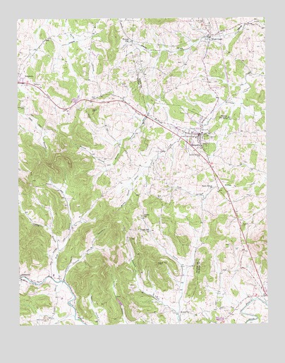
Alexandria, TN USGS Topographic Map
Click on map above to begin viewing in our Map Viewer.

This topographic map contains these locations and features:
Feature Name Type Latitude Longitude GNIS ID View Map
AlexandriaPopulated PlaceN36.0776°W86.0333°1313829View Map
Alexandria African Methodist Episcopal ChurchChurchN36.0764°W86.0300°1322494View Map
Alexandria Church of ChristChurchN36.0773°W86.0358°1322495View Map
Alexandria Colored School (historical)SchoolN36.0726°W86.0297°1322502View Map
Alexandria Eastview Colored CemeteryCemeteryN36.0750°W86.0291°2711217View Map
Alexandria Fire DepartmentBuildingN36.0767°W86.0335°2654312View Map
Alexandria Police DepartmentBuildingN36.0768°W86.0335°2765733View Map
Alexandria Post OfficePost OfficeN36.0761°W86.0330°1651898View Map
Alexandria SchoolSchoolN36.0753°W86.0372°1322505View Map
Allen CemeteryCemeteryN36.0312°W86.0142°1313832View Map
Bowers CemeteryCemeteryN36.0648°W86.0394°2711391View Map
Brush CreekPopulated PlaceN36.1173°W86.0278°1305471View Map
Brush Creek Baptist ChurchChurchN36.1209°W86.0280°1321090View Map
Brush Creek CemeteryCemeteryN36.1239°W86.0305°1278685View Map
Brush Creek Post OfficePost OfficeN36.1181°W86.0225°1651653View Map
Brush Creek School (historical)SchoolN36.1231°W86.0280°1321091View Map
Chumley HollowValleyN36.0182°W86.1025°1280543View Map
Cleaver CreekStreamN36.0203°W86.1250°1280690View Map
Commissioner District 9CivilN36.0474°W86.1189°2464752View Map
Coon BranchStreamN36.0531°W86.0305°1313893View Map
District 1 (historical)CivilN36.0417°W86.0167°1325899View Map
District 13 (historical)CivilN36.0126°W86.0125°1325911View Map
Eastview CemeteryCemeteryN36.0759°W86.0294°1313922View Map
Eavens BranchStreamN36.0837°W86.0622°1313923View Map
Ervin CemeteryCemeteryN36.0536°W86.0129°2711663View Map
Goose CreekStreamN36.0801°W86.0400°1313940View Map
Grandstaff CemeteryCemeteryN36.0889°W86.1217°1285825View Map
Hearn HillSummitN36.0876°W86.0880°1287289View Map
Hearn Hill CemeteryCemeteryN36.0926°W86.0883°1287287View Map
Hicks CemeteryCemeteryN36.0566°W86.0235°2712067View Map
Highland Memorial CemeteryCemeteryN36.0698°W86.0328°1313957View Map
Holmes GapLocaleN36.1162°W86.0678°1288132View Map
Johnson CreekStreamN36.0020°W86.0453°1289597View Map
Liberty HillPopulated PlaceN36.0434°W86.0630°1315395View Map
Liberty Hill ChurchChurchN36.0378°W86.0592°1291157View Map
Liberty Hill School (historical)SchoolN36.0384°W86.0630°1323204View Map
Mahone (historical)Populated PlaceN36.0914°W86.0886°1312867View Map
Malone HollowValleyN36.0661°W86.0786°1292544View Map
Marlen BranchStreamN36.0578°W86.0689°1292703View Map
Oakley BranchStreamN36.0306°W86.1050°1296194View Map
Old Campground CemeteryCemeteryN36.0026°W86.1108°1296285View Map
Rocky Springs School (historical)SchoolN36.0398°W86.0989°1323237View Map
Round TopPopulated PlaceN36.0048°W86.0447°1300182View Map
Round Top KnobSummitN36.0245°W86.0558°1300187View Map
Round Top School (historical)SchoolN36.0053°W86.0486°1323240View Map
Smith CemeteryCemeteryN36.0984°W86.0711°1270623View Map
StatesvillePopulated PlaceN36.0195°W86.1250°1303808View Map
Statesville Methodist ChurchChurchN36.0192°W86.1244°1323259View Map
Talley CemeteryCemeteryN36.0523°W86.0553°1272054View Map
Town of AlexandriaCivilN36.0791°W86.0381°2405130View Map
Upper Helton Missionary Baptist ChurchChurchN36.0557°W86.0263°1313805View Map
Vandatta CemeteryCemeteryN36.0412°W86.0125°1313806View Map
Walkers Chapel Primitive Baptist ChurchChurchN36.0756°W86.0347°1322635View Map
Webb BranchStreamN36.0184°W86.1042°1274007View Map
West Main Baptist ChurchChurchN36.0762°W86.0353°1322639View Map

Note: Coordinates in the location and feature list above are referenced to NAD83 datum.


Copyright (C) 2008-2024 Ryan Niemi / Sunset Dynamics ... All Rights Reserved