TopoQuest Logo
Do you find TopoQuest useful?
Help keep TopoQuest running and adding new maps/features by donating!
Bitcoin:  19c7KJd3qBynnjoSw5npx9KScwjBe4ifkT
Litecoin:  LXs6TkuXGGXo1vDsWCkWVdjQX94eUKd6ui
Home View Maps Find Maps Find Places Resources & Links


Brooksville NW, Florida Topographic Map

USGS Map Title: Brooksville NW, FL
USGS Map MRC: 28082F4
DRG (GeoTIFF) Download: o28082f4.tif


Neighboring USGS Topographic Map Quads:


  Homosassa, FL  
28082G5
 

  Lecanto, FL  
28082G4
 

  Inverness, FL  
28082G3
 

  Chassahowitzka, FL  
28082F5
 

  Brooksville NW, FL  
28082F4
 

  Nobleton, FL  
28082F3
 

  Weeki Wachee Spring, FL  
28082E5
 

  Brooksville, FL  
28082E4
 

  Brooksville SE, FL  
28082E3


Map MRC Location:

N29°
W83°
N29°
W82°
H8 H7 H6 H5 H4 H3 H2 H1
G8 G7 G6 G5 G4 G3 G2 G1
F8 F7 F6 F5 F4 F3 F2 F1
E8 E7 E6 E5 E4 E3 E2 E1
D8 D7 D6 D5 D4 D3 D2 D1
C8 C7 C6 C5 C4 C3 C2 C1
B8 B7 B6 B5 B4 B3 B2 B1
A8 A7 A6 A5 A4 A3 A2 A1
N28°
W83°
N28°
W82°

Brooksville NW, FL USGS 1:24K Topographic Map Preview:
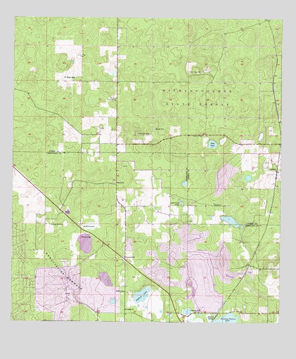
Brooksville NW, FL USGS Topographic Map
Click on map above to begin viewing in our Map Viewer.

This topographic map contains these locations and features:
Feature Name Type Latitude Longitude GNIS ID View Map
Annutteliga HammockIslandN28.6436°W82.4743°293911View Map
Brush SinkBasinN28.7044°W82.4334°279515View Map
CatawbaPopulated PlaceN28.6886°W82.3765°294708View Map
Hammock School (historical)SchoolN28.6517°W82.4468°283661View Map
Harris PondLakeN28.6704°W82.4739°283768View Map
Hebron Baptist ChurchChurchN28.6822°W82.4512°283854View Map
Hernando County Rock Canning Center & LibraryBuildingN28.6519°W82.4472°2376229View Map
Hobb PrairieSwampN28.6646°W82.4634°284058View Map
Horse LakeLakeN28.6683°W82.4682°300952View Map
Johnson PondLakeN28.6296°W82.4182°284885View Map
Live Oak FlatFlatN28.7347°W82.4682°285869View Map
Lizzie Hart SinkBasinN28.7028°W82.4420°285893View Map
Oak Grove Community Hall (historical)BuildingN28.7169°W82.4518°287957View Map
Ringhaver HeliportAirportN28.6317°W82.4220°309296View Map
Saint Joseph Church (historical)ChurchN28.6303°W82.4468°290245View Map
Saint Stanislaus Catholic ChurchChurchN28.6303°W82.4469°2376230View Map
Sand Point PondLakeN28.6745°W82.4211°290552View Map
Shiloh Baptist ChurchChurchN28.6736°W82.4056°291029View Map
Shiloh CemeteryCemeteryN28.6741°W82.4059°301101View Map
Simmons Prairie LakeLakeN28.6254°W82.3993°291150View Map
Skinner LakeLakeN28.6575°W82.4655°291205View Map
Stafford ChurchChurchN28.6375°W82.4468°291594View Map
Stafford LakeLakeN28.6362°W82.4391°291596View Map
Stafford SidingLocaleN28.6269°W82.4048°291598View Map
Stage PondLakeN28.6985°W82.4068°291602View Map
Stage Pond CemeteryCemeteryN28.7022°W82.4107°291603View Map
Sugarmill Woods Census Designated PlaceCensusN28.7321°W82.4986°2402899View Map
Sunset PlazaLocaleN28.6405°W82.4609°296495View Map
Tillis Hills Recreation AreaParkN28.7283°W82.4811°2376209View Map
Turkey PrairieFlatN28.6642°W82.4787°292541View Map
W Water HoleBayN28.7253°W82.4707°292799View Map

Note: Coordinates in the location and feature list above are referenced to NAD83 datum.


Copyright (C) 2008-2024 Ryan Niemi / Sunset Dynamics ... All Rights Reserved