TopoQuest Logo
Do you find TopoQuest useful?
Help keep TopoQuest running and adding new maps/features by donating!
Bitcoin:  19c7KJd3qBynnjoSw5npx9KScwjBe4ifkT
Litecoin:  LXs6TkuXGGXo1vDsWCkWVdjQX94eUKd6ui
Home View Maps Find Maps Find Places Resources & Links


Brookville, Ohio Topographic Map

USGS Map Title: Brookville, OH
USGS Map MRC: 39084G4
DRG (GeoTIFF) Download: o39084g4.tif


Neighboring USGS Topographic Map Quads:


  Arcanum, OH  
39084H5
 

  Laura, OH  
39084H4
 

  West Milton, OH  
39084H3
 

  Lewisburg, OH  
39084G5
 

  Brookville, OH  
39084G4
 

  Trotwood, OH  
39084G3
 

  West Alexandria, OH  
39084F5
 

  Farmersville, OH  
39084F4
 

  Miamisburg, OH  
39084F3


Map MRC Location:

N40°
W85°
N40°
W84°
H8 H7 H6 H5 H4 H3 H2 H1
G8 G7 G6 G5 G4 G3 G2 G1
F8 F7 F6 F5 F4 F3 F2 F1
E8 E7 E6 E5 E4 E3 E2 E1
D8 D7 D6 D5 D4 D3 D2 D1
C8 C7 C6 C5 C4 C3 C2 C1
B8 B7 B6 B5 B4 B3 B2 B1
A8 A7 A6 A5 A4 A3 A2 A1
N39°
W85°
N39°
W84°

Brookville, OH USGS 1:24K Topographic Map Preview:
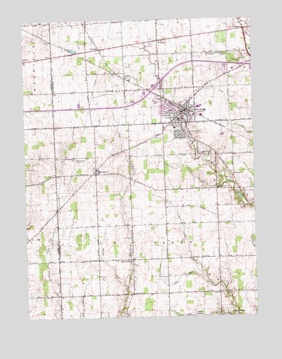
Brookville, OH USGS Topographic Map
Click on map above to begin viewing in our Map Viewer.

This topographic map contains these locations and features:
Feature Name Type Latitude Longitude GNIS ID View Map
ArlingtonPopulated PlaceN39.8664°W84.4247°1064341View Map
Arlington CemeteryCemeteryN39.8653°W84.4297°1961452View Map
BachmanPopulated PlaceN39.8628°W84.4572°1064369View Map
Bachman CemeteryCemeteryN39.8615°W84.4601°1961454View Map
Bachman Post Office (historical)Post OfficeN39.8626°W84.4569°2037587View Map
Brookside Plaza Shopping CenterLocaleN39.8406°W84.4222°1059204View Map
BrookvillePopulated PlaceN39.8367°W84.4113°1056728View Map
Brookville Air-ParkAirportN39.8644°W84.4337°1082522View Map
Brookville Church of the BrethrenChurchN39.8334°W84.4180°1063179View Map
Brookville Fire Department Station 1BuildingN39.8369°W84.4129°2549999View Map
Brookville Fire Department Station 2BuildingN39.8357°W84.4064°2549119View Map
Brookville High SchoolSchoolN39.8331°W84.4158°1051709View Map
Brookville Middle SchoolSchoolN39.8326°W84.4152°1051708View Map
Brookville Police DepartmentBuildingN39.8348°W84.4092°2733075View Map
Brookville Post OfficePost OfficeN39.8372°W84.4125°1806729View Map
Brookville Town HallBuildingN39.8367°W84.4130°1806730View Map
City of BrookvilleCivilN39.8393°W84.4176°2393433View Map
Community United Methodist ChurchChurchN39.8353°W84.4119°1063177View Map
DodsonPopulated PlaceN39.8506°W84.4433°1048664View Map
Dodson Post Office (historical)Post OfficeN39.8501°W84.4430°2037433View Map
Eversole CemeteryCemeteryN39.7595°W84.3897°1961465View Map
Eversole ChurchChurchN39.7598°W84.3933°1040286View Map
First Baptist Church of BrookvilleChurchN39.8337°W84.4055°1063178View Map
First Methodist Episcopal Church (historical)ChurchN39.8364°W84.4127°1806731View Map
Halbeisen Airport (historical)AirportN39.7787°W84.4172°1082523View Map
Interchange 21CrossingN39.8487°W84.4249°1061318View Map
Kreider CemeteryCemeteryN39.8414°W84.3872°1961476View Map
Kreitzer CornerPopulated PlaceN39.7598°W84.4430°1062844View Map
Landis CemeteryCemeteryN39.8187°W84.3977°1042410View Map
Lee FarmsLocaleN39.7839°W84.4633°2724333View Map
Lick RunStreamN39.7667°W84.4016°1042540View Map
Little RichmondPopulated PlaceN39.7742°W84.4444°1048925View Map
McNelly CemeteryCemeteryN39.7962°W84.3794°1961478View Map
Melody 49 Twin Drive-InLocaleN39.8597°W84.3781°2632544View Map
Olivet United Brethren in Christ ChurchChurchN39.7745°W84.4441°1063175View Map
Perry Township Police DepartmentBuildingN39.7890°W84.4237°2732427View Map
Plainview ChurchChurchN39.7673°W84.4222°1061549View Map
Pleasant Hill CemeteryCemeteryN39.8031°W84.3808°1044523View Map
Providence ChurchChurchN39.8039°W84.3941°1061576View Map
PyrmontPopulated PlaceN39.8120°W84.4608°1049107View Map
Pyrmont CemeteryCemeteryN39.8159°W84.4619°1961485View Map
Pyrmont Post Office (historical)Post OfficeN39.8126°W84.4611°2037448View Map
Pyrmont United Methodist ChurchChurchN39.8131°W84.4611°1063176View Map
Shiloh ChurchChurchN39.8095°W84.4841°1046212View Map
Shiloh Lutheran CemeteryCemeteryN39.8098°W84.4838°1961443View Map
Stone AirportAirportN39.7692°W84.4203°1082895View Map
SwanktownPopulated PlaceN39.8709°W84.3786°1049236View Map
Township of PerryCivilN39.7883°W84.4247°1086678View Map
Trinity Lutheran ChurchChurchN39.8367°W84.4144°1806732View Map
WengerlawnPopulated PlaceN39.8737°W84.4649°1084160View Map
Wengerlawn Post Office (historical)Post OfficeN39.8737°W84.4652°2037870View Map
Westbrook Elementary SchoolSchoolN39.8295°W84.4180°1051710View Map
WGTZ-FM (Eaton)TowerN39.8362°W84.4044°1085352View Map
Wolf Creek ChurchChurchN39.8098°W84.3858°1048030View Map
Wysong RunStreamN39.7631°W84.4452°1048168View Map

Note: Coordinates in the location and feature list above are referenced to NAD83 datum.


Copyright (C) 2008-2024 Ryan Niemi / Sunset Dynamics ... All Rights Reserved