TopoQuest Logo
Do you find TopoQuest useful?
Help keep TopoQuest running and adding new maps/features by donating!
Bitcoin:  19c7KJd3qBynnjoSw5npx9KScwjBe4ifkT
Litecoin:  LXs6TkuXGGXo1vDsWCkWVdjQX94eUKd6ui
Home View Maps Find Maps Find Places Resources & Links


Burbank, South Dakota Topographic Map

USGS Map Title: Burbank, SD
USGS Map MRC: 42096F7
DRG (GeoTIFF) Download: o42096f7.tif


Neighboring USGS Topographic Map Quads:


  Vermillion, SD  
42096G8
 

  Vermillion SE, SD  
42096G7
 

  Richland, SD  
42096G6
 

  Maskell, NE  
42096F8
 

  Burbank, SD  
42096F7
 

  Elk Point, SD  
42096F6
 

  Martinsburg SW, NE  
42096E8
 

  Martinsburg, NE  
42096E7
 

  Ponca, NE  
42096E6


Map MRC Location:

N43°
W97°
N43°
W96°
H8 H7 H6 H5 H4 H3 H2 H1
G8 G7 G6 G5 G4 G3 G2 G1
F8 F7 F6 F5 F4 F3 F2 F1
E8 E7 E6 E5 E4 E3 E2 E1
D8 D7 D6 D5 D4 D3 D2 D1
C8 C7 C6 C5 C4 C3 C2 C1
B8 B7 B6 B5 B4 B3 B2 B1
A8 A7 A6 A5 A4 A3 A2 A1
N42°
W97°
N42°
W96°

Burbank, SD USGS 1:24K Topographic Map Preview:
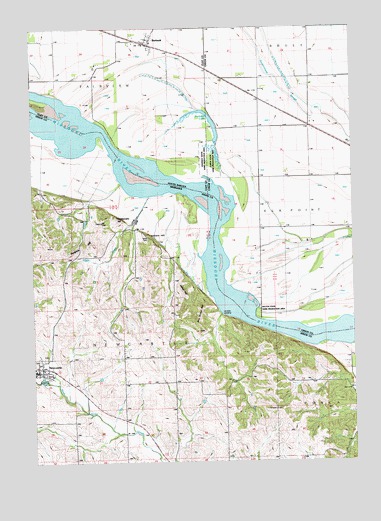
Burbank, SD USGS Topographic Map
Click on map above to begin viewing in our Map Viewer.

This topographic map contains these locations and features:
Feature Name Type Latitude Longitude GNIS ID View Map
Boy Scout HillSummitN42.6686°W96.8095°827604View Map
BurbankPopulated PlaceN42.7453°W96.8292°1265138View Map
Burbank LakeLakeN42.7259°W96.8094°1254160View Map
Gibbs CreekStreamN42.7044°W96.8284°829510View Map
Heald DamDamN42.6483°W96.7553°1767662View Map
Heald ReservoirReservoirN42.6483°W96.7553°1767663View Map
Indian HillSummitN42.6742°W96.8170°830282View Map
Ionia 'Volcano' Historical MarkerParkN42.6506°W96.8692°1884184View Map
Ionia (historical)Populated PlaceN42.6683°W96.7809°1759801View Map
Ionia CemeteryCemeteryN42.6894°W96.8303°830302View Map
Ionia Post Office (historical)Post OfficeN42.6625°W96.7809°1884147View Map
Kate Sweeney Bend (historical)BendN42.7028°W96.8039°1263486View Map
Lembke LandingPopulated PlaceN42.6672°W96.8017°835358View Map
NewcastlePopulated PlaceN42.6514°W96.8737°831615View Map
Newcastle Post OfficePost OfficeN42.6511°W96.8731°1884182View Map
Pfister ParkParkN42.6506°W96.8692°1884185View Map
Pumpkin HillSummitN42.6872°W96.8556°832413View Map
Rattlesnake HillSummitN42.6953°W96.8425°832465View Map
Saint Peters Catholic ChurchChurchN42.6514°W96.8737°1884181View Map
Township of NewcastleCivilN42.6616°W96.8461°838156View Map
Union County Waterfowl Production AreaParkN42.7375°W96.7769°2765540View Map
Village of NewcastleCivilN42.6524°W96.8740°2399491View Map
Volcano HillSummitN42.6886°W96.8278°834401View Map

Note: Coordinates in the location and feature list above are referenced to NAD83 datum.


Copyright (C) 2008-2024 Ryan Niemi / Sunset Dynamics ... All Rights Reserved