TopoQuest Logo
Do you find TopoQuest useful?
Help keep TopoQuest running and adding new maps/features by donating!
Bitcoin:  19c7KJd3qBynnjoSw5npx9KScwjBe4ifkT
Litecoin:  LXs6TkuXGGXo1vDsWCkWVdjQX94eUKd6ui
Home View Maps Find Maps Find Places Resources & Links


Butternut Lake, Wisconsin Topographic Map

USGS Map Title: Butternut Lake, WI
USGS Map MRC: 45090H5
DRG (GeoTIFF) Download: o45090h5.tif


Neighboring USGS Topographic Map Quads:


  Shanagolden, WI  
46090A6
 

  Peeksville, WI  
46090A5
 

  Butternut, WI  
46090A4
 

  Kennedy, WI  
45090H6
 

  Butternut Lake, WI  
45090H5
 

  Park Falls, WI  
45090H4
 

  Oxbo, WI  
45090G6
 

  Lugerville, WI  
45090G5
 

  Priest Lake, WI  
45090G4


Map MRC Location:

N46°
W91°
N46°
W90°
H8 H7 H6 H5 H4 H3 H2 H1
G8 G7 G6 G5 G4 G3 G2 G1
F8 F7 F6 F5 F4 F3 F2 F1
E8 E7 E6 E5 E4 E3 E2 E1
D8 D7 D6 D5 D4 D3 D2 D1
C8 C7 C6 C5 C4 C3 C2 C1
B8 B7 B6 B5 B4 B3 B2 B1
A8 A7 A6 A5 A4 A3 A2 A1
N45°
W91°
N45°
W90°

Butternut Lake, WI USGS 1:24K Topographic Map Preview:
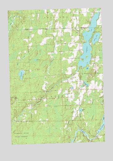
Butternut Lake, WI USGS Topographic Map
Click on map above to begin viewing in our Map Viewer.

This topographic map contains these locations and features:
Feature Name Type Latitude Longitude GNIS ID View Map
Arnold School (historical)SchoolN45.9136°W90.5763°1833491View Map
Bass LakeLakeN45.9403°W90.6092°1561268View Map
Beaver CreekStreamN45.9344°W90.5502°1561439View Map
Betsy CreekStreamN45.8769°W90.5199°1561659View Map
Buckman LakeLakeN45.9293°W90.5232°1562339View Map
Butternut LakeLakeN45.9678°W90.5186°1562483View Map
Butternut School (historical)SchoolN45.9722°W90.5310°1833492View Map
Cooley LakeLakeN45.9275°W90.5286°1563352View Map
Flood CreekStreamN45.8763°W90.5449°1565075View Map
Gardner CreekStreamN45.8869°W90.5349°1565404View Map
Gardner LakeLakeN45.9050°W90.5319°1565407View Map
Kaiser (historical)Populated PlaceN45.9097°W90.5516°1833517View Map
Kennedy Lookout TowerTowerN45.9186°W90.6196°1581243View Map
Mill PondLakeN45.9260°W90.5420°1569489View Map
Mud LakeLakeN45.9439°W90.5208°1569973View Map
Mud LakeLakeN45.9530°W90.5899°1569976View Map
Pinkerton CreekStreamN45.8816°W90.5227°1571536View Map
Pixley CreekStreamN45.8791°W90.5121°1571568View Map
Pixley DamDamN45.8802°W90.5118°1571569View Map
Pixley FlowageReservoirN45.8853°W90.5079°1571570View Map
Pixley WP61 DamDamN45.8800°W90.5118°1793048View Map
Schnur LakeLakeN45.9719°W90.5083°1573792View Map
Spiller CreekStreamN45.9766°W90.5254°1574551View Map
Town of LakeCivilN45.9216°W90.5686°1583509View Map
Wilson School (historical)SchoolN45.9250°W90.5324°1833565View Map

Note: Coordinates in the location and feature list above are referenced to NAD83 datum.


Copyright (C) 2008-2024 Ryan Niemi / Sunset Dynamics ... All Rights Reserved