TopoQuest Logo
Do you find TopoQuest useful?
Help keep TopoQuest running and adding new maps/features by donating!
Bitcoin:  19c7KJd3qBynnjoSw5npx9KScwjBe4ifkT
Litecoin:  LXs6TkuXGGXo1vDsWCkWVdjQX94eUKd6ui
Home View Maps Find Maps Find Places Resources & Links


Green Timbers, Michigan Topographic Map

USGS Map Title: Green Timbers, MI
USGS Map MRC: 45084B5
DRG (GeoTIFF) Download: o45084b5.tif


Neighboring USGS Topographic Map Quads:


  Wildwood, MI  
45084C6
 

  Wolverine, MI  
45084C5
 

  Afton, MI  
45084C4
 

  Vanderbilt, MI  
45084B6
 

  Green Timbers, MI  
45084B5
 

  Hardwood Lake, MI  
45084B4
 

  Gaylord, MI  
45084A6
 

  Sparr, MI  
45084A5
 

  Saunders Creek, MI  
45084A4


Map MRC Location:

N46°
W85°
N46°
W84°
H8 H7 H6 H5 H4 H3 H2 H1
G8 G7 G6 G5 G4 G3 G2 G1
F8 F7 F6 F5 F4 F3 F2 F1
E8 E7 E6 E5 E4 E3 E2 E1
D8 D7 D6 D5 D4 D3 D2 D1
C8 C7 C6 C5 C4 C3 C2 C1
B8 B7 B6 B5 B4 B3 B2 B1
A8 A7 A6 A5 A4 A3 A2 A1
N45°
W85°
N45°
W84°

Green Timbers, MI USGS 1:24K Topographic Map Preview:
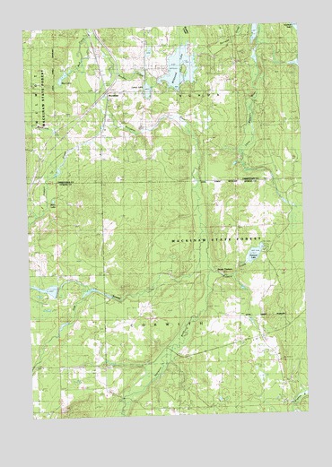
Green Timbers, MI USGS Topographic Map
Click on map above to begin viewing in our Map Viewer.

This topographic map contains these locations and features:
Feature Name Type Latitude Longitude GNIS ID View Map
Blackjack CreekStreamN45.2147°W84.6089°621541View Map
Bradley CreekStreamN45.2347°W84.5848°621849View Map
Burrows CreekStreamN45.2497°W84.5247°622326View Map
Club StreamStreamN45.1864°W84.5467°623503View Map
Elkwood CampgroundLocaleN45.2283°W84.5444°2369340View Map
Fontinalis ClubLocaleN45.1628°W84.5886°626213View Map
Green TimbersPopulated PlaceN45.1717°W84.5411°1617598View Map
Lance LakeLakeN45.2295°W84.5692°630118View Map
Mud CreekStreamN45.2478°W84.5942°632867View Map
Mud LakeLakeN45.2330°W84.6086°633016View Map
Pickerel CreekStreamN45.1706°W84.5428°634773View Map
Pickerel LakeLakeN45.1765°W84.5223°634792View Map
Pickerel Lake State Forest CampgroundLocaleN45.1778°W84.5172°2492478View Map
Pigeon River State ForestForestN45.1728°W84.5103°1618934View Map
Stewart CreekStreamN45.2225°W84.5884°638829View Map
Storey LakeLakeN45.1946°W84.6133°638924View Map
Sturgeon River CampgroundLocaleN45.2403°W84.5875°2369339View Map
Township of CorwithCivilN45.1566°W84.5515°1626135View Map
TrowbridgePopulated PlaceN45.2295°W84.5864°1617900View Map
Trowbridge Post Office (historical)Post OfficeN45.2294°W84.5864°2369393View Map
Trowbridge Station (historical)LocaleN45.2294°W84.5867°2369392View Map
Wildwood LakeLakeN45.2361°W84.5569°2100178View Map
Wildwood Lake Golf CourseLocaleN45.2389°W84.5694°2369338View Map

Note: Coordinates in the location and feature list above are referenced to NAD83 datum.


Copyright (C) 2008-2024 Ryan Niemi / Sunset Dynamics ... All Rights Reserved