TopoQuest Logo
Do you find TopoQuest useful?
Help keep TopoQuest running and adding new maps/features by donating!
Bitcoin:  19c7KJd3qBynnjoSw5npx9KScwjBe4ifkT
Litecoin:  LXs6TkuXGGXo1vDsWCkWVdjQX94eUKd6ui
Home View Maps Find Maps Find Places Resources & Links


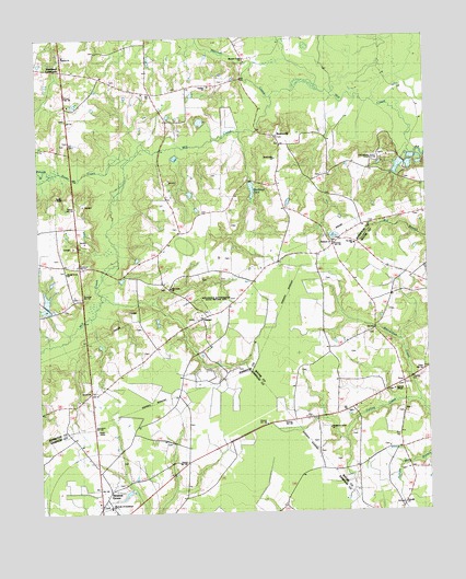
Newton Grove North, North Carolina Topographic Map

USGS Map Title: Newton Grove North, NC
USGS Map MRC: 35078C3
DRG (GeoTIFF) Download: o35078c3.tif


Neighboring USGS Topographic Map Quads:


  Four Oaks, NC  
35078D4
 

  Four Oaks NE, NC  
35078D3
 

  Princeton, NC  
35078D2
 

  Peacocks Crossroads, NC  
35078C4
 

  Newton Grove North, NC  
35078C3
 

  Grantham, NC  
35078C2
 

  Timothy, NC  
35078B4
 

  Newton Grove South, NC  
35078B3
 

  Dobbersville, NC  
35078B2


Map MRC Location:

N36°
W79°
N36°
W78°
H8 H7 H6 H5 H4 H3 H2 H1
G8 G7 G6 G5 G4 G3 G2 G1
F8 F7 F6 F5 F4 F3 F2 F1
E8 E7 E6 E5 E4 E3 E2 E1
D8 D7 D6 D5 D4 D3 D2 D1
C8 C7 C6 C5 C4 C3 C2 C1
B8 B7 B6 B5 B4 B3 B2 B1
A8 A7 A6 A5 A4 A3 A2 A1
N35°
W79°
N35°
W78°

Newton Grove North, NC USGS 1:24K Topographic Map Preview:
Newton Grove North, NC USGS Topographic Map
Click on map above to begin viewing in our Map Viewer.

This topographic map contains these locations and features:
Feature Name Type Latitude Longitude GNIS ID View Map
Antioch ChurchChurchN35.3704°W78.3664°1004614View Map
Beaverdam CreekStreamN35.2793°W78.2514°980835View Map
Bentonsville Beasley Post OfficePost OfficeN35.3488°W78.2967°981022View Map
BentonvillePopulated PlaceN35.3488°W78.2969°1004617View Map
Bentonville BattlegroundLocaleN35.3474°W78.3181°1008253View Map
Bentonville ChurchChurchN35.3432°W78.2981°1026181View Map
Bentonville Volunteer Fire DepartmentBuildingN35.3203°W78.2795°2639211View Map
Blackman PondReservoirN35.3371°W78.3050°981554View Map
Corinth ChurchChurchN35.3621°W78.3292°983557View Map
Ebenezer ChurchChurchN35.3210°W78.2797°1004619View Map
Flowers StoreLocaleN35.3210°W78.2789°985241View Map
Friendly ChurchChurchN35.2521°W78.2581°1004611View Map
Hannah CreekStreamN35.3593°W78.2989°986373View Map
Hannah Creek ChurchChurchN35.3696°W78.3489°1000939View Map
HarperPopulated PlaceN35.3018°W78.3219°1006231View Map
Hoods Grove ChurchChurchN35.3138°W78.3661°1004616View Map
Johnston County Emergency Medical Services Station 2BuildingN35.3153°W78.3644°2720325View Map
Jordans ChapelChurchN35.2821°W78.2608°1004609View Map
Jordans Chapel Fire DepartmentBuildingN35.2703°W78.2595°2638995View Map
Jordans StoreLocaleN35.2838°W78.2561°987785View Map
Langston StoreLocaleN35.2899°W78.3264°988140View Map
Mill Creek ChurchChurchN35.3096°W78.3322°989963View Map
Our Lady of Guadalupe ChurchChurchN35.2518°W78.3528°1004612View Map
OvershotPopulated PlaceN35.3066°W78.3631°1006323View Map
Pauline ChurchChurchN35.3618°W78.3186°1004615View Map
Rose PondReservoirN35.3052°W78.3731°998775View Map
Rose Pond DamDamN35.3052°W78.3731°998776View Map
Saint John ChurchChurchN35.3204°W78.2725°1004620View Map
Saw Pit BranchStreamN35.3579°W78.2764°2041847View Map
Small ChapelChurchN35.3332°W78.3689°1026036View Map
StarlightPopulated PlaceN35.2666°W78.2583°1006380View Map
Stone CreekStreamN35.3432°W78.3450°1025730View Map
Strickland CrossroadsPopulated PlaceN35.3677°W78.3672°1006382View Map
Stricklands Crossroads Volunteer Fire DepartmentBuildingN35.3669°W78.3646°2639212View Map
Thornton StoreLocaleN35.2935°W78.2806°996065View Map
Town of Newton GroveCivilN35.2522°W78.3553°2406990View Map
Township of BentonvilleCivilN35.3451°W78.2939°1026844View Map
Tuscarora Scout ReservationLocaleN35.3446°W78.2636°1004618View Map
Westbrook Grove ChurchChurchN35.2721°W78.2817°1004610View Map
Whiteoak BranchStreamN35.3393°W78.3708°1025793View Map

Note: Coordinates in the location and feature list above are referenced to NAD83 datum.


Copyright (C) 2008-2024 Ryan Niemi / Sunset Dynamics ... All Rights Reserved