TopoQuest Logo
Do you find TopoQuest useful?
Help keep TopoQuest running and adding new maps/features by donating!
Bitcoin:  19c7KJd3qBynnjoSw5npx9KScwjBe4ifkT
Litecoin:  LXs6TkuXGGXo1vDsWCkWVdjQX94eUKd6ui
Home View Maps Find Maps Find Places Resources & Links


Perkinstown, Wisconsin Topographic Map

USGS Map Title: Perkinstown, WI
USGS Map MRC: 45090B5
DRG (GeoTIFF) Download: o45090b5.tif


Neighboring USGS Topographic Map Quads:


  Jump River Fire Tower SW, WI  
45090C6
 

  Jump River Fire Tower, WI  
45090C5
 

  Mondeaux Dam, WI  
45090C4
 

  Lublin NW, WI  
45090B6
 

  Perkinstown, WI  
45090B5
 

  Medford NW, WI  
45090B4
 

  Lublin, WI  
45090A6
 

  Lublin SE, WI  
45090A5
 

  Medford SW, WI  
45090A4


Map MRC Location:

N46°
W91°
N46°
W90°
H8 H7 H6 H5 H4 H3 H2 H1
G8 G7 G6 G5 G4 G3 G2 G1
F8 F7 F6 F5 F4 F3 F2 F1
E8 E7 E6 E5 E4 E3 E2 E1
D8 D7 D6 D5 D4 D3 D2 D1
C8 C7 C6 C5 C4 C3 C2 C1
B8 B7 B6 B5 B4 B3 B2 B1
A8 A7 A6 A5 A4 A3 A2 A1
N45°
W91°
N45°
W90°

Perkinstown, WI USGS 1:24K Topographic Map Preview:
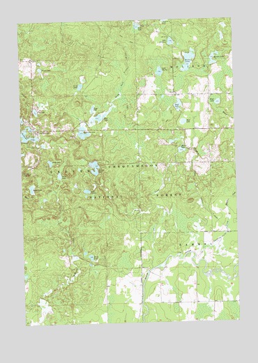
Perkinstown, WI USGS Topographic Map
Click on map above to begin viewing in our Map Viewer.

This topographic map contains these locations and features:
Feature Name Type Latitude Longitude GNIS ID View Map
1 ReservoirReservoirN45.2500°W90.5668°1792554View Map
Anderson LakeLakeN45.2039°W90.5887°1578654View Map
Birch LakeLakeN45.1523°W90.5856°1578790View Map
Cranberry LakeLakeN45.2077°W90.5299°1579947View Map
Dennis Gisvold E4894 DamDamN45.2500°W90.5668°1792553View Map
Eska LakeLakeN45.1916°W90.6083°1579217View Map
Foss LakeReservoirN45.2128°W90.6163°1579275View Map
Foss Lake Forest Service StationLocaleN45.2144°W90.6187°1580858View Map
Horten LakeLakeN45.1959°W90.5316°1579488View Map
Hulls LakeLakeN45.2325°W90.5263°1579496View Map
Jerry LakeLakeN45.2215°W90.5908°1579531View Map
Kathryn LakeLakeN45.2022°W90.6200°1579566View Map
Kathryn Lake CampgroundLocaleN45.2011°W90.6204°1580857View Map
Keyes LakeLakeN45.2155°W90.5096°1579584View Map
Kleutch LakeLakeN45.2319°W90.5113°1579594View Map
Lake ElevenLakeN45.1797°W90.5872°1579197View Map
Lake NineteenLakeN45.2408°W90.5363°1580013View Map
Lake ThirtyLakeN45.2286°W90.5432°1580602View Map
Long LakeLakeN45.2135°W90.5829°1579736View Map
Maurer CreekStreamN45.1775°W90.5051°1579826View Map
Mud LakeLakeN45.2104°W90.5766°1579948View Map
Nancy LakeLakeN45.2303°W90.6131°1579991View Map
Paradise CreekStreamN45.1505°W90.5204°1580088View Map
PerkinstownPopulated PlaceN45.2041°W90.6149°1580118View Map
Perkinstown CemeteryCemeteryN45.1986°W90.6168°1580119View Map
Perkinstown Lookout TowerTowerN45.1866°W90.6237°1581310View Map
Polack LakeLakeN45.1810°W90.6194°1580179View Map
Richter LakeLakeN45.1872°W90.5826°1580257View Map
Salem LakeLakeN45.2475°W90.5558°1580333View Map
Sawyer Dam School (historical)SchoolN45.1480°W90.5574°1840334View Map
Scoof LakeLakeN45.2145°W90.5328°1580363View Map
Taylor CountyCivilN45.2115°W90.5013°1581119View Map
Thief LakeLakeN45.1863°W90.6029°1580600View Map
Town of GroverCivilN45.2050°W90.6180°1583328View Map

Note: Coordinates in the location and feature list above are referenced to NAD83 datum.


Copyright (C) 2008-2024 Ryan Niemi / Sunset Dynamics ... All Rights Reserved