TopoQuest Logo
Do you find TopoQuest useful?
Help keep TopoQuest running and adding new maps/features by donating!
Bitcoin:  19c7KJd3qBynnjoSw5npx9KScwjBe4ifkT
Litecoin:  LXs6TkuXGGXo1vDsWCkWVdjQX94eUKd6ui
Home View Maps Find Maps Find Places Resources & Links


Sorrento, Louisiana Topographic Map

USGS Map Title: Sorrento, LA
USGS Map MRC: 30090B7
DRG (GeoTIFF) Download: o30090b7.tif


Neighboring USGS Topographic Map Quads:


  Prairieville, LA  
30090C8
 

  French Settlement, LA  
30090C7
 

  Whitehall, LA  
30090C6
 

  Gonzales, LA  
30090B8
 

  Sorrento, LA  
30090B7
 

  Mount Airy NW, LA  
30090B6
 

  Donaldsonville, LA  
30090A8
 

  Convent, LA  
30090A7
 

  Lutcher, LA  
30090A6


Map MRC Location:

N31°
W91°
N31°
W90°
H8 H7 H6 H5 H4 H3 H2 H1
G8 G7 G6 G5 G4 G3 G2 G1
F8 F7 F6 F5 F4 F3 F2 F1
E8 E7 E6 E5 E4 E3 E2 E1
D8 D7 D6 D5 D4 D3 D2 D1
C8 C7 C6 C5 C4 C3 C2 C1
B8 B7 B6 B5 B4 B3 B2 B1
A8 A7 A6 A5 A4 A3 A2 A1
N30°
W91°
N30°
W90°

Sorrento, LA USGS 1:24K Topographic Map Preview:
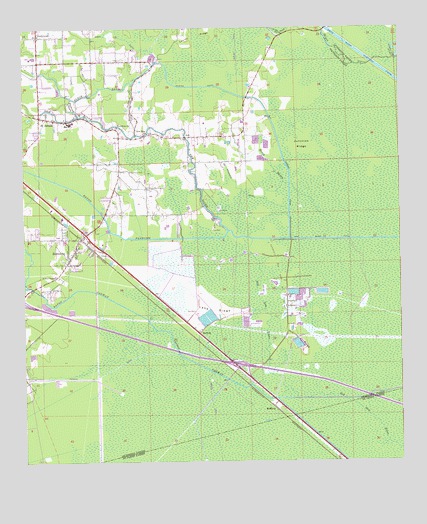
Sorrento, LA USGS Topographic Map
Click on map above to begin viewing in our Map Viewer.

This topographic map contains these locations and features:
Feature Name Type Latitude Longitude GNIS ID View Map
AcyPopulated PlaceN30.2188°W90.8204°532076View Map
Acy Fire Station (historical)BuildingN30.2195°W90.8322°2332708View Map
Amite River Diversion CanalCanalN30.2352°W90.7512°532155View Map
Anderson CanalCanalN30.2033°W90.8026°532161View Map
Babin CanalCanalN30.2483°W90.8468°532262View Map
BarmenPopulated PlaceN30.1624°W90.8162°542952View Map
Bayou ConwayStreamN30.1466°W90.7881°532535View Map
Bayou FrancoisStreamN30.1921°W90.8065°532599View Map
Bayou PierreStreamN30.2416°W90.7509°532719View Map
Bayou VicknairStreamN30.2196°W90.8376°532805View Map
BFI Colonial LandfillLocaleN30.1472°W90.8608°2600001View Map
Black BayouStreamN30.2402°W90.8282°533165View Map
DuckroostPopulated PlaceN30.2477°W90.8698°534640View Map
Duckroost BayouStreamN30.2249°W90.8559°534641View Map
Heath BayouStreamN30.1952°W90.7731°535592View Map
Holy Rosary Catholic ChurchChurchN30.2258°W90.8561°2601913View Map
Interchange 187CrossingN30.1535°W90.8057°541416View Map
Junction RidgeRidgeN30.2158°W90.7823°536139View Map
Lake RidgeRidgeN30.1691°W90.8120°536296View Map
Louisiana Technical College Ascension CampusSchoolN30.2031°W90.8706°2493510View Map
McElroyPopulated PlaceN30.1405°W90.7915°543458View Map
McElroy RidgeRidgeN30.1599°W90.7831°536988View Map
New RiverStreamN30.1894°W90.7990°537622View Map
New River CanalCanalN30.1894°W90.7568°537623View Map
New River ChurchChurchN30.2199°W90.8329°537624View Map
New River ChurchChurchN30.2213°W90.8432°537625View Map
Parish Governing Authority District 6CivilN30.1997°W90.7710°1930168View Map
Richardson CemeteryCemeteryN30.2088°W90.8401°538585View Map
River Parishes Community CollegeSchoolN30.1759°W90.8749°2493511View Map
Saint AmantPopulated PlaceN30.2246°W90.8690°543635View Map
Saint Amant Baptist ChurchChurchN30.2230°W90.8147°2602365View Map
Saint Amant Fire DepartmentBuildingN30.2404°W90.8555°2332570View Map
Saint Amant Head Start Number 4SchoolN30.2232°W90.8585°2600257View Map
Saint Amant High SchoolSchoolN30.2416°W90.8709°552707View Map
Saint Amant Middle SchoolSchoolN30.2231°W90.8596°552708View Map
Saint Amant Post OfficePost OfficeN30.2241°W90.8550°1632012View Map
Saint Amant Primary SchoolSchoolN30.2234°W90.8586°552709View Map
Saint Ann ChapelChurchN30.1788°W90.8643°538797View Map
Saveiro CanalCanalN30.2221°W90.7915°539196View Map
Second Mount Carmel Missionary Baptist ChurchChurchN30.1910°W90.8572°2602789View Map
SorrentoPopulated PlaceN30.1844°W90.8593°556083View Map
Sorrento Baptist ChurchChurchN30.1884°W90.8564°2602812View Map
Sorrento Gas and Oil FieldOilfieldN30.1788°W90.7909°556084View Map
Sorrento Police DepartmentBuildingN30.1861°W90.8579°2334061View Map
Sorrento Post OfficePost OfficeN30.1880°W90.8586°1631951View Map
Sorrento Town HallBuildingN30.1861°W90.8579°2603372View Map
Sorrento Volunteer Fire DepartmentBuildingN30.1845°W90.8596°2332467View Map
Town of SorrentoCivilN30.1828°W90.8674°2407367View Map
Ward TenCivilN30.2255°W90.8568°544900View Map

Note: Coordinates in the location and feature list above are referenced to NAD83 datum.


Copyright (C) 2008-2024 Ryan Niemi / Sunset Dynamics ... All Rights Reserved