TopoQuest Logo
Do you find TopoQuest useful?
Help keep TopoQuest running and adding new maps/features by donating!
Bitcoin:  19c7KJd3qBynnjoSw5npx9KScwjBe4ifkT
Litecoin:  LXs6TkuXGGXo1vDsWCkWVdjQX94eUKd6ui
Home View Maps Find Maps Find Places Resources & Links


Teec Nos Pos, Arizona Topographic Map

USGS Map Title: Teec Nos Pos, AZ
USGS Map MRC: 36109H1
DRG (GeoTIFF) Download: o36109h1.tif


Neighboring USGS Topographic Map Quads:


  Yellow Rock Point West, UT  
37109A2
 

  Yellow Rock Point East, UT  
37109A1
 

  Sentinel Peak SW, CO  
37108A8
 

  Cow Butte, AZ  
36109H2
 

  Teec Nos Pos, AZ  
36109H1
 

  Sallies Spring, NM  
36108H8
 

  Pastora Peak, AZ  
36109G2
 

  Beclabito, NM  
36109G1
 

  Rocky Point, NM  
36108G8


Map MRC Location:

N37°
W110°
N37°
W109°
H8 H7 H6 H5 H4 H3 H2 H1
G8 G7 G6 G5 G4 G3 G2 G1
F8 F7 F6 F5 F4 F3 F2 F1
E8 E7 E6 E5 E4 E3 E2 E1
D8 D7 D6 D5 D4 D3 D2 D1
C8 C7 C6 C5 C4 C3 C2 C1
B8 B7 B6 B5 B4 B3 B2 B1
A8 A7 A6 A5 A4 A3 A2 A1
N36°
W110°
N36°
W109°

Teec Nos Pos, AZ USGS 1:24K Topographic Map Preview:
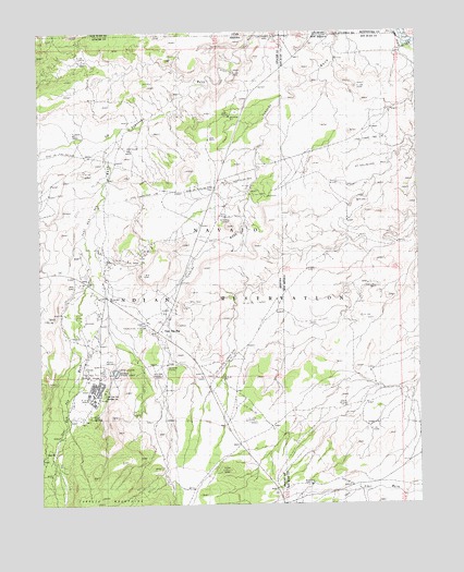
Teec Nos Pos, AZ USGS Topographic Map
Click on map above to begin viewing in our Map Viewer.

This topographic map contains these locations and features:
Feature Name Type Latitude Longitude GNIS ID View Map
12K-335 Water WellWellN36.8801°W109.0367°926992View Map
12T-340 Water WellWellN36.9370°W109.0374°927127View Map
Carrizo Mission SchoolSchoolN36.9036°W109.1045°2483View Map
Four CornersParkN36.9989°W109.0451°21631View Map
Four Corners MonumentLocaleN36.9989°W109.0452°902250View Map
Goat SpringSpringN36.8986°W109.1090°21642View Map
Navajo Lutheran MissionsChurchN36.9050°W109.1045°21718View Map
Shorthair WellWellN36.9692°W109.0965°21811View Map
Teec Nos PosPopulated PlaceN36.9211°W109.0857°12219View Map
Teec Nos Pos Ambulance ServiceBuildingN36.9242°W109.0868°2672401View Map
Teec Nos Pos Census Designated PlaceCensusN36.9221°W109.0753°2410063View Map
Teec Nos Pos Chapter HouseBuildingN36.9100°W109.1079°21838View Map
Teec Nos Pos Landing Strip (historical)AirportN36.9119°W109.0648°21839View Map
Teec Nos Pos Post OfficePost OfficeN36.9217°W109.0854°2783326View Map
Teec Nos Pos WashArroyoN36.9750°W109.0976°12221View Map
Tiis Nazbas Community SchoolSchoolN36.9039°W109.1082°21837View Map
Tohache Recreation AreaParkN36.9236°W109.0923°21844View Map

Note: Coordinates in the location and feature list above are referenced to NAD83 datum.


Copyright (C) 2008-2024 Ryan Niemi / Sunset Dynamics ... All Rights Reserved