TopoQuest Logo
Do you find TopoQuest useful?
Help keep TopoQuest running and adding new maps/features by donating!
Bitcoin:  19c7KJd3qBynnjoSw5npx9KScwjBe4ifkT
Litecoin:  LXs6TkuXGGXo1vDsWCkWVdjQX94eUKd6ui
Home View Maps Find Maps Find Places Resources & Links


Walthill, Nebraska Topographic Map

USGS Map Title: Walthill, NE
USGS Map MRC: 42096B4
DRG (GeoTIFF) Download: o42096b4.tif


Neighboring USGS Topographic Map Quads:


  Emerson SE, NE  
42096C5
 

  Homer, NE  
42096C4
 

  Salix, IA  
42096C3
 

  Pender NE, NE  
42096B5
 

  Walthill, NE  
42096B4
 

  Albaton, IA  
42096B3
 

  Bancroft, NE  
42096A5
 

  Walthill SW, NE  
42096A4
 

  Macy, NE  
42096A3


Map MRC Location:

N43°
W97°
N43°
W96°
H8 H7 H6 H5 H4 H3 H2 H1
G8 G7 G6 G5 G4 G3 G2 G1
F8 F7 F6 F5 F4 F3 F2 F1
E8 E7 E6 E5 E4 E3 E2 E1
D8 D7 D6 D5 D4 D3 D2 D1
C8 C7 C6 C5 C4 C3 C2 C1
B8 B7 B6 B5 B4 B3 B2 B1
A8 A7 A6 A5 A4 A3 A2 A1
N42°
W97°
N42°
W96°

Walthill, NE USGS 1:24K Topographic Map Preview:
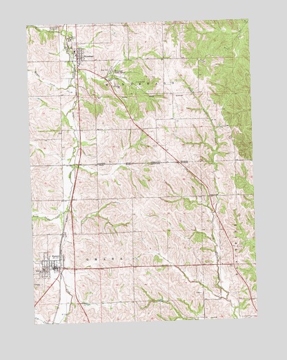
Walthill, NE USGS Topographic Map
Click on map above to begin viewing in our Map Viewer.

This topographic map contains these locations and features:
Feature Name Type Latitude Longitude GNIS ID View Map
Assembly of God ChurchChurchN42.1505°W96.4889°1883905View Map
Cow CreekStreamN42.1253°W96.4867°828417View Map
Doctor Susan LaFlesche Picotte CenterBuildingN42.1519°W96.4914°1883911View Map
Evergreen CemeteryCemeteryN42.1414°W96.4956°829174View Map
Faith United Presbyterian ChurchChurchN42.1492°W96.4889°1883906View Map
First United Methodist ChurchChurchN42.1483°W96.4884°1883908View Map
IHS Winnebago Indian HospitalHospitalN42.2325°W96.4706°1883916View Map
Little Priest Tribal College LibraryBuildingN42.2358°W96.4725°1883919View Map
Morgan CreekStreamN42.2242°W96.4764°831411View Map
North Omaha CreekStreamN42.1714°W96.4823°831716View Map
Reorganized Church of Jesus Christ of Latter Day SaintsChurchN42.1483°W96.4884°1883909View Map
Saint Augustine Catholic ChurchChurchN42.2400°W96.4756°1883922View Map
Saint Augustine Elementary SchoolSchoolN42.2403°W96.4753°1883923View Map
Saint Augustine Indian MissionLocaleN42.2430°W96.4761°832841View Map
Saint Augustine Mission CemeteryCemeteryN42.2497°W96.4831°832842View Map
Saint Josephs Catholic ChurchChurchN42.1486°W96.4934°1883907View Map
School Number 35SchoolN42.1769°W96.4000°836625View Map
South Omaha CreekStreamN42.1714°W96.4823°833606View Map
Susan LaFlesche Picotte Memorial Hospital Historical MarkerParkN42.1483°W96.4884°1883904View Map
Township of OmahaCivilN42.1478°W96.4780°838174View Map
Township of WinnebagoCivilN42.2346°W96.4447°838334View Map
Trinity Lutheran ChurchChurchN42.1483°W96.4884°1883910View Map
Turtle CreekStreamN42.2472°W96.4806°834229View Map
Veterans ParkParkN42.2358°W96.4725°1883920View Map
Village of WalthillCivilN42.1489°W96.4929°2400090View Map
Village of WinnebagoCivilN42.2360°W96.4718°2399717View Map
WalthillPopulated PlaceN42.1483°W96.4884°834465View Map
WalthillLocaleN42.1494°W96.4848°1883927View Map
Walthill Post OfficePost OfficeN42.1482°W96.4894°1883903View Map
Walthill Public LibraryBuildingN42.1480°W96.4878°1883912View Map
Walthill Public SchoolsSchoolN42.1478°W96.4942°1883926View Map
Walthill Rural Fire and Rescue ProtectionBuildingN42.1486°W96.4895°1883902View Map
WinnebagoPopulated PlaceN42.2358°W96.4725°834815View Map
WinnebagoLocaleN42.2347°W96.4753°1883921View Map
Winnebago CemeteryCemeteryN42.2242°W96.4498°834816View Map
Winnebago Dental ClinicHospitalN42.2358°W96.4725°1883914View Map
Winnebago Indian AgencyLocaleN42.2297°W96.4534°834818View Map
Winnebago Police DepartmentBuildingN42.2344°W96.4728°2739903View Map
Winnebago Post OfficePost OfficeN42.2361°W96.4728°1883913View Map
Winnebago Pow Wow GroundsLocaleN42.2358°W96.4725°1883917View Map
Winnebago Public SchoolsSchoolN42.2386°W96.4736°1883924View Map
Winnebago Reformed ChurchChurchN42.2358°W96.4725°1883918View Map
Winnebago Scouts Historical MarkerParkN42.2272°W96.4581°1883925View Map
Winnebago Tribal Rescue and AmbulanceBuildingN42.2324°W96.4704°2553724View Map
Winnebago Volunteer Fire DepartmentBuildingN42.2342°W96.4728°1883915View Map

Note: Coordinates in the location and feature list above are referenced to NAD83 datum.


Copyright (C) 2008-2024 Ryan Niemi / Sunset Dynamics ... All Rights Reserved