TopoQuest Logo
Do you find TopoQuest useful?
Help keep TopoQuest running and adding new maps/features by donating!
Bitcoin:  19c7KJd3qBynnjoSw5npx9KScwjBe4ifkT
Litecoin:  LXs6TkuXGGXo1vDsWCkWVdjQX94eUKd6ui
Home View Maps Find Maps Find Places Resources & Links


Warrenton, Missouri Topographic Map

USGS Map Title: Warrenton, MO
USGS Map MRC: 38091G2
DRG (GeoTIFF) Download: o38091g2.tif


Neighboring USGS Topographic Map Quads:


  Bellflower South, MO  
38091H3
 

  Hawk Point, MO  
38091H2
 

  Warrenton NE, MO  
38091H1
 

  Jonesburg, MO  
38091G3
 

  Warrenton, MO  
38091G2
 

  Wright City, MO  
38091G1
 

  Berger, MO  
38091F3
 

  Treloar, MO  
38091F2
 

  Marthasville, MO  
38091F1


Map MRC Location:

N39°
W92°
N39°
W91°
H8 H7 H6 H5 H4 H3 H2 H1
G8 G7 G6 G5 G4 G3 G2 G1
F8 F7 F6 F5 F4 F3 F2 F1
E8 E7 E6 E5 E4 E3 E2 E1
D8 D7 D6 D5 D4 D3 D2 D1
C8 C7 C6 C5 C4 C3 C2 C1
B8 B7 B6 B5 B4 B3 B2 B1
A8 A7 A6 A5 A4 A3 A2 A1
N38°
W92°
N38°
W91°

Warrenton, MO USGS 1:24K Topographic Map Preview:
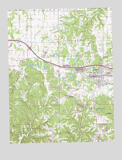
Warrenton, MO USGS Topographic Map
Click on map above to begin viewing in our Map Viewer.

This topographic map contains these locations and features:
Feature Name Type Latitude Longitude GNIS ID View Map
B and K Lake Number 1 DamDamN38.8184°W91.2068°764329View Map
B and K Lake Number 2 DamDamN38.8200°W91.2052°761653View Map
Birkemeier LakeReservoirN38.8219°W91.2144°764331View Map
Black Hawk Middle SchoolSchoolN38.8093°W91.1384°2652412View Map
Block School (historical)SchoolN38.8142°W91.1957°747923View Map
Brady Lake Dam NorthDamN38.8434°W91.1485°765296View Map
Brady Lake Dam SouthDamN38.8400°W91.1335°765297View Map
Camp Branch CemeteryCemeteryN38.8450°W91.2360°715252View Map
Carla Company Section 6 DamDamN38.8667°W91.1735°761498View Map
Cedar Grove DamDamN38.7867°W91.1952°761731View Map
Cedar Grove LakeReservoirN38.7865°W91.1935°761732View Map
Central Wesleyan College (historical)SchoolN38.8123°W91.1407°730327View Map
City of WarrentonCivilN38.8187°W91.1360°2397196View Map
Clarks BranchStreamN38.7623°W91.2246°715888View Map
Clarks HollowValleyN38.7623°W91.2238°730331View Map
College Methodist ChurchChurchN38.8119°W91.1391°730340View Map
Daniel Boone Elementary SchoolSchoolN38.8076°W91.1382°2652415View Map
Dirkemeier Lake DamDamN38.8200°W91.2135°764330View Map
Dogwood Lake DamDamN38.7784°W91.1435°760271View Map
E H Winter Bridge (historical)BridgeN38.8131°W91.1418°730330View Map
Givens Number 1 LakeReservoirN38.8325°W91.1931°760244View Map
Holy Rosary CemeteryCemeteryN38.8070°W91.1307°719745View Map
Huelin McDaniels DamDamN38.8217°W91.2202°764332View Map
KWRE-AM (Warrenton)TowerN38.8223°W91.1376°754258View Map
Lake OyateReservoirN38.8225°W91.2228°764333View Map
Lakeview Estates DamDamN38.8134°W91.1718°761656View Map
Lichte School (historical)SchoolN38.7531°W91.1990°747924View Map
Lime Kiln SchoolSchoolN38.8470°W91.1596°747925View Map
Lippstadt ChurchChurchN38.7567°W91.1415°721142View Map
Lippstadt CommunityPopulated PlaceN38.7581°W91.1440°730329View Map
Lippstadt School (historical)SchoolN38.7600°W91.1443°747926View Map
Lowell Sprick LakeReservoirN38.8043°W91.1464°764635View Map
Macedonia ChurchChurchN38.7614°W91.1993°721721View Map
Macedonia NeighborhoodPopulated PlaceN38.7612°W91.1990°730328View Map
Money Sunk Ranch DamDamN38.7850°W91.1368°764673View Map
Money Sunk Ranch LakeReservoirN38.7848°W91.1375°764674View Map
Niko LakeReservoirN38.8166°W91.1911°761655View Map
Niko Lake DamDamN38.8184°W91.1902°761654View Map
Owl Creek Estates Lake DamDamN38.7667°W91.1335°765295View Map
PendletonPopulated PlaceN38.8273°W91.2352°731631View Map
Pendleton Gore RidgeRidgeN38.7931°W91.2496°724199View Map
Pendleton School (historical)SchoolN38.8256°W91.2360°730326View Map
Petersmeyer Lake DamDamN38.8267°W91.1651°761651View Map
Petersmeyers Lower Lake DamDamN38.8267°W91.1618°761652View Map
Ramada Camp Inn LakeReservoirN38.7795°W91.1432°760272View Map
Rattle CemeteryCemeteryN38.7661°W91.2479°725112View Map
Rebecca Boone Elementary SchoolSchoolN38.8098°W91.1325°2652417View Map
Reid Lake Section 13 DamDamN38.8334°W91.1902°760243View Map
Roundabout HillSummitN38.7553°W91.2321°725625View Map
Schlanker BranchStreamN38.8659°W91.1490°726102View Map
Seven Oaks Ranch LakeReservoirN38.8659°W91.1754°761499View Map
Shelton School (historical)SchoolN38.8581°W91.2127°747922View Map
Sprick Lake DamDamN38.8050°W91.1468°764634View Map
Stark AirportAirportN38.7745°W91.1512°2679400View Map
Stein LakeReservoirN38.8280°W91.1787°760246View Map
Stein Lake DamDamN38.8284°W91.1768°760245View Map
Steinhagen ChurchChurchN38.8664°W91.1310°727059View Map
Steinhagen Post Office (historical)Post OfficeN38.8670°W91.1313°759756View Map
The Warren County Shopping CenterLocaleN38.8200°W91.1388°742404View Map
Township of North ElkhornCivilN38.8336°W91.1958°767502View Map
Township of South ElkhornCivilN38.7851°W91.1308°767504View Map
TruesdalePopulated PlaceN38.8117°W91.1304°740024View Map
Truesdale School (historical)SchoolN38.8114°W91.1322°730967View Map
Turner HollowValleyN38.7756°W91.2213°727904View Map
Utch BranchStreamN38.7639°W91.1660°728089View Map
Village of PendletonCivilN38.8263°W91.2321°2399648View Map
Warren CountyCivilN38.7646°W91.1607°758562View Map
Warren County Sheriff's OfficeBuildingN38.8108°W91.1496°2752264View Map
WarrentonPopulated PlaceN38.8114°W91.1415°728363View Map
Warrenton Fire Protection District Station 1BuildingN38.8346°W91.1407°2620998View Map
Warrenton Fire Protection District Station 2BuildingN38.8039°W91.1438°2621290View Map
Warrenton Fire Protection District Station 3BuildingN38.8253°W91.2362°2621289View Map
Warrenton High SchoolSchoolN38.7982°W91.1401°2652407View Map
Warrenton Police DepartmentBuildingN38.8107°W91.1502°2752340View Map
Warrenton Post OfficePost OfficeN38.8115°W91.1437°2779453View Map
Warrenton State Wildlife AreaParkN38.7928°W91.1793°743177View Map
Warrior Ridge Elementary SchoolSchoolN38.7948°W91.1403°2652419View Map
White, Smith and Austin Lake DamDamN38.8150°W91.1885°764414View Map
Woodridge Lake DamDamN38.7834°W91.1618°761657View Map

Note: Coordinates in the location and feature list above are referenced to NAD83 datum.


Copyright (C) 2008-2024 Ryan Niemi / Sunset Dynamics ... All Rights Reserved