TopoQuest Logo
Do you find TopoQuest useful?
Help keep TopoQuest running and adding new maps/features by donating!
Bitcoin:  19c7KJd3qBynnjoSw5npx9KScwjBe4ifkT
Litecoin:  LXs6TkuXGGXo1vDsWCkWVdjQX94eUKd6ui
Home View Maps Find Maps Find Places Resources & Links


Denver City, Texas Topographic Map

USGS Map Title: Denver City, TX
USGS Map MRC: 32102H7
DRG (GeoTIFF) Download: o32102h7.tif


Neighboring USGS Topographic Map Quads:


  Ink Basin, TX  
33102A8
 

  Plains SE, TX  
33102A7
 

  Pleasant Hill, TX  
33102A6
 

  Higginbotham, TX  
32102H8
 

  Denver City, TX  
32102H7
 

  Seagraves NW, TX  
32102H6
 

  Denver City SW, TX  
32102G8
 

  Denver City SE, TX  
32102G7
 

  Seagraves SW, TX  
32102G6


Map MRC Location:

N33°
W103°
N33°
W102°
H8 H7 H6 H5 H4 H3 H2 H1
G8 G7 G6 G5 G4 G3 G2 G1
F8 F7 F6 F5 F4 F3 F2 F1
E8 E7 E6 E5 E4 E3 E2 E1
D8 D7 D6 D5 D4 D3 D2 D1
C8 C7 C6 C5 C4 C3 C2 C1
B8 B7 B6 B5 B4 B3 B2 B1
A8 A7 A6 A5 A4 A3 A2 A1
N32°
W103°
N32°
W102°

Denver City, TX USGS 1:24K Topographic Map Preview:
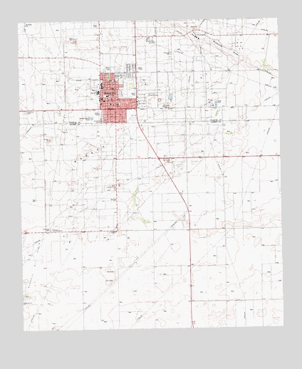
Denver City, TX USGS Topographic Map
Click on map above to begin viewing in our Map Viewer.

This topographic map contains these locations and features:
Feature Name Type Latitude Longitude GNIS ID View Map
Abundant Life FellowshipChurchN32.9642°W102.8263°2573616View Map
Bethel Baptist ChurchChurchN32.9645°W102.8224°2024881View Map
Church of the NazareneChurchN32.9657°W102.8305°2024885View Map
Denver CityPopulated PlaceN32.9645°W102.8291°1334272View Map
Denver City AirportAirportN32.9761°W102.8395°1386549View Map
Denver City City HallBuildingN32.9670°W102.8295°2753833View Map
Denver City Emergency Medical ServiceBuildingN32.9671°W102.8303°2655840View Map
Denver City Fire Marshal's OfficeBuildingN32.9670°W102.8301°2552095View Map
Denver City High SchoolSchoolN32.9709°W102.8370°2009300View Map
Denver City Historical MuseumBuildingN32.9687°W102.8319°2014361View Map
Denver City Intermediate SchoolSchoolN32.9740°W102.8358°2009301View Map
Denver City Junior High SchoolSchoolN32.9682°W102.8369°2009302View Map
Denver City Police DepartmentBuildingN32.9677°W102.8308°2750235View Map
Denver City Post OfficePost OfficeN32.9682°W102.8285°2731714View Map
Denver City Volunteer Fire DepartmentBuildingN32.9670°W102.8302°2551897View Map
El Calvario Assembly of God ChurchChurchN32.9634°W102.8316°2024880View Map
Excalibur Adult Education SchoolSchoolN32.9682°W102.8369°2009303View Map
Faith Baptist ChurchChurchN32.9595°W102.8294°2024882View Map
Kelley Dodson Elementary SchoolSchoolN32.9698°W102.8235°2009304View Map
Mustang StadiumParkN32.9695°W102.8369°2027707View Map
Saint Williams Catholic ChurchChurchN32.9679°W102.8363°2024884View Map
Town of Denver CityCivilN32.9680°W102.8318°2412419View Map
Trinity Baptist ChurchChurchN32.9668°W102.8355°2024883View Map
Yoakum County HospitalHospitalN32.9685°W102.8358°2015659View Map
Yoakum County Sheriff's Office SubstationBuildingN32.9744°W102.8290°2750369View Map

Note: Coordinates in the location and feature list above are referenced to NAD83 datum.


Copyright (C) 2008-2024 Ryan Niemi / Sunset Dynamics ... All Rights Reserved