TopoQuest Logo
Do you find TopoQuest useful?
Help keep TopoQuest running and adding new maps/features by donating!
Bitcoin:  19c7KJd3qBynnjoSw5npx9KScwjBe4ifkT
Litecoin:  LXs6TkuXGGXo1vDsWCkWVdjQX94eUKd6ui
Home View Maps Find Maps Find Places Resources & Links


Claflin, Kansas Topographic Map

USGS Map Title: Claflin, KS
USGS Map MRC: 38098E5
DRG (GeoTIFF) Download: o38098e5.tif


Neighboring USGS Topographic Map Quads:


  Beaver, KS  
38098F6
 

  Dubuque, KS  
38098F5
 

  Holyrood NW, KS  
38098F4
 

  Redwing, KS  
38098E6
 

  Claflin, KS  
38098E5
 

  Holyrood, KS  
38098E4
 

  Ellinwood NW, KS  
38098D6
 

  Ellinwood NE, KS  
38098D5
 

  Chase NW, KS  
38098D4


Map MRC Location:

N39°
W99°
N39°
W98°
H8 H7 H6 H5 H4 H3 H2 H1
G8 G7 G6 G5 G4 G3 G2 G1
F8 F7 F6 F5 F4 F3 F2 F1
E8 E7 E6 E5 E4 E3 E2 E1
D8 D7 D6 D5 D4 D3 D2 D1
C8 C7 C6 C5 C4 C3 C2 C1
B8 B7 B6 B5 B4 B3 B2 B1
A8 A7 A6 A5 A4 A3 A2 A1
N38°
W99°
N38°
W98°

Claflin, KS USGS 1:24K Topographic Map Preview:
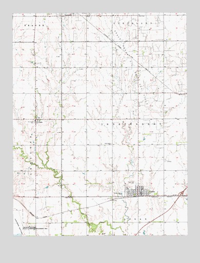
Claflin, KS USGS Topographic Map
Click on map above to begin viewing in our Map Viewer.

This topographic map contains these locations and features:
Feature Name Type Latitude Longitude GNIS ID View Map
Bloomingdale CemeteryCemeteryN38.5513°W98.5545°475529View Map
Brooklyn (historical)LocaleN38.5795°W98.5353°482163View Map
City of ClaflinCivilN38.5244°W98.5370°2393529View Map
ClaflinPopulated PlaceN38.5250°W98.5337°475531View Map
Claflin Ambulance Service AssociationBuildingN38.5221°W98.5371°2696544View Map
Claflin City HallBuildingN38.5233°W98.5327°2693217View Map
Claflin Community BuildingBuildingN38.5243°W98.5347°2692905View Map
Claflin Elementary SchoolSchoolN38.5260°W98.5330°2497541View Map
Claflin Fire DepartmentBuildingN38.5222°W98.5371°2111199View Map
Claflin High SchoolSchoolN38.5263°W98.5433°480697View Map
Claflin Police DepartmentBuildingN38.5232°W98.5327°2504099View Map
Claflin Post OfficePost OfficeN38.5243°W98.5333°2693668View Map
Claflin United Methodist ChurchChurchN38.5233°W98.5359°2689377View Map
Claflin Wastewater PlantLocaleN38.5239°W98.5480°2691997View Map
Faith in Motion Worship Arts CenterChurchN38.5232°W98.5347°2690724View Map
HitschmannPopulated PlaceN38.6242°W98.5815°475439View Map
Holy Family CemeteryCemeteryN38.5637°W98.6102°475527View Map
Immaculate Conception ChurchChurchN38.5248°W98.5331°2690761View Map
Independent Township LibraryBuildingN38.5229°W98.5333°2694763View Map
OdinPopulated PlaceN38.5661°W98.6087°475528View Map
Odin Census Designated PlaceCensusN38.5654°W98.6088°2629167View Map
Pleasant View CemeteryCemeteryN38.5297°W98.5370°475530View Map
Township of IndependentCivilN38.5654°W98.5352°475525View Map
Zion Lutheran ChurchChurchN38.5233°W98.5393°2688795View Map

Note: Coordinates in the location and feature list above are referenced to NAD83 datum.


Copyright (C) 2008-2024 Ryan Niemi / Sunset Dynamics ... All Rights Reserved