TopoQuest Logo
Do you find TopoQuest useful?
Help keep TopoQuest running and adding new maps/features by donating!
Bitcoin:  19c7KJd3qBynnjoSw5npx9KScwjBe4ifkT
Litecoin:  LXs6TkuXGGXo1vDsWCkWVdjQX94eUKd6ui
Home View Maps Find Maps Find Places Resources & Links


Cooksville, Illinois Topographic Map

USGS Map Title: Cooksville, IL
USGS Map MRC: 40088E6
DRG (GeoTIFF) Download: o40088e6.tif


Neighboring USGS Topographic Map Quads:


  Lexington, IL  
40088F7
 

  Chenoa, IL  
40088F6
 

  Fairbury, IL  
40088F5
 

  Merna, IL  
40088E7
 

  Cooksville, IL  
40088E6
 

  Colfax, IL  
40088E5
 

  Holder, IL  
40088D7
 

  Arrowsmith, IL  
40088D6
 

  Saybrook, IL  
40088D5


Map MRC Location:

N41°
W89°
N41°
W88°
H8 H7 H6 H5 H4 H3 H2 H1
G8 G7 G6 G5 G4 G3 G2 G1
F8 F7 F6 F5 F4 F3 F2 F1
E8 E7 E6 E5 E4 E3 E2 E1
D8 D7 D6 D5 D4 D3 D2 D1
C8 C7 C6 C5 C4 C3 C2 C1
B8 B7 B6 B5 B4 B3 B2 B1
A8 A7 A6 A5 A4 A3 A2 A1
N40°
W89°
N40°
W88°

Cooksville, IL USGS 1:24K Topographic Map Preview:
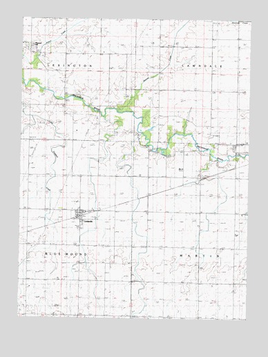
Cooksville, IL USGS Topographic Map
Click on map above to begin viewing in our Map Viewer.

This topographic map contains these locations and features:
Feature Name Type Latitude Longitude GNIS ID View Map
Blue Mound Township CemeteryCemeteryN40.5050°W88.7291°404599View Map
CooksvillePopulated PlaceN40.5431°W88.7165°406510View Map
Cooksville Fire DepartmentBuildingN40.5433°W88.7196°2682329View Map
Cooksville Post OfficePost OfficeN40.5432°W88.7166°2788459View Map
Evergreen CemeteryCemeteryN40.5940°W88.6752°408113View Map
Henline CreekStreamN40.5864°W88.6976°410058View Map
Pleasant HillPopulated PlaceN40.6131°W88.7470°415816View Map
Schertz Aerial Service - Cooksville AirportAirportN40.5807°W88.7068°2679036View Map
Township of Blue MoundCivilN40.5304°W88.7476°428687View Map
Township of LawndaleCivilN40.6215°W88.6311°429235View Map
Township of LexingtonCivilN40.6213°W88.7479°429251View Map
Township of MartinCivilN40.5296°W88.6313°429331View Map
Village of CooksvilleCivilN40.5426°W88.7146°2398622View Map
Wiley CemeteryCemeteryN40.5717°W88.6331°421166View Map
Wiley CemeteryCemeteryN40.5998°W88.7298°421167View Map

Note: Coordinates in the location and feature list above are referenced to NAD83 datum.


Copyright (C) 2008-2024 Ryan Niemi / Sunset Dynamics ... All Rights Reserved