TopoQuest Logo
Do you find TopoQuest useful?
Help keep TopoQuest running and adding new maps/features by donating!
Bitcoin:  19c7KJd3qBynnjoSw5npx9KScwjBe4ifkT
Litecoin:  LXs6TkuXGGXo1vDsWCkWVdjQX94eUKd6ui
Home View Maps Find Maps Find Places Resources & Links


Corsica, South Dakota Topographic Map

USGS Map Title: Corsica, SD
USGS Map MRC: 43098D4
DRG (GeoTIFF) Download: o43098d4.tif


Neighboring USGS Topographic Map Quads:


  Aurora Center, SD  
43098E5
 

  Stickney, SD  
43098E4
 

  Old Stickney Lake, SD  
43098E3
 

  New Holland, SD  
43098D5
 

  Corsica, SD  
43098D4
 

  Corsica Lake, SD  
43098D3
 

  Geddes SE, SD  
43098C5
 

  Armour SW, SD  
43098C4
 

  Armour, SD  
43098C3


Map MRC Location:

N44°
W99°
N44°
W98°
H8 H7 H6 H5 H4 H3 H2 H1
G8 G7 G6 G5 G4 G3 G2 G1
F8 F7 F6 F5 F4 F3 F2 F1
E8 E7 E6 E5 E4 E3 E2 E1
D8 D7 D6 D5 D4 D3 D2 D1
C8 C7 C6 C5 C4 C3 C2 C1
B8 B7 B6 B5 B4 B3 B2 B1
A8 A7 A6 A5 A4 A3 A2 A1
N43°
W99°
N43°
W98°

Corsica, SD USGS 1:24K Topographic Map Preview:
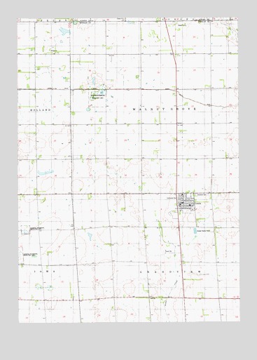
Corsica, SD USGS Topographic Map
Click on map above to begin viewing in our Map Viewer.

This topographic map contains these locations and features:
Feature Name Type Latitude Longitude GNIS ID View Map
Anderson School (historical)SchoolN43.3778°W98.4851°1264278View Map
Beulah (historical)LocaleN43.4708°W98.3920°1264298View Map
City of CorsicaCivilN43.4224°W98.4073°1267338View Map
Clark School (historical)SchoolN43.3847°W98.4267°1264280View Map
CorsicaPopulated PlaceN43.4253°W98.4073°1254469View Map
Corsica City HallBuildingN43.4235°W98.4063°2724703View Map
Corsica Community Fire DepartmentBuildingN43.4234°W98.4064°2580688View Map
Corsica Elementary SchoolSchoolN43.4231°W98.4033°2728539View Map
Corsica High SchoolSchoolN43.4236°W98.3991°2728540View Map
Corsica Middle SchoolSchoolN43.4236°W98.3991°2728541View Map
Corsica Municipal AirportAirportN43.4330°W98.3999°2444001View Map
Corsica Police DepartmentBuildingN43.4234°W98.4064°2755622View Map
Corsica Post OfficePost OfficeN43.4235°W98.4079°2709779View Map
Douglas County Ambulance Service CorsicaBuildingN43.4239°W98.4010°2658981View Map
Garden Valley School (historical)SchoolN43.4708°W98.4892°1264291View Map
Graceland CemeteryCemeteryN43.4274°W98.4001°1264309View Map
Grandview TownhallBuildingN43.3850°W98.3845°1266525View Map
Kunefke School (historical)SchoolN43.4430°W98.4198°1265740View Map
Messing School (historical)SchoolN43.4194°W98.3837°1264277View Map
Plainview School (historical)SchoolN43.4430°W98.3795°1264281View Map
Priscilla Club LibraryBuildingN43.4236°W98.4065°2723446View Map
Simpson Lake (historical)LakeN43.3957°W98.4127°1264297View Map
Township of GrandviewCivilN43.3837°W98.4070°1268858View Map
Township of Walnut GroveCivilN43.4633°W98.4109°1268853View Map
Van Vuren School (historical)SchoolN43.4861°W98.4212°1264279View Map
Vanden Hoek School (historical)SchoolN43.4430°W98.4795°1264293View Map
Walnut Grove TownhallBuildingN43.4564°W98.4106°1266524View Map

Note: Coordinates in the location and feature list above are referenced to NAD83 datum.


Copyright (C) 2008-2024 Ryan Niemi / Sunset Dynamics ... All Rights Reserved