TopoQuest Logo
Do you find TopoQuest useful?
Help keep TopoQuest running and adding new maps/features by donating!
Bitcoin:  19c7KJd3qBynnjoSw5npx9KScwjBe4ifkT
Litecoin:  LXs6TkuXGGXo1vDsWCkWVdjQX94eUKd6ui
Home View Maps Find Maps Find Places Resources & Links


Stickney, South Dakota Topographic Map

USGS Map Title: Stickney, SD
USGS Map MRC: 43098E4
DRG (GeoTIFF) Download: o43098e4.tif


Neighboring USGS Topographic Map Quads:


  Crystal Lake, SD  
43098F5
 

  Plankinton, SD  
43098F4
 

  Mount Vernon, SD  
43098F3
 

  Aurora Center, SD  
43098E5
 

  Stickney, SD  
43098E4
 

  Old Stickney Lake, SD  
43098E3
 

  New Holland, SD  
43098D5
 

  Corsica, SD  
43098D4
 

  Corsica Lake, SD  
43098D3


Map MRC Location:

N44°
W99°
N44°
W98°
H8 H7 H6 H5 H4 H3 H2 H1
G8 G7 G6 G5 G4 G3 G2 G1
F8 F7 F6 F5 F4 F3 F2 F1
E8 E7 E6 E5 E4 E3 E2 E1
D8 D7 D6 D5 D4 D3 D2 D1
C8 C7 C6 C5 C4 C3 C2 C1
B8 B7 B6 B5 B4 B3 B2 B1
A8 A7 A6 A5 A4 A3 A2 A1
N43°
W99°
N43°
W98°

Stickney, SD USGS 1:24K Topographic Map Preview:
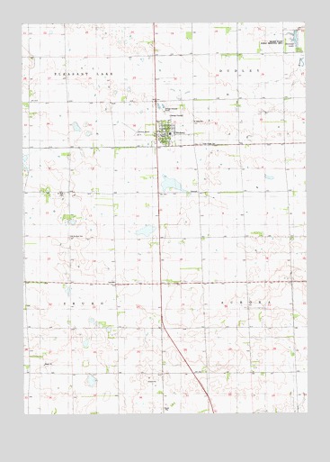
Stickney, SD USGS Topographic Map
Click on map above to begin viewing in our Map Viewer.

This topographic map contains these locations and features:
Feature Name Type Latitude Longitude GNIS ID View Map
Dudley (historical)LocaleN43.5130°W98.4204°1260272View Map
Dudley TownhallBuildingN43.5708°W98.4176°1266545View Map
Livingston AirportAirportN43.5902°W98.4506°1259242View Map
Nelson State Public Shooting AreaParkN43.6192°W98.3790°1256668View Map
Old Saint Paul CemeteryCemeteryN43.5569°W98.4801°1256868View Map
Rollins (historical)LocaleN43.5680°W98.4892°1263226View Map
Saint Mary CemeteryCemeteryN43.5933°W98.4254°1257670View Map
Saint Paul CemeteryCemeteryN43.5705°W98.4820°1257715View Map
Silver Ridge CemeteryCemeteryN43.5861°W98.4215°1258071View Map
StickneyPopulated PlaceN43.5892°W98.4373°1258346View Map
Stickney City HallBuildingN43.5894°W98.4370°2725281View Map
Stickney Deputy Sheriff's OfficeBuildingN43.5891°W98.4372°2755523View Map
Stickney Elementary SchoolSchoolN43.5895°W98.4353°2729670View Map
Stickney High SchoolSchoolN43.5895°W98.4353°2729671View Map
Stickney Junior High SchoolSchoolN43.5895°W98.4353°2729672View Map
Stickney LakeReservoirN43.6197°W98.3799°1258347View Map
Stickney Post OfficePost OfficeN43.5889°W98.4376°2711902View Map
Stickney Volunteer Fire DepartmentBuildingN43.5887°W98.4398°2580644View Map
Town of StickneyCivilN43.5893°W98.4376°1267592View Map
Township of AuroraCivilN43.5422°W98.3813°1267823View Map
Township of TruroCivilN43.5417°W98.4981°1267824View Map
Trura TownhallBuildingN43.5422°W98.4604°1266544View Map

Note: Coordinates in the location and feature list above are referenced to NAD83 datum.


Copyright (C) 2008-2024 Ryan Niemi / Sunset Dynamics ... All Rights Reserved