TopoQuest Logo
Do you find TopoQuest useful?
Help keep TopoQuest running and adding new maps/features by donating!
Bitcoin:  19c7KJd3qBynnjoSw5npx9KScwjBe4ifkT
Litecoin:  LXs6TkuXGGXo1vDsWCkWVdjQX94eUKd6ui
Home View Maps Find Maps Find Places Resources & Links


Crewe East, Virginia Topographic Map

USGS Map Title: Crewe East, VA
USGS Map MRC: 37078B1
DRG (GeoTIFF) Download: o37078b1.tif


Neighboring USGS Topographic Map Quads:


  Deatonville, VA  
37078C2
 

  Jetersville, VA  
37078C1
 

  Amelia Court House, VA  
37077C8
 

  Crewe West, VA  
37078B2
 

  Crewe East, VA  
37078B1
 

  Wellville, VA  
37077B8
 

  Rubermont, VA  
37078A2
 

  Blackstone West, VA  
37078A1
 

  Blackstone East, VA  
37077A8


Map MRC Location:

N38°
W79°
N38°
W78°
H8 H7 H6 H5 H4 H3 H2 H1
G8 G7 G6 G5 G4 G3 G2 G1
F8 F7 F6 F5 F4 F3 F2 F1
E8 E7 E6 E5 E4 E3 E2 E1
D8 D7 D6 D5 D4 D3 D2 D1
C8 C7 C6 C5 C4 C3 C2 C1
B8 B7 B6 B5 B4 B3 B2 B1
A8 A7 A6 A5 A4 A3 A2 A1
N37°
W79°
N37°
W78°

Crewe East, VA USGS 1:24K Topographic Map Preview:
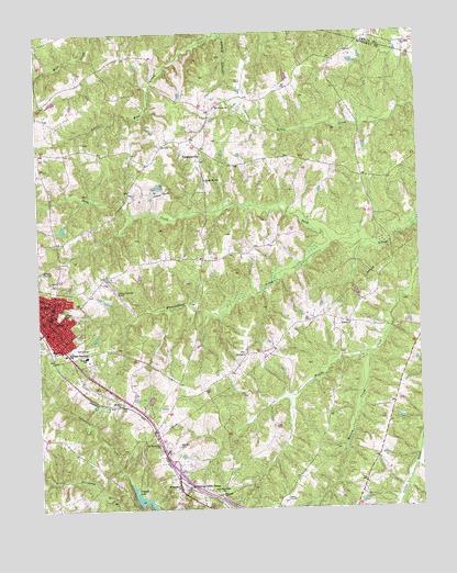
Crewe East, VA USGS Topographic Map
Click on map above to begin viewing in our Map Viewer.

This topographic map contains these locations and features:
Feature Name Type Latitude Longitude GNIS ID View Map
Arnolds DamDamN37.2318°W78.1181°1490513View Map
Austins DamDamN37.2402°W78.0431°1490510View Map
Belfast ChurchChurchN37.1654°W78.0572°1463021View Map
Bethesda ChurchChurchN37.1288°W78.0661°1463218View Map
Blendon CemeteryCemeteryN37.1413°W78.0800°1463568View Map
CrewePopulated PlaceN37.1732°W78.1233°1492824View Map
Crewe Baptist ChurchChurchN37.1715°W78.1219°1493908View Map
Crewe Christian ChurchChurchN37.1774°W78.1225°1493910View Map
Crewe High SchoolSchoolN37.1763°W78.1208°1493912View Map
Crewe Municipal AirportAirportN37.1802°W78.0976°1498643View Map
Crewe Police DepartmentBuildingN37.1752°W78.1233°2331997View Map
Crewe Post OfficePost OfficeN37.1765°W78.1238°1493913View Map
Crewe Primary SchoolSchoolN37.1652°W78.1095°1493911View Map
Crewe United Methodist ChurchChurchN37.1771°W78.1250°1493914View Map
Crystal LakeReservoirN37.1268°W78.0895°1465506View Map
District 2CivilN37.1639°W78.0313°1927208View Map
District 3CivilN37.2056°W78.0983°1927229View Map
Eleven Oaks ChurchChurchN37.1665°W78.1192°1466208View Map
FergusonvillePopulated PlaceN37.2177°W78.0706°1492936View Map
Fourth Mount Zion ChurchChurchN37.2115°W78.0697°1466813View Map
Freeman CemeteryCemeteryN37.1940°W78.0492°1493917View Map
Gibson Memorial ChurchChurchN37.1790°W78.1239°1467071View Map
Hendersonville (historical)Populated PlaceN37.1457°W78.0875°1493920View Map
Hendersonville School (historical)SchoolN37.1540°W78.0992°1493921View Map
Lazaretto CreekStreamN37.1318°W78.0961°1469224View Map
Liberty ChurchChurchN37.1735°W78.0228°1469360View Map
Little West CreekStreamN37.2490°W78.0667°1469683View Map
Lunsalord CemeteryCemeteryN37.1938°W78.0539°1493925View Map
Mount Calvary ChurchChurchN37.2310°W78.0656°1470826View Map
New Poplar Mountain ChurchChurchN37.1296°W78.0667°1471486View Map
Nottoway CountyCivilN37.1431°W78.0513°1493928View Map
Nottoway County Emergency SquadBuildingN37.1707°W78.1203°2075301View Map
Nottoway County Sheriff's OfficeBuildingN37.1289°W78.0800°2332090View Map
Nottoway Court HousePopulated PlaceN37.1307°W78.0767°1471678View Map
Nottoway Court House Census Designated PlaceCensusN37.1270°W78.0733°2628840View Map
Nottoway Post OfficePost OfficeN37.1279°W78.0795°2766263View Map
Old Poplar Mountain ChurchChurchN37.1413°W78.0858°1471864View Map
Pryor Memorial Presbyterian ChurchChurchN37.1760°W78.1222°1493933View Map
Robinson CemeteryCemeteryN37.1793°W78.0736°1493934View Map
Saint Johns ChurchChurchN37.1793°W78.1203°1473765View Map
Saint Johns ChurchChurchN37.2465°W78.0044°1473767View Map
Saint Matthews ChurchChurchN37.1296°W78.0797°1473848View Map
Sharon ChurchChurchN37.1532°W78.0986°1474440View Map
Sheltons DamDamN37.2002°W78.1164°1490512View Map
Southside Skill CenterSchoolN37.1659°W78.1162°1474917View Map
Strum CemeteryCemeteryN37.1929°W78.1250°1493941View Map
Towler CemeteryCemeteryN37.2215°W78.0653°1493943View Map
Watson CreekStreamN37.1654°W78.0169°1476388View Map
Watson Elementary SchoolSchoolN37.1654°W78.1092°1476391View Map
Winningham CreekStreamN37.1946°W78.0281°1476868View Map

Note: Coordinates in the location and feature list above are referenced to NAD83 datum.


Copyright (C) 2008-2024 Ryan Niemi / Sunset Dynamics ... All Rights Reserved