TopoQuest Logo
Do you find TopoQuest useful?
Help keep TopoQuest running and adding new maps/features by donating!
Bitcoin:  19c7KJd3qBynnjoSw5npx9KScwjBe4ifkT
Litecoin:  LXs6TkuXGGXo1vDsWCkWVdjQX94eUKd6ui
Home View Maps Find Maps Find Places Resources & Links


Culbertson, Nebraska Topographic Map

USGS Map Title: Culbertson, NE
USGS Map MRC: 40100B7
DRG (GeoTIFF) Download: o40100b7.tif


Neighboring USGS Topographic Map Quads:


  Beverly, NE  
40100C8
 

  Burger Canyon SE, NE  
40100C7
 

  Red Willow Dam, NE  
40100C6
 

  Culbertson NW, NE  
40100B8
 

  Culbertson, NE  
40100B7
 

  McCook West, NE  
40100B6
 

  Culbertson SW, NE  
40100A8
 

  Culbertson SE, NE  
40100A7
 

  McCook SW, NE  
40100A6


Map MRC Location:

N41°
W101°
N41°
W100°
H8 H7 H6 H5 H4 H3 H2 H1
G8 G7 G6 G5 G4 G3 G2 G1
F8 F7 F6 F5 F4 F3 F2 F1
E8 E7 E6 E5 E4 E3 E2 E1
D8 D7 D6 D5 D4 D3 D2 D1
C8 C7 C6 C5 C4 C3 C2 C1
B8 B7 B6 B5 B4 B3 B2 B1
A8 A7 A6 A5 A4 A3 A2 A1
N40°
W101°
N40°
W100°

Culbertson, NE USGS 1:24K Topographic Map Preview:
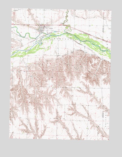
Culbertson, NE USGS Topographic Map
Click on map above to begin viewing in our Map Viewer.

This topographic map contains these locations and features:
Feature Name Type Latitude Longitude GNIS ID View Map
Bethel ChurchChurchN40.2342°W100.8602°827380View Map
Blackwood CreekStreamN40.2275°W100.8043°827476View Map
Blackwood Lateral CanalCanalN40.2406°W100.7829°827477View Map
CulbertsonPopulated PlaceN40.2297°W100.8385°828508View Map
CulbertsonLocaleN40.2278°W100.8282°1841358View Map
Culbertson City ParkParkN40.2297°W100.8385°1841376View Map
Culbertson Election PrecinctCivilN40.2197°W100.8163°1928801View Map
Culbertson ElevatorLocaleN40.2297°W100.8385°1841370View Map
Culbertson Fire DepartmentBuildingN40.2305°W100.8380°2553348View Map
Culbertson First Hitchcock County Seat Historical MarkerParkN40.2297°W100.8385°1841377View Map
Culbertson Post OfficePost OfficeN40.2295°W100.8391°1841356View Map
Culbertson Public LibraryBuildingN40.2297°W100.8385°1841359View Map
Culbertson Public SchoolsSchoolN40.2333°W100.8343°1841371View Map
Culbertson Rescue SquadBuildingN40.2293°W100.8394°2553784View Map
Driftwood West CanalCanalN40.1389°W100.7635°828777View Map
Frenchman CreekStreamN40.2247°W100.8265°836013View Map
Frenchman Valley Farmers Cooperative ElevatorLocaleN40.2297°W100.8385°1841369View Map
Hoyt DamDamN40.1355°W100.8042°1769566View Map
Hoyt ReservoirLakeN40.1362°W100.8050°1769567View Map
Korell DamDamN40.2083°W100.7821°1769982View Map
Korell ReservoirLakeN40.2056°W100.7850°1769983View Map
Kugler DamDamN40.1850°W100.8504°1768990View Map
Kugler ReservoirLakeN40.1847°W100.8492°1768991View Map
KZMC-FM (McCook)TowerN40.1883°W100.8107°837817View Map
Logan Election PrecinctCivilN40.1311°W100.8153°1929034View Map
Saint Johns Lutheran ChurchChurchN40.2322°W100.8346°1841360View Map
Township of CulbertsonCivilN40.2194°W100.8157°1841365View Map
Township of LoganCivilN40.1278°W100.8143°1841363View Map
United Methodist ChurchChurchN40.2322°W100.8379°1841361View Map
Village of CulbertsonCivilN40.2281°W100.8396°2398657View Map
Westside ManorHospitalN40.2297°W100.8385°1841357View Map

Note: Coordinates in the location and feature list above are referenced to NAD83 datum.


Copyright (C) 2008-2024 Ryan Niemi / Sunset Dynamics ... All Rights Reserved