TopoQuest Logo
Do you find TopoQuest useful?
Help keep TopoQuest running and adding new maps/features by donating!
Bitcoin:  19c7KJd3qBynnjoSw5npx9KScwjBe4ifkT
Litecoin:  LXs6TkuXGGXo1vDsWCkWVdjQX94eUKd6ui
Home View Maps Find Maps Find Places Resources & Links


McCook West, Nebraska Topographic Map

USGS Map Title: McCook West, NE
USGS Map MRC: 40100B6
DRG (GeoTIFF) Download: o40100b6.tif


Neighboring USGS Topographic Map Quads:


  Burger Canyon SE, NE  
40100C7
 

  Red Willow Dam, NE  
40100C6
 

  Quick SE, NE  
40100C5
 

  Culbertson, NE  
40100B7
 

  McCook West, NE  
40100B6
 

  McCook East, NE  
40100B5
 

  Culbertson SE, NE  
40100A7
 

  McCook SW, NE  
40100A6
 

  McCook SE, NE  
40100A5


Map MRC Location:

N41°
W101°
N41°
W100°
H8 H7 H6 H5 H4 H3 H2 H1
G8 G7 G6 G5 G4 G3 G2 G1
F8 F7 F6 F5 F4 F3 F2 F1
E8 E7 E6 E5 E4 E3 E2 E1
D8 D7 D6 D5 D4 D3 D2 D1
C8 C7 C6 C5 C4 C3 C2 C1
B8 B7 B6 B5 B4 B3 B2 B1
A8 A7 A6 A5 A4 A3 A2 A1
N40°
W101°
N40°
W100°

McCook West, NE USGS 1:24K Topographic Map Preview:
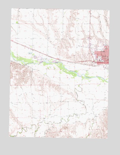
McCook West, NE USGS Topographic Map
Click on map above to begin viewing in our Map Viewer.

This topographic map contains these locations and features:
Feature Name Type Latitude Longitude GNIS ID View Map
Calvary CemeteryCemeteryN40.2083°W100.6471°827862View Map
Central Elementary SchoolSchoolN40.2031°W100.6279°828065View Map
Christian Science ChurchChurchN40.2031°W100.6268°1841214View Map
Cornerstone Fellowship ChurchChurchN40.2022°W100.6296°1841216View Map
Driftwood CanalCanalN40.1661°W100.7235°828775View Map
Driftwood CreekStreamN40.1833°W100.6546°828776View Map
Driftwood Election PrecinctCivilN40.1316°W100.7040°1928827View Map
Dry Creek South Dam 2-ADamN40.1368°W100.6376°1767834View Map
Dry Creek South Reservoir 2-ALakeN40.1362°W100.6372°1767835View Map
Egan Park Baptist ChurchChurchN40.2139°W100.6313°1841232View Map
Elks City ParkParkN40.2022°W100.6329°1841192View Map
First Christian ChurchChurchN40.2050°W100.6268°1841215View Map
First Church of GodChurchN40.2097°W100.6252°1841235View Map
Frank Lloyd Wright HouseBuildingN40.2031°W100.6260°1841189View Map
George W Norris HomeBuildingN40.2042°W100.6252°1841272View Map
George William Norris Historical MarkerParkN40.2042°W100.6252°1841273View Map
Hillcrest Nursing HomeHospitalN40.2006°W100.6346°1841201View Map
Jaycees Ball ParkParkN40.2019°W100.6257°1841194View Map
KBRL-AM (McCook)TowerN40.1919°W100.6521°837347View Map
Kelly Creek West DamDamN40.2205°W100.6315°1769960View Map
Kelly Creek West ReservoirLakeN40.2206°W100.6320°1769961View Map
KFBU-FM (McCook)TowerN40.2181°W100.7213°837410View Map
KICX-FM (McCook)TowerN40.1719°W100.6852°837411View Map
Kingdom Hall of Jehovas WitnessesChurchN40.2069°W100.6490°1841230View Map
KNGN-AM (McCook)TowerN40.1958°W100.6996°837349View Map
Lazy L Mobile RanchPopulated PlaceN40.2144°W100.6327°1841212View Map
McCookPopulated PlaceN40.2019°W100.6257°831117View Map
McCook Bible ChurchChurchN40.2017°W100.6396°1841223View Map
McCook City Volunteer Fire DepartmentBuildingN40.2004°W100.6323°1841207View Map
McCook Junior High SchoolSchoolN40.2047°W100.6365°1841204View Map
McCook Police DepartmentBuildingN40.2003°W100.6321°1841206View Map
McCook Post OfficePost OfficeN40.2014°W100.6293°1841185View Map
McCook Presbyterian ChurchChurchN40.2056°W100.6418°1841229View Map
McCook Public LibraryBuildingN40.2050°W100.6260°1841195View Map
McCook Senior High SchoolSchoolN40.2028°W100.6354°1841203View Map
McCook Townhouse IncorporatedHospitalN40.2008°W100.6260°1841199View Map
Meeker CanalCanalN40.1864°W100.7063°831190View Map
Memorial Park CemeteryCemeteryN40.2086°W100.6446°831212View Map
Museum of the High PlainsBuildingN40.2014°W100.6257°1841188View Map
Nazarene ChurchChurchN40.2069°W100.6410°1841231View Map
Norris ParkParkN40.2042°W100.6252°831652View Map
North Ward Elementary SchoolSchoolN40.2122°W100.6302°831748View Map
PerryPopulated PlaceN40.2103°W100.7229°835410View Map
Perry Census Designated PlaceCensusN40.2095°W100.7052°2587011View Map
Perry Election PrecinctCivilN40.2207°W100.7058°1929140View Map
Perry Grain Company ElevatorLocaleN40.2019°W100.6257°1841205View Map
Red Willow County CourthouseBuildingN40.2022°W100.6263°1841208View Map
Red Willow County FairgroundsLocaleN40.2119°W100.6365°1841200View Map
Red Willow County Sheriff's OfficeBuildingN40.2023°W100.6262°1841209View Map
Red Willow Western Fire Protection DistrictBuildingN40.1958°W100.6363°2553436View Map
Saint Albans Episcopal ChurchChurchN40.2025°W100.6268°1841213View Map
Saint Catherines HospitalHospitalN40.2094°W100.6313°832851View Map
School Number 16SchoolN40.1453°W100.6932°836280View Map
School Number 23SchoolN40.2211°W100.7224°836417View Map
School Number 8SchoolN40.1636°W100.6502°837096View Map
Senator George Norris State Historical SiteParkN40.2042°W100.6252°1841280View Map
Seventh Day Adventist ChurchChurchN40.1997°W100.6354°1841222View Map
Spring CreekStreamN40.1311°W100.7163°833696View Map
Township of DriftwoodCivilN40.1289°W100.7018°1841289View Map
Township of PerryCivilN40.2208°W100.7027°1841290View Map
Trinity Lutheran ChurchChurchN40.2133°W100.6296°1841217View Map
United Methodist ChurchChurchN40.2019°W100.6252°1841225View Map
West Ward Elementary SchoolSchoolN40.2006°W100.6315°834637View Map
Westview PlazaLocaleN40.2019°W100.6257°1841187View Map
Wilcox Trailer CourtPopulated PlaceN40.2019°W100.6257°1841211View Map

Note: Coordinates in the location and feature list above are referenced to NAD83 datum.


Copyright (C) 2008-2024 Ryan Niemi / Sunset Dynamics ... All Rights Reserved